Thanks for the link, I think as at first glance there are a lot of rabbit holes thereWe have geo-fixed satellites over each pole and are monitored and discussed here.
National Snow and Ice Data Center |
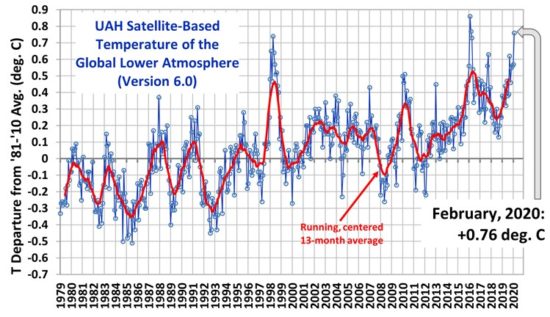
The key is our Sun and its radiation activities.
The snow fall and melt is a concern per this thread.
But it is down hill flow as long as the ocean levels don't rise, too much.
Jim...
PS: Also Sun's gravitational effects, that do cycle every ≈11 years.
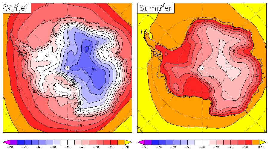
PSS: They are wondering why the ice is increasing at that link.
I’m thinking that 270 ft above sea level I’m pretty safe from having salt water at the dock! However it was windy onshore a few days ago and we had some waves slosh some water over the top and we are no where close to annual peak!
I guess weather is sort of like the stock market, ups and downs that aren’t under human control