Investigation 94L is now showing enough counter clockwise circulation to be tagged...
Potential Tropical Cyclone #6
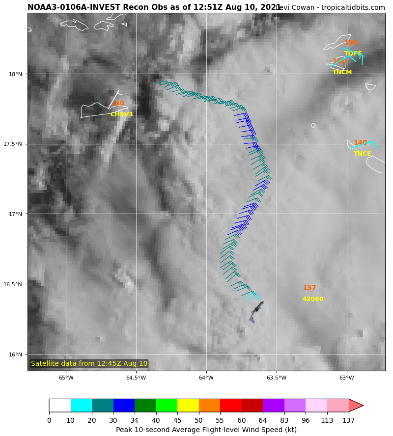
The PTC designation triggers Hurricane Hunters and NOAA flights to get better data than the Satellites.

This NOAA aircraft did drop a buoy, which showed surface 15 knots and Dry air mixing in to dampen the formation.
The News Cycle is the GFS model, but the most aggressive model is HWRF.
HWRF shows a mild storm, south of Miami on Friday the 13th.
All models should converge in next 2 days.
The paths show Dry Air mixing and shear to keep a defined eye from forming this week.
Florida should prepare now for soon to be named, TS Fred
Jim...
Potential Tropical Cyclone #6
The PTC designation triggers Hurricane Hunters and NOAA flights to get better data than the Satellites.
This NOAA aircraft did drop a buoy, which showed surface 15 knots and Dry air mixing in to dampen the formation.
The News Cycle is the GFS model, but the most aggressive model is HWRF.
HWRF shows a mild storm, south of Miami on Friday the 13th.
All models should converge in next 2 days.
The paths show Dry Air mixing and shear to keep a defined eye from forming this week.
Florida should prepare now for soon to be named, TS Fred
Jim...


