How often have you had a GPS 'wink out'? The only time I've ever had that happen is when the boat had the electronics wired to the starting battery, and the battery was failing. If I turn mine off and back on it does not start all over again, but displays the data recorded at the time of the shut-off. I must physically 'clear' the data before every trip if I want that trip data to be accurate. It will store the last data indefinitely.I've rented small boats with GPS to get from point A to point B, but they give a turn by turn instruction and if they blink out, there is no record, no plan, not even a general, "go that direction". I like sailing by the compass, not by the computer screen.-Will (Dragonfly)
What is your backup GPS solution?
- Thread starter Jackdaw
- Start date
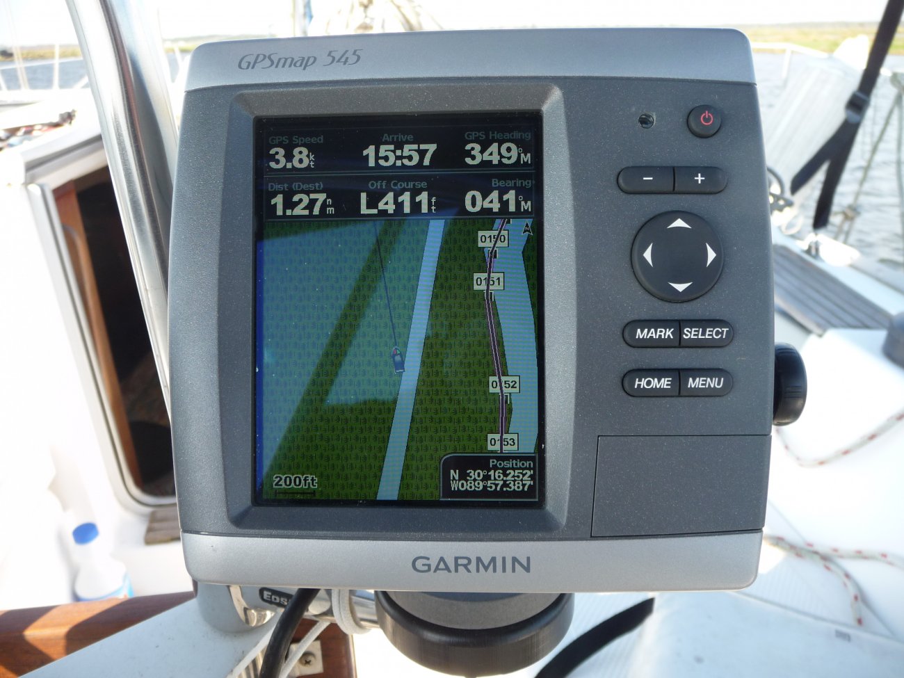
The little dears can have "brain fartz" occasionally as in this trip.. I was certainly in the bayou at the right of the screen and the icon shows me many yards to the left.. you can see from the old track that it had known almost where I was on a previous trip.. These are the times when ya think ya have good info and then, squoosh, ya in the mud !
Bingo!Sorry....but for back-ups when coastal cruising you will never replace a compass and a good set of charts.
I have my phone GPS and charts installed on it as backup to my Garmin... and yes, it works fine out of a service area.
But perhaps the bigger question is what if the GPS system fails, or is somehow rendered inert by a solar flare?
Paper charts and a compass and good old DR navigating. Now if the earth flips magnetic poles... well, then I'm in real trouble.
I find it interesting that so many think of charts as their go-to back up for navigation when there are excellent cruising guides available for most areas we all sail. These cruising guides have so much more information in them than one could ever glean from a chart.
Most cruising guides have websites that the author constantly updates for his/her guide, which is probably much more often than those of you who use charts make the published corrections.
Sure, carry an overall area chart, but a cruising guide is a much better source of information IMO, especially in unfamiliar waters.
Very good advice, and what we did coming up the coast in 2016. The level of detail in the cruising guides is unsurpassed. Lapush is a prime example: the hole in the breakwater was only 60 feet wide! Charlie's Charts had excellent guidance, even better than the Douglass' book. Woulda been a lot knarlier than it was without it.Sure, carry an overall area chart, but a cruising guide is a much better source of information IMO, especially in unfamiliar waters.
GPS Map 76Cx
old Blazer Magellan backup
cruising guides
charts
The danger of having too many "backups" is the old saw about navigation: if you have too many sources and they are different, who ya gonna trust?
Eyeballs and ears work, too.
")
jssailem
SBO Weather and Forecasting Forum Jim & John
- Oct 22, 2014
- 24,516
The origin premise to this meme was “What is your back up GPS solution?” “Look here I have a hand held solution that is independent of my chart plotter.”
And that was good as an alternative should the boats chart plotter fail. I am guessing multiple phone, tablet, laptop and hand held GPS devices equally replace the chart plotter gps unit example of the OP. Maybe not as elegantly as the OP’s unit. But they serve up the same function to back up the GPS chart plotter should it fail.
And if that is all there is I guess the question has been answered.
For a cruising sailor the meme is perhaps too narrow. We rely on GPS to always function to tell us within a few meters where we are on the planet. For 98% of the time during our sailing activities that is likely all we need. But what if.... there is a hiccup in the GPS satellite system? All of the gadgets become big and little bricks. What is a sailor to do? Shut down and vegetate?
I look at my paper charts, my depth meter and dead reckoning skills as my back up solution to my GPS systems. And perhaps we should occasionally practice and compare our seamanship skills with these meager tools to our more sophisticated plotters and igadgets.
Just got back from moving a boat (mostly) down the ICW from Beaufort NC to Brunswick GA. It had a <1 year old Garmin chartplotter with internal GPS antenna that decided one morning to quit talking to the satellites. No manner of rebooting, cable unplugging/plugging, or sailor words fazed it. Fortunately another crew had a iPad with SEAiq which worked great, except when it didn't, and froze up, requiring a reboot. After a long day, some more fiddling with cables, or maybe the sailor words, the Garmin magically started working again. Both devices worked fine the rest of the trip. Multiple cell phones with GPS, charts, and mark 1 eyeballs also on board.
Last edited:
More than likely the cartography was wrong but the GPS position was right. (Many charts are based on ~100 year-old cartography.)The little dears can have "brain fartz" occasionally as in this trip.. I was certainly in the bayou at the right of the screen and the icon shows me many yards to the left.. you can see from the old track that it had known almost where I was on a previous trip.. These are the times when ya think ya have good info and then, squoosh, ya in the mud ! View attachment 159157
Given the amount of infrastructure, planes, cars, etc that rely on GPS now, if there is a significant failure I think I might prefer to be "lost" at sea.But perhaps the bigger question is what if the GPS system fails, or is somehow rendered inert by a solar flare?
The infrastructure that runs on GPS goes beyond just transportation. Anything that needs a precise time signal runs on a GPS, the power grid, cell phones, and who knows what else.Given the amount of infrastructure, planes, cars, etc that rely on GPS now, if there is a significant failure I think I might prefer to be "lost" at sea.
There's an interesting chapter in Finding North: How Navigation Makes Us Human about GPS. The author gets a tour of the GPS command. Amazing what they do.
garmin colorado. built in charts. -NLA
in 2011 we finished the Ft Lauderdale - Key West race using this as the backup at night, with zero house battery or nav lights.
raining and blowing 30 knts. after that race I searched ebay til I found one. without a backup gps we would have been screwed.
in 2011 we finished the Ft Lauderdale - Key West race using this as the backup at night, with zero house battery or nav lights.
raining and blowing 30 knts. after that race I searched ebay til I found one. without a backup gps we would have been screwed.
Backup one is a 7" Samsung tablet with MX Mariner installed and Active Captain overlay. The tablet was about $120 w/64 gig chip and about $10-$20 for MX Mariner/Active Captain. Waterproof cover $7. Next is water proof Samsung cell phone also with MX Mariner/Active Captain.
yes;this is an example where the convenient chart overlay the manufacturer gives you is not worth a can of cold beans. Good news, you have a previous plot of a tracked course. Turn that into a ‘route’ and follow it back with 9ft accuracy. Got to know the technology features. Good reason to use your own gear, not borrowed.More than likely the cartography was wrong but the GPS position was right. (Many charts are based on ~100 year-old cartography.)
Who will write the app?
It's happened: GPS ceases to exist, your icons - all 7 or 8 of them,..freeze.
Like many boats, you're ready with back-up paper charts. Unfortunately, you're one of those lackeys, and haven't been piloting along on paper, and it takes a while just to remember where you stowed them.
You find the thick musty roll in a locker and start to locate the chart detail you need. You have them all, right?
They have changed the buoyed channel since you 'last' updated them(you do update them?).
Your icons may be frozen but your boat is drifting with a strong current carrying it toward hazards,...
Spreading the chart out below on the chart table, with parallel rules and pencil, you begin to locate known bearings(begin to shoot more up on deck), last heading, speed, last known lat and lon,....
Then you remember, you downloaded the Apocalypse App, unto your tablet (it was 5 bucks at the App store).
Programmed into your device(s) and triggered by this very event, your device has already set up your screen with your boats frozen location on it's up to date chart it has stored.
Suddenly, a second pulsing icon, materializes on the screen. Your device instantly measures motion in relation to stored current data, boat speed, weather forecast data last updated. Your pulsing Apocalypse icon, moves slowly with the currents drift.
Your Apocalypse app is dead reckoning, to the best of it's ability with various sensors and computations.
It has started with a very accurate location(unlike your old chart below), that is stored as your frozen-dead icon, now pulsing bright red(last known location).
You get back on deck and raise sails. The apps accuracy will diminish, as dead reckoning tends to do, with an ever increasing circle of the devices perceived location on the chart for you to consider. But it leads you to the safety outside the hazards. There is much to consider right now,...
Pondering the end of the world, you set sail far out to sea, adding bearings and data to app, and dead reckon, together, over the horizon.
This app might be a good idea, but I probably wouldn't spend the 5 bucks. It would have to be free for me.
Yes, this has always been the elephant in the room with GPS. Since its introduction, it has always been much more accurate than the charts made before its inception.yes;this is an example where the convenient chart overlay the manufacturer gives you is not worth a can of cold beans. Good news, you have a previous plot of a tracked course. Turn that into a ‘route’ and follow it back with 9ft accuracy. Got to know the technology features. Good reason to use your own gear, not borrowed.
Those who travel the AICW know this to be true, as much of their voyaging is overland, according to the GPS. Of course, in the AICW it is pretty easy to see this and make the appropriate adjustments.
When I sailed the Caribbean in the '70s and '80s, there was a notation on the charts that Antigua was mischarted by something like 1.25 miles, if memory serves. That is pretty significant if one is relying on a navigation system that is much more accurate than the charting software, especially if one is making a night landfall.
I imagine much of the charting commonly used by commercial vessels has been updated, but certainly, many of the charts we use on small craft may never be upgraded as we are just too small a market for the investment.
Mastering the old LORAN system required a bit of interpolation and I believe that is still quite true with GPS today. The only foolproof navigation system is your eyes, ears and common sense.
Last edited:
I am under the impression that if you pay for Navionics or other electronic charts that have a business model of issuing paid updates, then you're getting the same accuracy and updates the commercial boats get.snip
I imagine much of the charting commonly used by commercial vessels has been updated, but certainly, many of the charts we use on small craft may never be upgraded as we are just too small a market for the investment.
snip
jssailem
SBO Weather and Forecasting Forum Jim & John
- Oct 22, 2014
- 24,516
Bill Murry "That's the Facts, Jack"
Mastering the old LORAN system required a bit of interpolation and I believe that is still quite true with GPS today. The only foolproof navigation system is your eyes, ears and common sense.