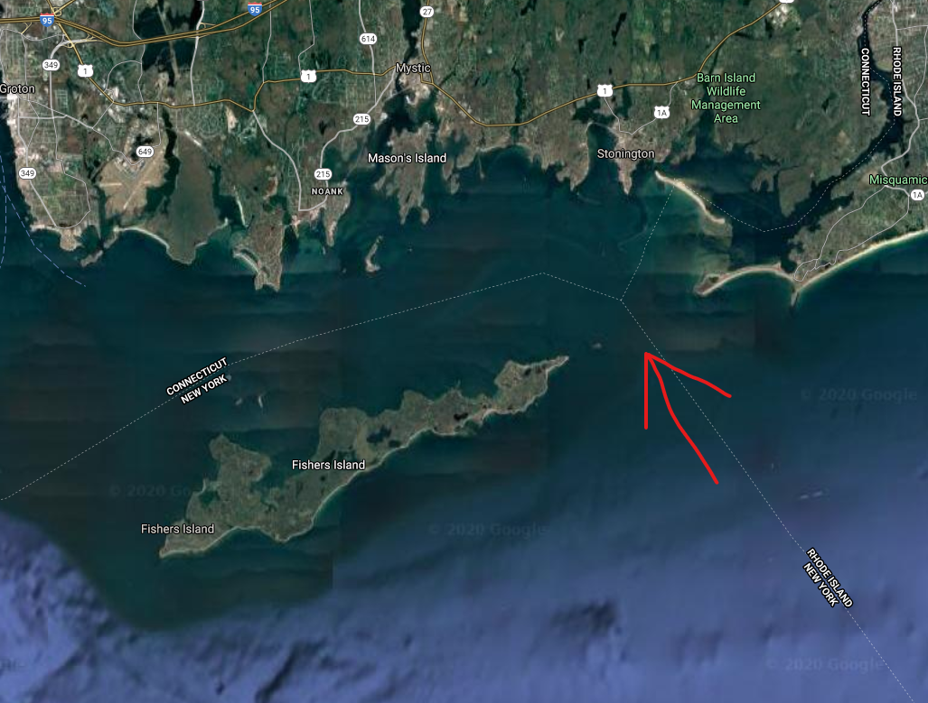
This summer I am hoping to take the trip from Narragansett Bay to Mystic Ct for a few days. Is anyone familiar with the route, particularly when it comes to which side of Fisher Island to go on. In the picture attached the red arrow indicates the most direct route, but it is also loaded with reefs. (sorry i couldn't get a screen shot of the chart). I spoke with one person that always just goes around the West side of Fisher Island to get there as to not deal with the reefs, but that obviously adds a lot of time/distance.
Anyone familiar with the area know if the reefs are well marked or if it is reasonable to navigate? Also I am going to be just using paper charts and do not have a chart plotter installed on the boat.
Thanks all
Anyone familiar with the area know if the reefs are well marked or if it is reasonable to navigate? Also I am going to be just using paper charts and do not have a chart plotter installed on the boat.
Thanks all


