I’m looking for your recommendations as to which Tide Chart do you use on your cell phone. Not for “On the Boat” use, but just for daily knowledge of the tides in your area. Which ones are the easiest to use and read.
What Tide Chart do you use on your Cell Phone?
- Thread starter sailcapt340
- Start date
I have Navionics and I just use the tide and current charts built into that. Works pretty well - You can pick a tide station and a day and see the chart for it.
Thank you. I’m looking for a quick to see tide chart for when we go shell fishing. No one of our friends have the Navionics you mention on their phones. Most have complicated to use apps because they want them for actual boating use not for casual “lets go clamming and get lunch” while sitting at home.
I‘ll check it out.
I‘ll check it out.
When we were in tidal waters we used Tides Near Me.

I’m a big fan of tides… the icon looks like this on the App Store

And it looks like this when open. Color coding also shows sunrise/sunset

You can select the tide station… and scroll along the curve to see exactly what time goes with a specific tide depth.
And it looks like this when open. Color coding also shows sunrise/sunset
You can select the tide station… and scroll along the curve to see exactly what time goes with a specific tide depth.
jssailem
SBO Weather and Forecasting Forum Jim & John
- Oct 22, 2014
- 24,455

Perfect help again. I checked out all your recommendations. I downloaded the Tides Near Me app on my iPhone. Its quick, easy and to the point. Just what we wanted for the quick check of the tides. Give’s me the area’s we frequent in our neck of the woods. And it agrees with my Tide Clock on the wall.
Thank you all, but keep your favorites coming for everyone to check out.
Thank you all, but keep your favorites coming for everyone to check out.
Attachments
-
 585.7 KB Views: 125
jssailem
SBO Weather and Forecasting Forum Jim & John
- Oct 22, 2014
- 24,455
How about Andrews Island.
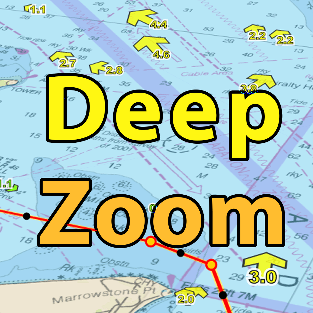

For many years (before I had a boat), I have used the Tide Times app when we were on a beach trip (Oregon). It is simple for non-sailors to use to plan walks on the beach, etc. I still use that for a quick look at the tides but I use DeepZoom for planning a crossing of the Columbia Bar and transit through narrow passages in the San Juan Islands. The tides affect bridge clearances 50+ miles inland on the Columbia River so I use both Tide Times and Deep Zoom when planning trips that involve passing under bridges and going into areas with shallow depths during parts of the tide cycle.
