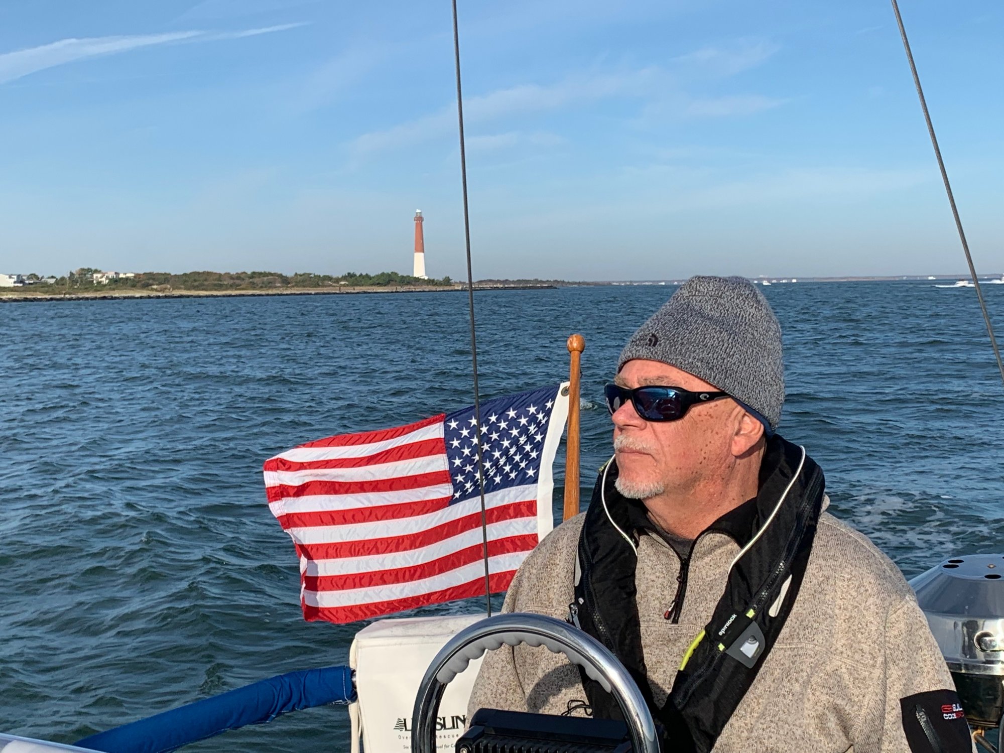
North Atlantic Adventure!

Oct 26, 2008
6,081
Catalina 320 Barnegat, NJ
Well, ok, it was just a day sail :cool: @Ward H and I took advantage of a decent forecast on Saturday to make our way out from Barnegat Inlet for Ward's first trip past the light house and into the Atlantic on his boat. It may not seem like such an adventure, but almost all of our sailing has been in the Bay and the inlet has a little mystique for us due to its reputation!
IMG_0781-1.JPG


We had a favorable tide for our trip out in the morning and the wind was supposed to be mild in the morning at about 10 to 12 knots from the northwest. Instead, it was more like northerly and it was 18 to 20 knots TWS during our entire ride towards the east. Our destination was over the horizon and back! We went straight out almost 11 nm and came back in at low tide and a ripping ebb current. At one point we were only making about 1.5 knots headway while inside the inlet when we were coming home.

IMG_0809.JPG


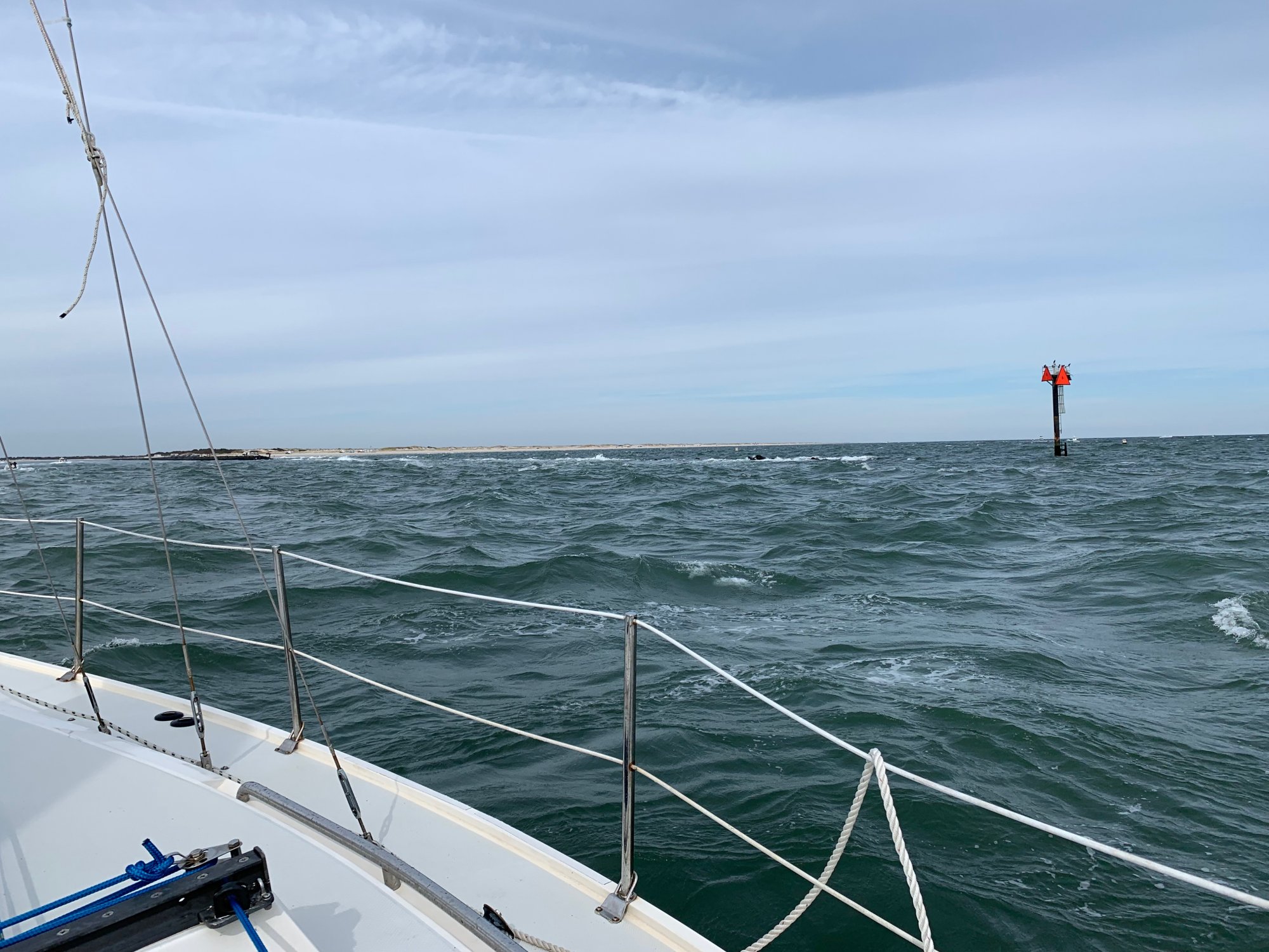
Here's the north jetty with the marker at the end of the submerged stone (only exposed at low tide). Reportedly, there is a sail boat that is in for repairs at our marina that recently came from Spain. The sailor was solo and for some reason came in to Barnegat Inlet at night during the lousy weather we've had recently. He was over-tired and made a critical mistake, putting his boat on this jetty. :(:(

IMG_0785.JPG


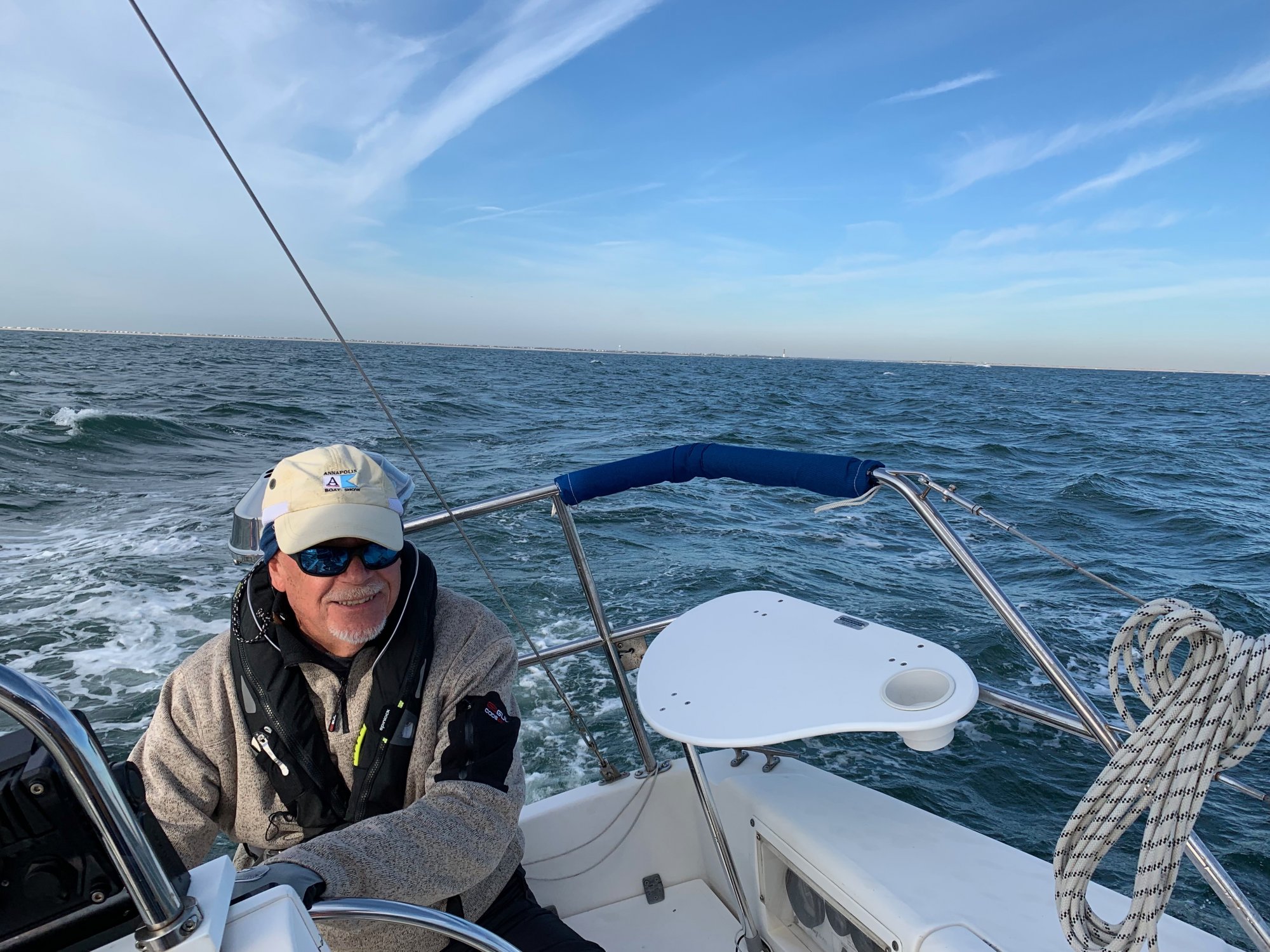
Our trip put a big smile on Ward's face!
 
Last edited:

JRacer

.
Aug 9, 2011
1,333
Beneteau 310 Cheney KS (Wichita)
All in all a great adventure, I'd say. Congrat's Ward and Scott.
 

dLj

.
Mar 23, 2017
3,423
Belliure 41 Sailing back to the Chesapeake
Saturday was lovely where I am. Looks similar there. Nice day for a sail! Glad you enjoyed! And made it back in without problems.

dj
 

TomY

Alden Forum Moderator
Jun 22, 2004
2,759
Alden 38' Challenger yawl Rockport Harbor
Actually, we were talking about most embarrassing moments while sailing. @Ward H was happy we were in deep water and we managed to stay off the bottom in the channels! ;);)
I still get the chills thinking about that Alden Challenger that went down in the Barnegat Inlet. I corresponded with the owner during a refit he did over a few years. All that work,...sunk.

 
Oct 26, 2008
6,081
Catalina 320 Barnegat, NJ
Yes, it is easy to see the way in when the sun is out. In the fog, it will be much easier to make mistakes. My second photo shows the north jetty and the submerged portion is just about a half mile long. Those rocks are truly submerged at high tide. My photo is just about exactly low tide for that day. It's easy when the rocks are covered to think it is alright to go in right there. I think there have been many that have made that mistake and probably many more in shallow draft boats whom have unwittingly escaped unharmed. The marks that we use to line up the inlet are almost 0.7 nm further out. In fog, it would be very easy to never see them.

Absecon Inlet is similar. If you cut the corner to close from the north you can find breakers before you know it.
 
  • Like
Likes: TomY

Ward H

.
Nov 7, 2011
3,651
Catalina 30 Mk II Barnegat, NJ
Yep, sailing last Saturday with @Scott T-Bird was a blast. I was a little nervous about the inlet but Scott had picked a good window to go out and I picked the brains of an experienced couple in our marina so I felt as prepared as I could be. While the conditions outside were a little more than we expected it was good sailing.
My decision to come in earlier than planned put us into the ebb tide, something I'll remember on our next ocean sail. The ride in was a bit squirrelly with the strong current and sport fishers putting out nice wakes but it was manageable. I can't imagine running the inlet in fog or darkness.
Overall a great day and hoping to do it again before the season ends.

Now if only I can get a couple of Scott's videos posted.
 

Ward H

.
Nov 7, 2011
3,651
Catalina 30 Mk II Barnegat, NJ
I spent some time today with the owner of the Alden 30 who grounded on the north jetty of BI a few weeks back. He's in our yard and just about finished with repairs.
He has been cruising solo for 3 years and just finished sailing up the NE coast. He had left Rhode Island for Norfolk VA and was 40 miles out when heavy seas, bad weather and fatigue got the best of him so he headed for Barnegat Inlet. Apparently what he thought were the lights for the outer markers were the jetty marker lights. He tried to take the inside of the north jetty marker and ran onto the rocks. USCG got him off the rocks and BoatUS towed him into Mariners. He got away with a few crunched spots in the hull and some scars but is now patched up and ready to continue south. Interesting guy.

Here are a couple of videos @Scott T-Bird took.
Leaving BI
Coming in BI

Edited to fix second link.
 
Last edited:
Oct 22, 2014
21,104
CAL 35 Cruiser #21 moored EVERETT WA
It is easy to get confused when entering an unfamiliar port with marginal lighting. Add to that the reasons for his seeking shelter, “Tired from being at sea in bad conditions” and you have an unfavorable cocktail.

Glad he made it in with minor scrapes and able to get his boat repaired. His experience is one that we can learn from.
 

dLj

.
Mar 23, 2017
3,423
Belliure 41 Sailing back to the Chesapeake
Really glad he can save his boat and nothing worse happened. May it be his worst event for the rest of his sailing!

dj
 
  • Like
Likes: jssailem

Ward H

.
Nov 7, 2011
3,651
Catalina 30 Mk II Barnegat, NJ
I post this as a cautionary tale when using the Navionics "Boat To" feature. While I never used the Boat To feature this was a learning experience for me.

The owner of the Alden uses Navionics when coastal cruising in the US. He showed me what he saw on the Navionics charts using his iPhone. He doesn't save his tracks so he chose a spot near Absecon Inlet and used the Boat To feature to show me how his "Boat To" track took him between markers #3 Green (unlit) and #4 Red (lit). He said he saw the red and green lights and turned just inside of the Red (he took red to port instead of starboard). the chart showed enough water but he said there were uncharted rocks.
I thought about this some more today.
He had said he was 40 miles from BI and 50 miles from Sandy Hook when he decided to take BI.
So using Navionics on my iPhone I put a spot out a ways and NE from BI. I then used the "Boat To" feature to create a track into the inlet. I did this a couple of times and each time the Boat To track has you rounding #6 Red (lit) marker, which marks the end of the jetty, to make the turn into the inlet.
As others have said, using the outer markers allows you to line up properly to come into the inlet and also provides the best approach for the wave action.
I think trusting the Navionics "Boat To" feature was his downfall, as well as fatigue and poor conditions. He thought he was at the outer markers and instead was looking at the jetty markers. Cutting the corner at the red would have been OK at the outer markers but not at the end of the jetty.

BTW, the "Boat To" track to inside the Absecon Inlet does the same thing. It takes you the closest route into the inlet, not the safest route by taking you through the outer markers.

There is supposedly a great photo of the grounded boat on the BoatUS Instagram page but I know nothing of Instagram to go looking for it. Maybe someone else can find it?

BTW, I corrected the link for the "Coming into BI" video.
 
  • Like
Likes: jssailem
Oct 22, 2014
21,104
CAL 35 Cruiser #21 moored EVERETT WA
"I think trusting the Navionics "Boat To" feature was his downfall,"

Good observation about the risks of navigational tools that are becoming "user friendly" but with unidentified risks.

John Harries of Attainable Adventure Cruising makes this statement: "I strongly caution against using auto routing for actual navigation." (bold face emphasis not added)

Even the professionally skippered and navigated Vestas made an error in the use of electronic charts when it ran aground on a shoal in the Indian Ocean during the 2014 Volvo Ocean Race.

The printed charts of the area show the reef.

Chart your route. Know your chart. Check it to verify that you are aware of the hazards.

I have used the chart software "Coastal Explorer" by Rosepoint since 2014. One of the features I like is the ability to enter a start and an end point. Then the software draws a line for you. It is a straight line. It is up to you examine the detail and adjust the line around all of the rocks or islands shown on the map. Once your feeling pretty good about the waypoints and your route, you can look at the detail report. The software triggers Warnings and Cautions along your planned route. This is a great aid to call your attention to the pitfalls along your chosen route. Perhaps you want to add another waypoint that will lead you around a known kelp bed or submerged rock that is within 10 feet of your planned route.

It is a great thing to be able to learn from another sailor. Thank you for sharing this experience, @Ward H .
 
Oct 26, 2008
6,081
Catalina 320 Barnegat, NJ
The video tells the story pretty well. We're entering in line with the Inlet Buoys, which you can see behind us. Actually, there is another set even further out and further yet is the Inlet Whistle Buoy. The marker that resides at the end of the jetty is a fixed pylon. I'm going to suggest that it isn't smart to cut the corner on a fixed pylon as there is bound to be solid ground on the side closest to land. The rocks of the jetty just barely break the surface during low tide. We could see waves breaking on the rocks, but the video doesn't show it very clearly. It's easy to see how darkness and/or fog would make it nearly impossible to discern the submersed rocks.

It seems to me that a Federal or State funded project should be contemplated at this location. It seems that boats on the rocks at this location is a pretty frequent occurrence. It doesn't seem to make any sense to leave the jetty as it is from a navigation standpoint.

Perhaps there is a reason why there is such a long stretch that is below the water surface and maybe it has something to do with the way sand is deposited around these jetties. Maybe the water needs to flow to keep the inlet from filling with sand too frequently.
 
Oct 2, 2008
3,807
Pearson/ 530 Strafford, NH
The video tells the story pretty well. We're entering in line with the Inlet Buoys, which you can see behind us. Actually, there is another set even further out and further yet is the Inlet Whistle Buoy. The marker that resides at the end of the jetty is a fixed pylon. I'm going to suggest that it isn't smart to cut the corner on a fixed pylon as there is bound to be solid ground on the side closest to land. The rocks of the jetty just barely break the surface during low tide. We could see waves breaking on the rocks, but the video doesn't show it very clearly. It's easy to see how darkness and/or fog would make it nearly impossible to discern the submersed rocks.

It seems to me that a Federal or State funded project should be contemplated at this location. It seems that boats on the rocks at this location is a pretty frequent occurrence. It doesn't seem to make any sense to leave the jetty as it is from a navigation standpoint.

Perhaps there is a reason why there is such a long stretch that is below the water surface and maybe it has something to do with the way sand is deposited around these jetties. Maybe the water needs to flow to keep the inlet from filling with sand too frequently.
I’ve asked myself these same questions. With so many inlets along our coast it’s difficult to decide who gets funded next.
 
Oct 10, 2011
619
Tartan 34C Toms River, New Jersey
The video tells the story pretty well. We're entering in line with the Inlet Buoys, which you can see behind us. Actually, there is another set even further out and further yet is the Inlet Whistle Buoy. The marker that resides at the end of the jetty is a fixed pylon. I'm going to suggest that it isn't smart to cut the corner on a fixed pylon as there is bound to be solid ground on the side closest to land. The rocks of the jetty just barely break the surface during low tide. We could see waves breaking on the rocks, but the video doesn't show it very clearly. It's easy to see how darkness and/or fog would make it nearly impossible to discern the submersed rocks.

It seems to me that a Federal or State funded project should be contemplated at this location. It seems that boats on the rocks at this location is a pretty frequent occurrence. It doesn't seem to make any sense to leave the jetty as it is from a navigation standpoint.

Perhaps there is a reason why there is such a long stretch that is below the water surface and maybe it has something to do with the way sand is deposited around these jetties. Maybe the water needs to flow to keep the inlet from filling with sand too frequently.
Don't you just love BI!!!!!!!!!!!!!!!