@dLj has posted his communications about his cruise in the Cruiser Forum. You can find his posts on this thread.
This is a grand journey.
To cruise the Atlantic means
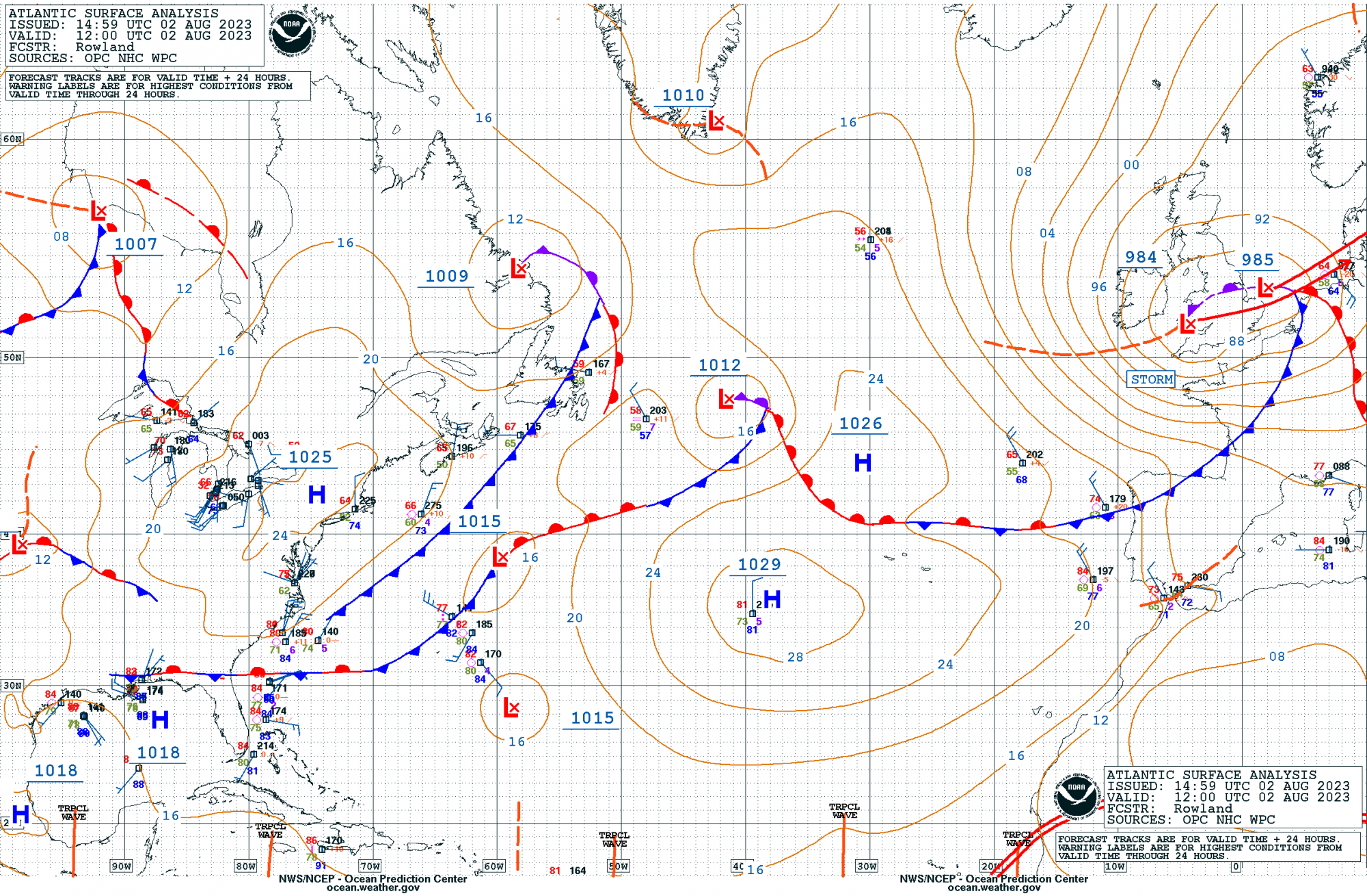
Highs bring clear weather. Winds that rotate clockwise as the HIGH cell moves eastward.
Lows are unsettled air with winds rotating in a counter clockwise direction.
Forecasting the weather is done in blocks of 96 hours. Beyond the current 96 hours window the quality of the weather data deteriorates. For Dave, 96 hours means somewhere between 380 and 570 nm of travel. You are dealing with a constantly changing condition. Choosing your route and adjusting as you move across the ocean and the weather moves up behind you.
With regard to LOW cells, you want to be on the quadrant (assuming the cell is divided in to 4 pie shaped pieces) generally on the southern side with the LOW center passing north of you in the Northern Hemisphere. The most dangerous side of a low is the “right side” in the northern hemisphere. If the low is moving from south to north, this would be the east side. Winds are strongest over a much larger area and the seas are also largest on the “right side.”
Your route selection is critical. Areas to avoid are the seas between a northern HIGH cell and a LOW cell moving towards it. The combination creates strong gales and large waves compressed between the two cells.
Here is NOAA's forecast site for the Atlantic. You can click on the charts to get a picture of the weather conditions Dave will be facing.
 ocean.weather.gov
Todays current forecast.
Jim and John
Trip to Europe (and back) begins
As many of you know, I'm heading off to sail to Europe this year. I'll try to post updates with photos as time permits. Today was the splash, boat is now in the water after a fair amount of work was done. All new thru hulls: several removed - I went from 8 thru hulls to 5. The kitchen sink thru...
forums.sailboatowners.com
This is a grand journey.
To cruise the Atlantic means
- looking for a window to escape the shoreline,
- choose a bearing (often a great circle route) to your target port of call,
- and strict attention to the developing weather patterns as they form and head out across the Atlantic in an East North Easterly direction.
Highs bring clear weather. Winds that rotate clockwise as the HIGH cell moves eastward.
Lows are unsettled air with winds rotating in a counter clockwise direction.
Forecasting the weather is done in blocks of 96 hours. Beyond the current 96 hours window the quality of the weather data deteriorates. For Dave, 96 hours means somewhere between 380 and 570 nm of travel. You are dealing with a constantly changing condition. Choosing your route and adjusting as you move across the ocean and the weather moves up behind you.
With regard to LOW cells, you want to be on the quadrant (assuming the cell is divided in to 4 pie shaped pieces) generally on the southern side with the LOW center passing north of you in the Northern Hemisphere. The most dangerous side of a low is the “right side” in the northern hemisphere. If the low is moving from south to north, this would be the east side. Winds are strongest over a much larger area and the seas are also largest on the “right side.”
Your route selection is critical. Areas to avoid are the seas between a northern HIGH cell and a LOW cell moving towards it. The combination creates strong gales and large waves compressed between the two cells.
Here is NOAA's forecast site for the Atlantic. You can click on the charts to get a picture of the weather conditions Dave will be facing.
Ocean Prediction Center - Atlantic Marine
Todays current forecast.
Jim and John


