Major Flash Flood on the N. Chesapeake

Status
Not open for further replies.

RichH

.
Feb 14, 2005
4,773
Tayana 37 cutter; I20/M20 SCOWS Worton Creek, MD
Flood stage due to the 'remnants of TS Lee' at the Conowingo Dam on the Susquehanna River just north of Harve de Grace is showing 32 feet above normal ... and thats only about 4 ft. lower than Hurricane Agnes ('72) @ 36 ft. which caused a mega-major disaster to the Upper Chesapeake.

Im sure that the pilings where ROSS keeps his boat nor the pilings on the North East River arent good for a 32ft. rise. So here's hoping that all those that keep their boats on the far N. Chesapeake ride this one out and remain safe.

Check in guys when you can as Im quite concerned about you all.

http://water.weather.gov/ahps2/hydrograph.php?wfo=phi&gage=cnwm2&view=1,1,1,1,1,1,1,1"

http://www.foxnews.com/weather/2011...-fresh-flood-worries-to-east/?test=latestnews
 

zeehag

.
Mar 26, 2009
3,198
1976 formosa 41 yankee clipper santa barbara. ca.(not there)
be safe everyone... why couldnt some of the water be sent to texas... geez.....feast or famine...
32 ft above normal is awfully lot of water!
 

Ross

.
Jun 15, 2004
14,693
Islander/Wayfairer 30 sail number 25 Perryville,Md.
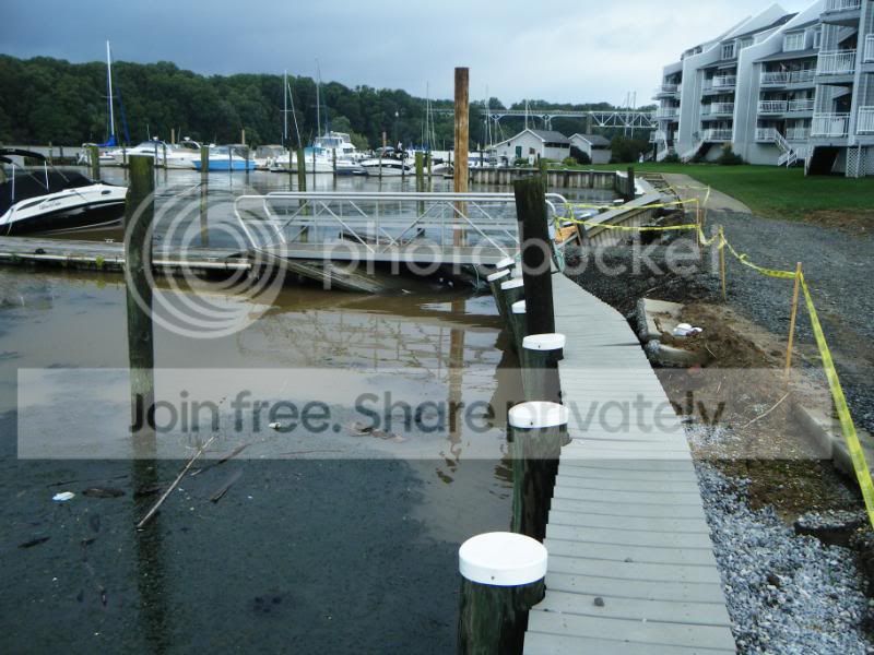
I took this picture Tuesday morning.

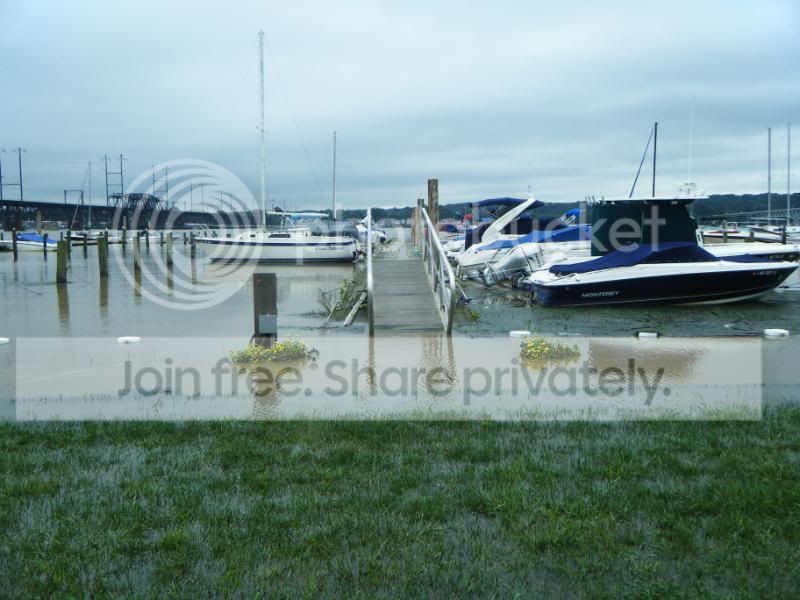
And this one this afternoon about 4 PM.

We are good if the river doesn't rise more than about six more feet. It is up about six now.
 

RichH

.
Feb 14, 2005
4,773
Tayana 37 cutter; I20/M20 SCOWS Worton Creek, MD
Good to see your post. Sounds like you have a good shot at being 'safe'.
Still waiting for the NE River folks to check in.
Im wondering how much larger the Susque Flats will grow ... H. Agnes 'did a job' and doubled the size. Before then you could sail direct from HdG to NE !!!!
best regards
;-)
 

Ross

.
Jun 15, 2004
14,693
Islander/Wayfairer 30 sail number 25 Perryville,Md.
There are some major logs drifting past Owen's at Perryville. We are bow to the current and have 3 feet before the water reaches our bowlines and 4 to 5 feet from there before they go taut.. The river is quite wide at this point and each extra foot makes it wider.
 
Oct 14, 2005
2,191
1983 Hunter H34 North East, MD
Rich H and others...

I haven't heard anything from my marina buddies in North East as yet, and am planning to head down the boat by tomorrow afternoon at the latest.

When we built our new floating dock system marina, the pilings were set to be taller than the effects of Isabell by a margin of more than a couple of feet. Irene tested the opposite effect by sucking a lot of water out. This will be more like Agnes.

Daughter lives upstate near the Susquehanna. At dinner time tonight the river was still a good two feet below the high point for Agnes in her back yard. Over in Sunbury they expect the crest to be below the 41 foot dikes, but are sandbagging "just in case". Already many bridges and roads are closed due to flooding at or over them.

At Bridgeport in Lancaster, the Conestoga River is higher than in Irene by four or five feet, with the flow at the top of all arches on the Rt 462 bridge there. At Marietta they are expecting a crest greater than Agnes, in the 62 foot range.

Last projection I saw for Connawingo was less than two feet below Agnes' level. They've already started to open more spillways (Safe Harbor on the news appeared to have almost all theirs open). The 2pm river forecast for the dam is showing a crest of 35.7 feet before subsiding on Saturday mornng. It was at 30.1 feet then.

It's not looking good for Port Deposit, Perryville, and Harve de Grace. From Ross's pics, it doesn't look like he has much of a margin to deal with.

All the pics I saw of the rivers showed them as ugly brown torrents. This isn't going to be pretty on the Bay.

PS: Check this site out for the flooding predictions on the Susquehanna and its tributaries: http://water.weather.gov/ahps2/glan...&view=1,1,1,1,1,1,1,1&toggles=10,7,8,2,9,15,6
 

Ross

.
Jun 15, 2004
14,693
Islander/Wayfairer 30 sail number 25 Perryville,Md.
Re: Rich H and others...

The pilings for the floating dock have at least eight feet left. I have at least four feet of slack in my bow lines. The river is up to the top of the seawall or about six feet or less. If the river rises six more at the dam then probably only about 3 or 4 at Perryville.
 
Oct 14, 2005
2,191
1983 Hunter H34 North East, MD
Manny...

Thanks for the link...any thoughts of a condo on the water in HdG have been thoroughly erased!
 

zeehag

.
Mar 26, 2009
3,198
1976 formosa 41 yankee clipper santa barbara. ca.(not there)
i hope all ends up ok for you guys up there in wetville---looks nasty. be safe and keep your feets dry.

re: a condo in the water--i cant understand why you dont want to swim to bathroom....is really excellent exercise...

could ye send some of that wet stuff over to texas, by any chance?? they just burning up out there..
 
Oct 26, 2008
6,432
Catalina 320 Barnegat, NJ
Pipeline to Texas ...

to transport water instead of oil??

The ripples in this photo are from me wading in ankle deep water on our concrete pier. Thankfully, we don't have the damage or mess like the river systems have been delivering.

I-287 was closed on the northbound side near Boonton because the Rockaway River washed it out. Contractors got it put back together miraculously right after Irene. I drove by a few times recently and the Rockaway looks more like the Colorado thru the Grand Canyon as it floods right alongside the highway.
 

Attachments

Oct 14, 2005
2,191
1983 Hunter H34 North East, MD
North East River Update...

I just walked up to our Club office to use the conputer to send ths. The water level here is slightly above normal high tide. The water isn't muddy at all (looks its normal cloudy self). There has been some debris that has come into the marina and is now firewood for our firepit on our picnic grounds.

The guys up at West Marine reported that the Connowingo dam has closed down some of the flood gates, with 40 now open (from 53).

Couple of go-fast boats running in the river--waiting to hear one hit something. :D

Bay Jam race off Turkey Point tomorrow has been postponed until 9/24 due to the debris in the Bay coming from the Susquehanna.

Sky is blue, sun is out, temp's near 80, beer's cold--what's not to like!
 

Ross

.
Jun 15, 2004
14,693
Islander/Wayfairer 30 sail number 25 Perryville,Md.
Re: North East River Update...

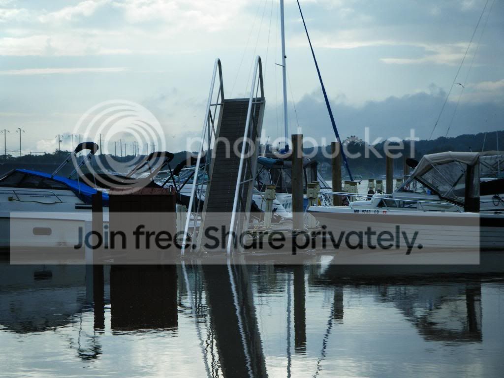
This is a ramp lifted by the dock at high water.

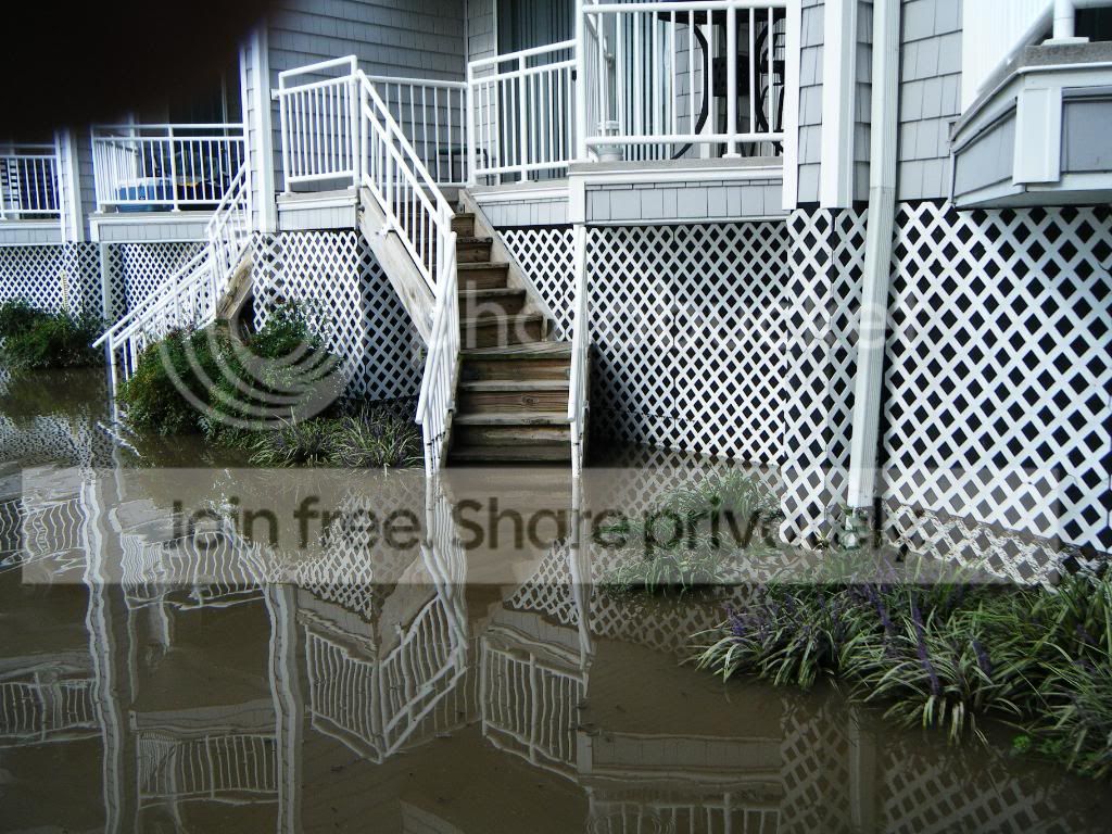
This is the high water mark.

And this is what the locals felt about the high water.
This guy was fishing over the lawn. There was a man with a cast net catching small bait fish on the road.
 
Dec 4, 2006
281
Hunter 34 Havre de Grace
Manny,

I've been out on the hard since the Friday before Irene.
Poor old girl got hit by the mast of a Lightning that slid off it's trailer.
Just a scrape that rubbed out by hand.

I haven't heard anything directly from the marina. Which I guess could be a good sign. And from what I've seen on the internet and Ross's pictures from Perryville, the water probably was lapping the bottom foot or so of the keel. We're headed down to HdG tommorrow to see what's what.

You're down on the Middle River now right? How did things fare down there?
One of the guys at work has a boat on Frog Mortar creek, heard that he had no problems.
 

Ross

.
Jun 15, 2004
14,693
Islander/Wayfairer 30 sail number 25 Perryville,Md.
Bob, the current speed report from the yellow bouy off concord point at the last time I check was .8 kts. that is down from about 3 early Friday. Port Deposit is drying out and I think that you will just find a lot of mud.
Link to data buoy: http://buoybay.noaa.gov/locations/susquehanna.html
 
Status
Not open for further replies.