Maine has the fourth(edit) longest tidal shoreline in the United States. 3,478 miles. Longer than larger states like Texas and even California.
If you draw a straight-line from Kittery to Eastport, the distance is only 220 or so miles. That’s only a third of California’s length - as the crow flies.
But tidal shoreline — which officially* takes into account offshore islands, sounds, bays, rivers, and creeks to the head of tidewater or to a point where tidal waters narrow to a width of 100 feet — is the sailers coastline.
* official-check your state here, shoreline length: https://coast.noaa.gov/
This “coastline paradox”, a term used in Oceanography, is easy to understand if you live-work and sail along the coast of Maine.
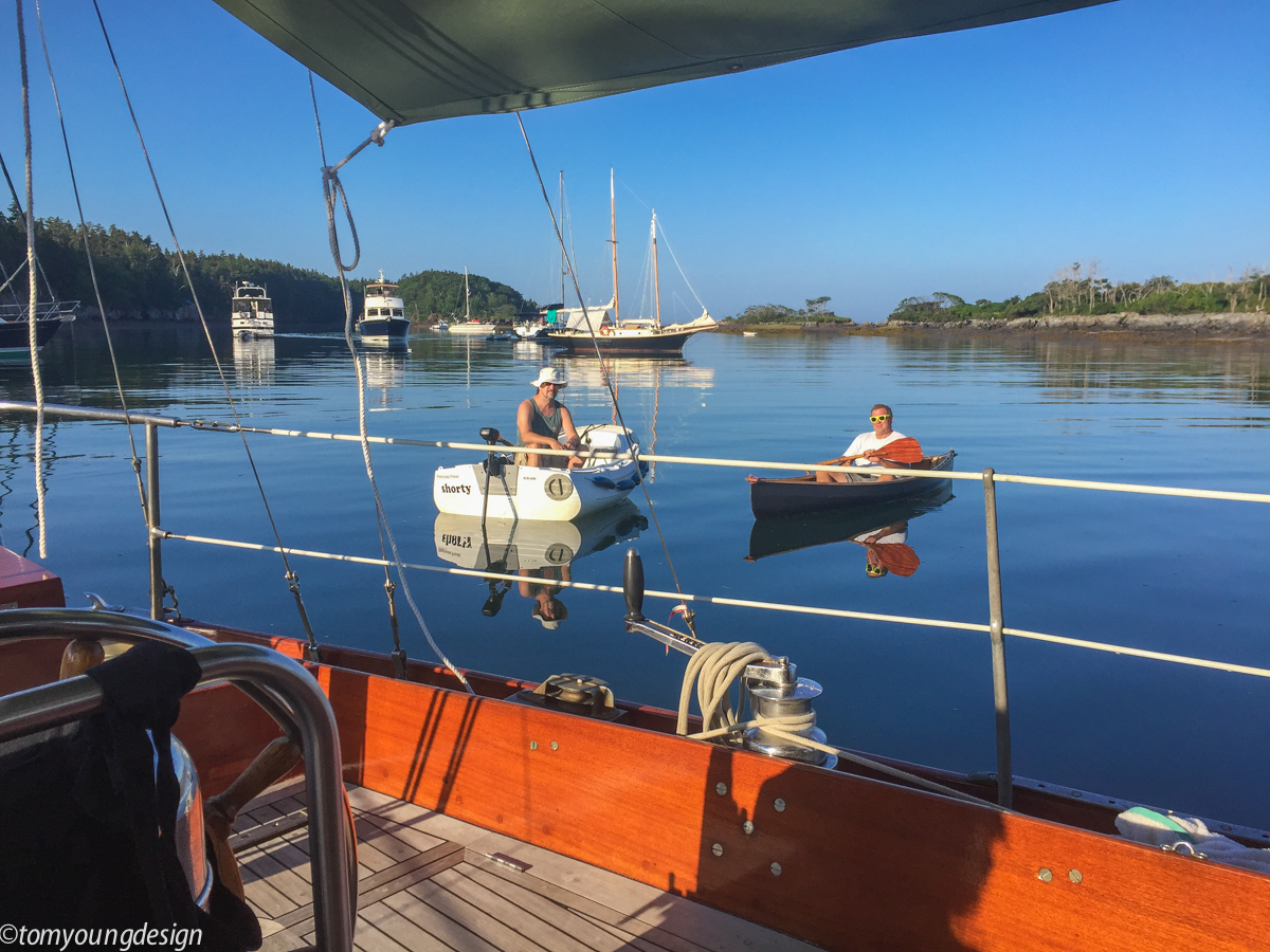
Last season, with the prospect of a hot August Westerly later in the day, we lingered over breakfast and had time to meet other coastal sailors(one from NH, one Calif.) in the Jewel Island anchorage in Casco Bay.
There are a wide range of wonderful people, boats and dinghy's, doing our coasts.
By mid morning, we’re under way and headed Eastward, bound for home.
August is Fire and Ice on the coast of Maine. Icy seawater quickly chills the land heated West wind (high 80's), keeping us cool and moist in the cockpit.
We sailed through Casco Bay leaving hundreds of miles of shoreline, islands and unexplored sailing behind, for another time.
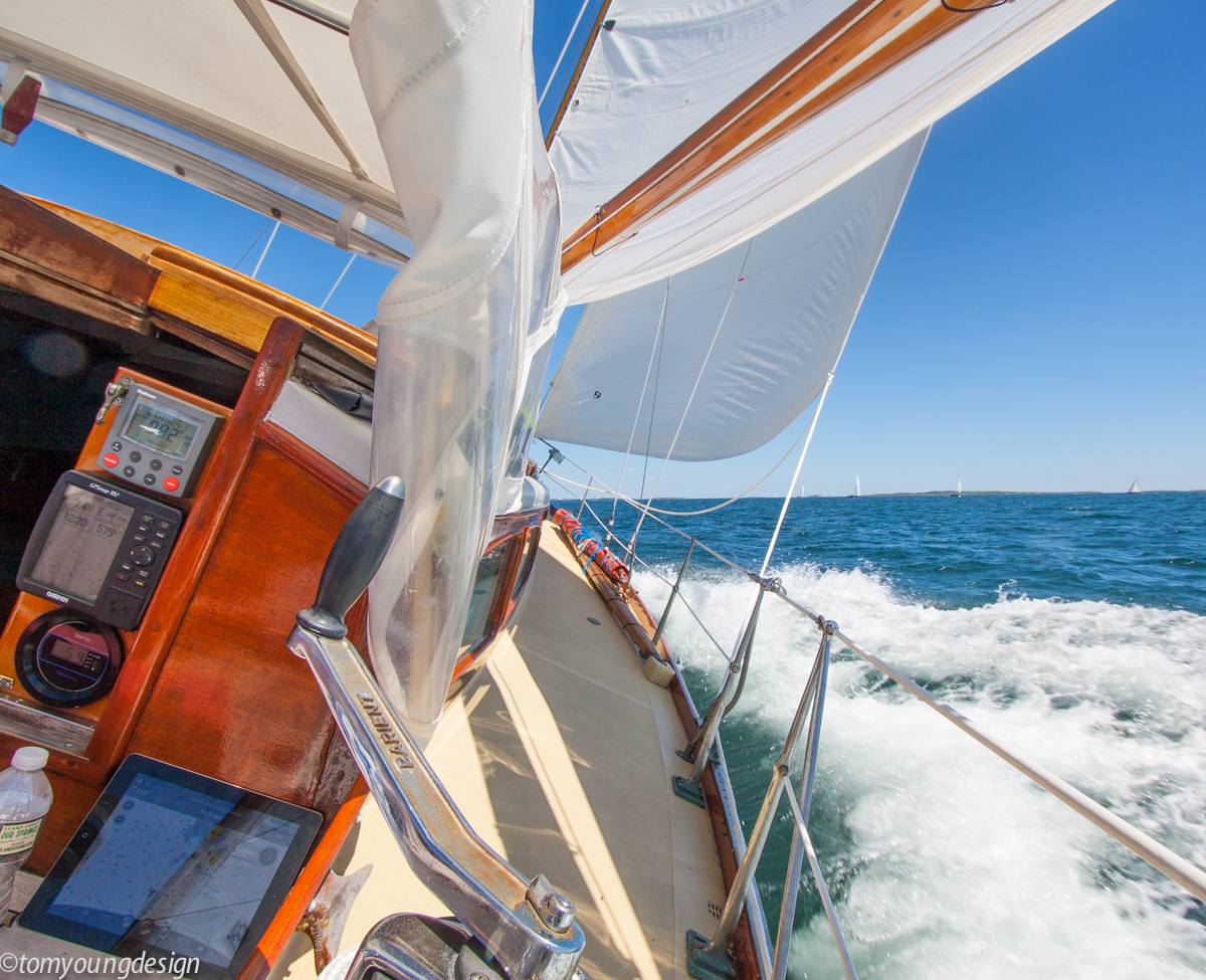
A morning broad reach was coaxed onto the beam as both our course and the wind swing more Northerly bringing the shoreline, closer, closer. Water flattens, boat speed climbs.
As a headland moved aft, we leaned on a growing breeze that increased through the wide valley formed by the mighty Kennebec River.
I can attest, you have to pay attention when sailing closely along the coast of Maine. Not all hazards are easy to see (many are submerged), especially with all the beautiful distractions going by.
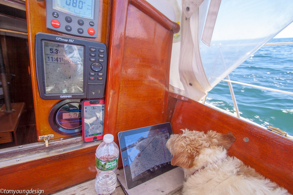
(I prefer many portable minders in the cockpit helping keep an eye on hazards, many not marked ahead.)
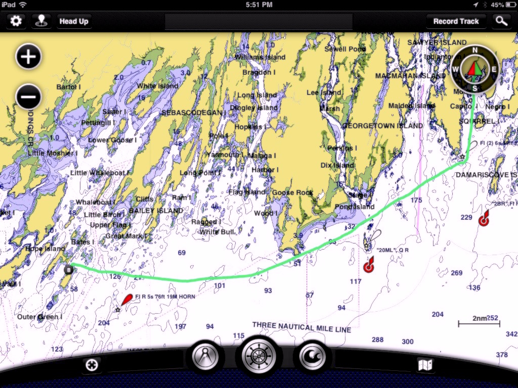
We took the route on the inside of Sequin Island.
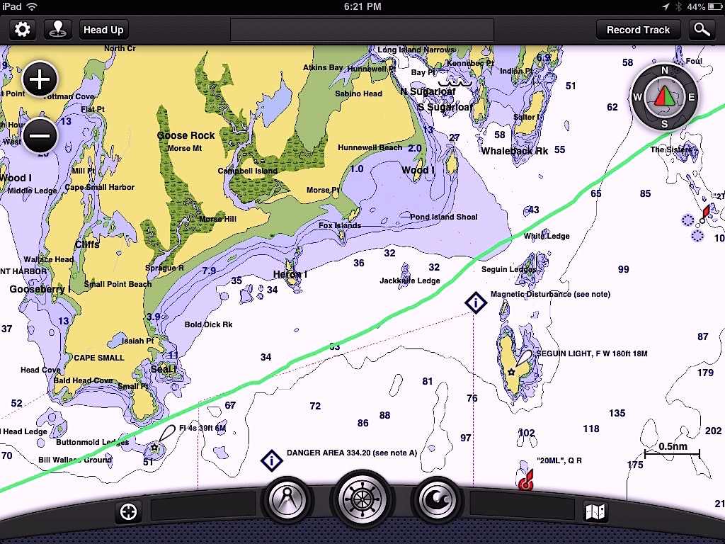
Other boats had the same idea and passed us heading South (up ahead), as we sliced our way inside Sequin Island at hull speed.
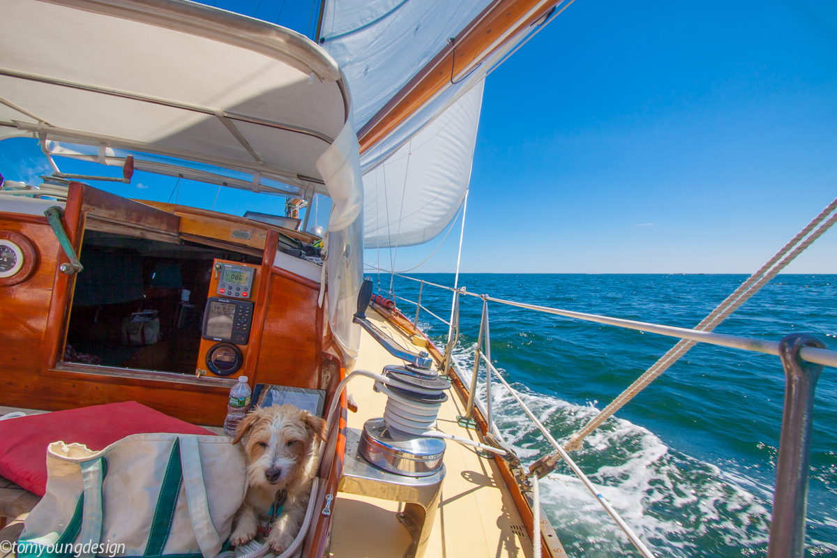
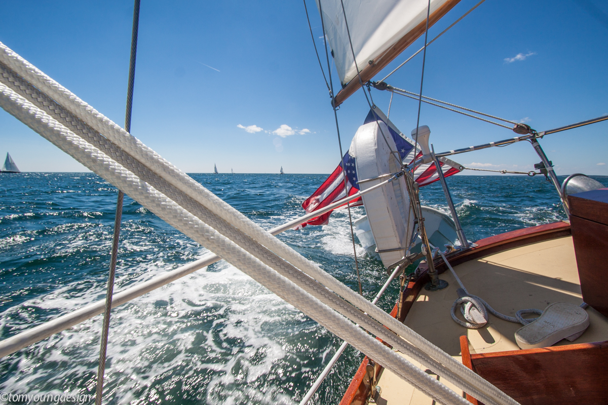
Another headland slows things down just long enough for lunch under sail (AP) before the Westerly picks our sails up in the next open valley formed by the Sheepscot River.
See ya!
By mid afternoon, the wind was at it’s peak for the day and I was wishing for a reef in the main. Time to quit.
We rolled up the genoa in the lee of Southport Island and listened to the rattling mainsail as the engine drove us dead to windward, into Boothbay Harbor.
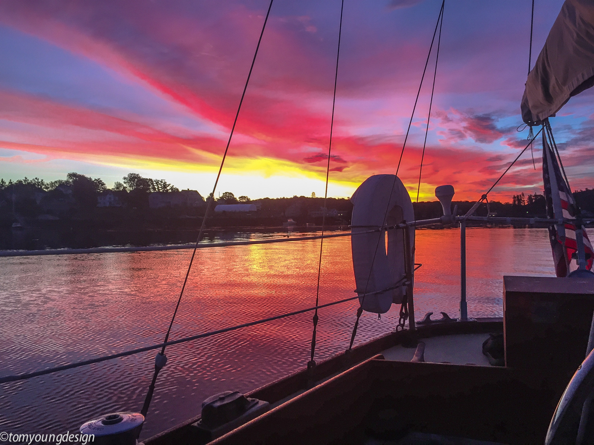
The anchorage was a mill pond, a perfect place to spend a peaceful night and enjoy the next sunrise (5:19 am).
Almost home. Just little Muscongus Bay between us and Penobscot Bay.
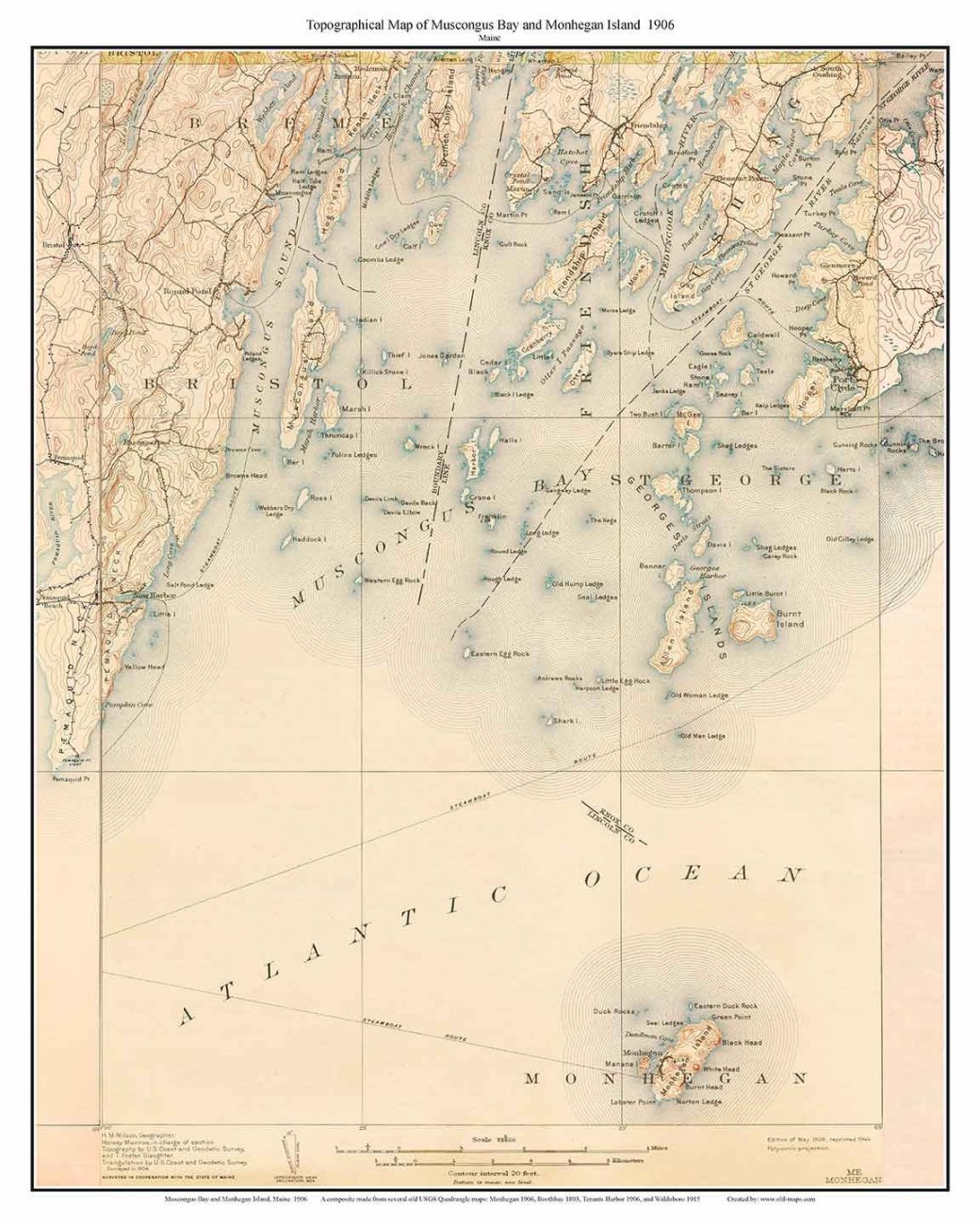
Someday, instead of just passing through, I have to explore Muscongus Bay. Someday,….
If you draw a straight-line from Kittery to Eastport, the distance is only 220 or so miles. That’s only a third of California’s length - as the crow flies.
But tidal shoreline — which officially* takes into account offshore islands, sounds, bays, rivers, and creeks to the head of tidewater or to a point where tidal waters narrow to a width of 100 feet — is the sailers coastline.
* official-check your state here, shoreline length: https://coast.noaa.gov/
This “coastline paradox”, a term used in Oceanography, is easy to understand if you live-work and sail along the coast of Maine.
Last season, with the prospect of a hot August Westerly later in the day, we lingered over breakfast and had time to meet other coastal sailors(one from NH, one Calif.) in the Jewel Island anchorage in Casco Bay.
There are a wide range of wonderful people, boats and dinghy's, doing our coasts.
By mid morning, we’re under way and headed Eastward, bound for home.
August is Fire and Ice on the coast of Maine. Icy seawater quickly chills the land heated West wind (high 80's), keeping us cool and moist in the cockpit.
We sailed through Casco Bay leaving hundreds of miles of shoreline, islands and unexplored sailing behind, for another time.
A morning broad reach was coaxed onto the beam as both our course and the wind swing more Northerly bringing the shoreline, closer, closer. Water flattens, boat speed climbs.
As a headland moved aft, we leaned on a growing breeze that increased through the wide valley formed by the mighty Kennebec River.
I can attest, you have to pay attention when sailing closely along the coast of Maine. Not all hazards are easy to see (many are submerged), especially with all the beautiful distractions going by.
(I prefer many portable minders in the cockpit helping keep an eye on hazards, many not marked ahead.)
We took the route on the inside of Sequin Island.
Other boats had the same idea and passed us heading South (up ahead), as we sliced our way inside Sequin Island at hull speed.
Another headland slows things down just long enough for lunch under sail (AP) before the Westerly picks our sails up in the next open valley formed by the Sheepscot River.
See ya!
By mid afternoon, the wind was at it’s peak for the day and I was wishing for a reef in the main. Time to quit.
We rolled up the genoa in the lee of Southport Island and listened to the rattling mainsail as the engine drove us dead to windward, into Boothbay Harbor.
The anchorage was a mill pond, a perfect place to spend a peaceful night and enjoy the next sunrise (5:19 am).
Almost home. Just little Muscongus Bay between us and Penobscot Bay.
Someday, instead of just passing through, I have to explore Muscongus Bay. Someday,….
Last edited:

