

This morning I was supposed to meet one of my customers, "bright and early", to move his boat to the boat yard, and do a short haul to replace the depth transducer. I'm really pretty much dragging arse today as I was working on another customers boat until 12:00 am last night.
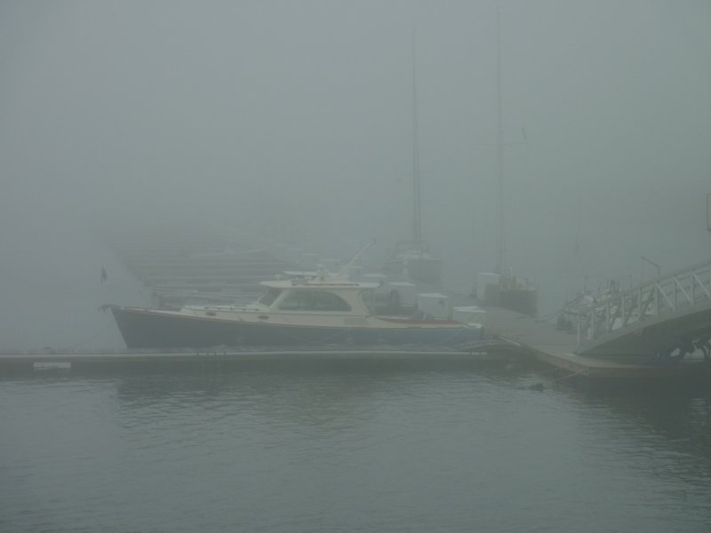
As I am walking down the ramp to the dock I get a call. "Is it possible for you to move the boat without me, I can't make it."... "Ahh sure....." Of course this is Maine, and the FOG this morning is typical thick, moving in and out from 30 yards to 150 yards visibility. The customer has a brand new compass that has yet to be swung, waiting on the compass adjuster, and a brand new e7 plotter that I have not had enough time using to feel comfortable with.
So now I am digging through his boat to find the tools to plot my course, on paper, and locating the charts so I can get the boat there for the short haul time. Let's just say I made do with the tools he had, which are not the tools I am used to using. My plotting skills are rusty at best using other peoples tools, boats and compasses.... Lesson learned, always show up with my own hand held plotter.... Luckily I had my hand bearing compass in the car because the brand new compass is NOT accurate, yet. I also managed to find his fog horn and I had mounted his radar reflector so I knew that was good.....
So now that I am here I have to wait for three boats to get launched before I get hauled, but, they have a nice lounge....
Real time (the fog was less thick at the marina):
As I am walking down the ramp to the dock I get a call. "Is it possible for you to move the boat without me, I can't make it."... "Ahh sure....." Of course this is Maine, and the FOG this morning is typical thick, moving in and out from 30 yards to 150 yards visibility. The customer has a brand new compass that has yet to be swung, waiting on the compass adjuster, and a brand new e7 plotter that I have not had enough time using to feel comfortable with.
So now I am digging through his boat to find the tools to plot my course, on paper, and locating the charts so I can get the boat there for the short haul time. Let's just say I made do with the tools he had, which are not the tools I am used to using. My plotting skills are rusty at best using other peoples tools, boats and compasses.... Lesson learned, always show up with my own hand held plotter.... Luckily I had my hand bearing compass in the car because the brand new compass is NOT accurate, yet. I also managed to find his fog horn and I had mounted his radar reflector so I knew that was good.....
So now that I am here I have to wait for three boats to get launched before I get hauled, but, they have a nice lounge....
Real time (the fog was less thick at the marina):


