Killarney and the North Channel

Status
Not open for further replies.
Sep 20, 2006
2,953
Hunter 33 Georgian Bay, Ontario, Canada
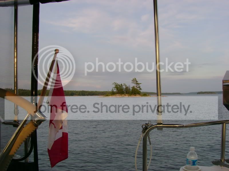
After many years of wishing to return to Killarney at the north end of Georgian Bay, ( I've canoed every lake in Killarney Park and hiked several ridges including to the top of Siver Peak the highest point in the area) we spent 1 1/2 weeks going up and returning. We initially crossed the top end of Georgian Bay and spent 10 hours to cross and the first time I've ever been far enough out to not see land in any direction. Was chased by a thunderstorm on the last part of the trip and survived a Gale Force thunderstorm ( 52.2 knot winds ) but the reward was worth it.

I'll try to post more in the photo forum but this is just a sampling for those that have not been to this area.
 

Attachments

Sep 20, 2006
2,953
Hunter 33 Georgian Bay, Ontario, Canada
Awesome anchorage

we're in 35 ft. of water with and anchor out front and tied to shore
 
Sep 20, 2006
2,953
Hunter 33 Georgian Bay, Ontario, Canada
Our greeting at Killarney

3 hours from Killarney this was waiting for us and was directly in our path. We headed west to clear sky until it passed.
 
Sep 20, 2006
2,953
Hunter 33 Georgian Bay, Ontario, Canada
The Pool

At the end of Baie Fine is a narrow channel that leads to a small pool of water with great views, that has been used for anchoring since the early 1900's.

Personally I was disappointed, but maybe because I've seen all the other lakes in this area which are much more spectacular. The Pool also has weeds just below the surface of the water which to me made it seem more like a swamp and was not swimmable ( is that a word??) We ended up anchoring ( see above) in Baie Fine which had more spectacular views and you could swim.
 

Mike B

.
Apr 15, 2007
1,013
Beneteau 43 Baltimore, MD
Beautiful

It's beautiful. I don't know where it is but suspect perhaps Maine?
 
Sep 20, 2006
2,953
Hunter 33 Georgian Bay, Ontario, Canada
Actually

nowhere near. Killarney and the North Channel are at the north end of Georgian Bay and Lake Michigan and is a large bay attached to Lake Huron.
 

Mike B

.
Apr 15, 2007
1,013
Beneteau 43 Baltimore, MD
Thanks!

Scott, thanks for the geography lesson. Looks like you had the place to yourself. Hope you enjoyed it.
Mike
 
Sep 20, 2006
2,953
Hunter 33 Georgian Bay, Ontario, Canada
very popular

the North Channel is world famous and a very popular destination. Not only is it accessible from Georgian Bay, Lake Huron, Michigan and Superior, it's also a stopping point for anyone doing "the loop". i.e the Gulf, ICW, Great Lakes, Missisippi.....
 
S

Scott

Beautiful ...

I'm glad you have water that is warm enough for swimming! During the time when I lived along the north shore of Lake Superior, there was no way to go in the water even for a quick dip. It had to have been in the 50's even during July. Maybe with climate change, that is changing ;).

I'd like to know how you handled the blow! What tactics did you use? Should we assume that the storm was coming in from the southwest? Did you shorten sail and run to the west to skirt by it and let it get by you quickly? Or did you drop sails entirely? I'll bet it felt good to choose a tactic and have it work out for you.
 
Sep 20, 2006
2,953
Hunter 33 Georgian Bay, Ontario, Canada
ran like crazy

The winds all afternoon were 13 - 15 knots from the West and were headed NW which was perfect. Forecast was W10, which is why we decided to do the 10 hours crossing, rather than stay closer to shore and take an extra day. Directy west you could see a large area of rain. These clouds were forming to the north and were moving in a westerly direction, but we were headed into them. I was hoping it would pass by before we got too close. In order to pass some shoals I had to head more in a northerly direction but that put us straight into the middle of it. I turned back to NW and headed for clear sky that was still left between the two storms to let it pass by before we headed N again. The wind changed from W15 to E 20 - 25 as the clouds got closer and at one point a large mass of the clouds started doing a vertical roll. o) By this time I had the sails down, assuming that if we got hit with the front the winds would be strong. Eventually the winds died down again and we thankfully missed the majority of this storm, unlike the one that ran right over us several days later, which you can read about below.

This is what greated us in Killarney.
 
Sep 20, 2006
2,953
Hunter 33 Georgian Bay, Ontario, Canada
lots of ideas

I was out tonight and am heading up to the boat Friday right after work. We're just nirth of Guelph and the boat is in Penetang. I will pass on some tips next week when I have more time. How long are you planning to take, how much experience do you have in cruising up to or in the area.

If you don't already have it, buy the Ports book on Georgian Bay. If your unfamiliar with the region or even a little familiar, the book will save you tons of time searching out services for pump outs, refuelling, groceries all the way up to and around the North Channel. Other huge savings is locating anchorages in all the regions. We could not have made the trip without the book. Made locating anchorages very easy and all the descriptions are accurate.

Check back again next week and I'll update info on the area and along the east side of Georgian bay if you've not been up there.
 
Sep 20, 2006
2,953
Hunter 33 Georgian Bay, Ontario, Canada
james

Have you been in the 30,000 islands area or Killarney before and / or anchored out before. Just curious as how much info I can pass along.

We bought our first boat last year and now have over 50 nights on the hook. I've been in the southern area, Honey Harbour for years as well as Killarney and Parry Sound, but either land based, cottage/ cottage boat or canoes.
 
Sep 20, 2006
2,953
Hunter 33 Georgian Bay, Ontario, Canada
hope this helps

As I said above make sure you study the Ports book thoroughly. It is invaluable in finding anchorages, marinas and services along the way instead of hunting around. It’s hard to say 100% of her advise is correct, but I did not find any inaccuracies in any advise she gave and we just could not have made the trip in the time we did without the book.


There are two ways to get up to Killarney, either Kokomo “we’ll get there fast and then we’ll take it slow” as we did, or take your time going up and back. We took 1 ½ days to get to the town of Killarney. 6-7 hours from Penetang to Kilbear / Kilcoursie Bay and then 12 hours to Killarney cutting across from Point au Baril. Just after we arrived at the docks at The Sportsman Inn, a couple of guys pulled in that had spent 12 hours coming from Wiarton. After that we took a couple of days to explore Baie Fine before takling 3 days to return home. As I said, the Ports book is very accurate in her description of the Killarney and surrounding area. we wanted to see The Pool at the end of Baie Fine, having been in this area many years ago on canoe trips. If you’ve never been to this area it is probably the best for scenery etc. From the Pool you can hike up / over to a couple of other lakes in the Killarney Prov. Park, ( Baie Fine and the Pool are also in the park as well as part of Collins Inlet. Topaz Lake and OSA Lake which are on the trail, which is a canoe portage that I’ve been on, are very clear and you can see 20 – 30 ft. to the bottom. That is due to them being acid lakes which is naturally occurring from the rocks. The second night we were in this area there were many boats anchored along the narrow inlet leading to the Pool as well as anchored in The Pool itslef. The bottom of this water had weeds growing up to just below the surface so was not swimmable. We opted to stay out in the many coves along Baie Fine. You could see further and the ridges make for an awesome backdrop for anchoring. We dropped the anchor in 35 ft. of water on the north side and backed into shore and tied up 50 ft. away from shore and still had 35 ft. depth. I didn’t want to swing around and end up too exposed to the main body of water. The south shore has a better view but you have to watch the wind directions overnight to avoid being bounced around. Check the forecast and pick a spot that will shelter you from the winds that night. We headed over in the dinghy and sat on the rocks on the south shore and had afternoon cocktails to enjoy the view. You can also hike up any of the ridges in the area. we picked a spot that looked relatively easy and hiked up to 900 ft. elevation above the bay for a differnet view of things.

Beyond Killarney there is lots to explore, but you will probably need more than two weeks to see much, unless you go hard up there and back leaving you close to a week up there.

On the way back we went through Collins Inlet ( search for my post on the T-storm that ran over us in there) It is around 6 miles long and at times only 150 ft. wide with rocks 50 ft. above you along the shore. Depth at the Eastern end was not a problem given that Huron / Georgian Bay are 7-8” above last year and close to 12” above chart datum.

We anchored in The Bustards in one of the eastern Bays. Exactly as described in Ports. A lot of boats in the larger bay but ours only had 5-6. We stayed clear of the cottage to not crowd them and to give ourselves some privacy. Lots of interesting small inlets to explore in the dinghy.

Between Point au Baril and Byng Inlet you might as well stay out of the channel. It runs along the shoreline between rocky shoals and is fully exposed to the main bay. Most boats opt to head out and run north/south in the open water.

Another nice anchorage was on the East side of Shawanagan (sp?) Island just above Franklin and north of Parry Sound. Several nice bays and being Crown Land you can go onto the rocky shore to stretch your legs.

Kilcoursie Bay / Kilbear Park is another good anchorage. A very long beach to walk along and towards the eastern end a high rock along the shore that is a very popular spot to watch the sunset. The park also has a new interpretive centre but I have not seen it yet. If you use the Park during the day there is a day use fee box on shore.

Further down, Beckwith Island, just behind Christian is another worhtwhile anchorage. Clear blue wtare, sandy bottom and shallow for a ways out. Only 15 ft. several hundred yards from shore. Check the wind forecasts and go the the East side with the normal W or NW or S winds. You can go to the west side for great sunsets if the wind comes from East. Beckwith is also within range of Collingwood for a weekend destination if you’ve never been.

As I said above study the Ports book ( I can’t sat this enough). Make sure you have all the strip charts for the inside route and the larger charts to get in and out to the small craft route and for sailing out in the open.

If your in the small craft route, stay in the small craft route and only venture beyond with caution. We heard 3- 4 Maydays on our 1 ½ weeks for people abandoning there vessel after hitting a rock. We also came across a barge with a 36 ft. power boat in tow with gas pumps pumping water out to keep it afloat.

Let me know if this is what
 
Sep 20, 2006
2,953
Hunter 33 Georgian Bay, Ontario, Canada
Hey Brian

Yes we did realize it was you after we passed. My wife heard you calling your name. Guess we could have used the VHF.

The remoteness is a huge contrast compared to Midland area which somdays sailing in the area is like trying to walk across the 401. Evin in Baie Fine, which was busy with boats, we had the cove to ourselves during the day and only one boat was anchored overnight and left in the morning, on the two nights we stayed there.

We met up with that boat that ran aground north of Shwanagan being towed by a salvage barge and had to pull aside to let it pass in a narrow part of the channel and had to do some manouvering as we had little room to move. They had at least 3 gas pumps going pumping the water out to keep it afloat. The swim platform was smashed. Wish I had taken a couple of pics but I had my hands full.
We listened to 3 Mayday calls that week from people abandoning their vessels up in that area. ( all 3 were large powerboats )

Collins Inlet was interesting. Did you see the trees down at the East end of Mill Lake, just past the lodge on the south shore, that's where we were when we were hit with the t-storm.

We stayed in the bay you enter from the NE corner of the Bustards and toured around in the dinghy to check out the bigger bay.


Too bad we didn't hook up somewhere.
 
Sep 20, 2006
2,953
Hunter 33 Georgian Bay, Ontario, Canada
Killbear

Kilcoursie Bay was the first stop on our way up North. My wife and I used to camp there with our families way before we even knew each other and continued to camp there after we got married and watch the boats come in and anchor, wishing we were out there. Now we finally got back to "camp" on the water. Great place for kids, with lots of beach, hiking trails, rocks to climb on and the interprative centre.

 
Sep 20, 2006
2,953
Hunter 33 Georgian Bay, Ontario, Canada
Sunset Rock

and the view from the top of the Sunset Rock farther down the bay.
 
Sep 20, 2006
2,953
Hunter 33 Georgian Bay, Ontario, Canada
Sunset Rock

and the view from Sunset Rock farther down the bay.
 
Status
Not open for further replies.