-
Sailing is all about the Weather.
Big into the exploration of Atlantic Hurricanes since Katrina came uninvited into his world, James (Jim) Gurley (JamesG161) has followed every Tropical Storm birthed in Atlantic, Gulf and Caribbean waters since. Being a boater, he knows that we often need more time to prepare than we get from the TV weather folk. Jim relies on the science of storm development to share early warning info with friends and fellow boaters.
Early in 2018, Jim and John Shepard, (JSSailem) started to chat about the weather data available. John asked Jim to help forecast Pacific NW storms, and this morphed into discussions on weather forecasting.For John, sailing in the PNW is sometimes hit and miss. One day is ugly, then a string of beautiful days but no wind, followed by a series of blue-sky days and 12 knot breezes. Being ready for those great sailing days means you need to look to the Pacific Ocean and what is brewing. John has been into Pacific NW Weather since the 1970’s when his first PNW November storm hit bringing more than 40 days and 40 nights of continual rain.
Together we want to share information, new APPs, safety, and thoughts about letting the weather help you. Identify some of the resources for sailors and help prepare you for your next sailboat outing.It is far better to go out on the water knowing what to expect in weather terms, than to be out on the water and see dark ominous clouds suddenly appear, unprepared.
Hurricane Marco <--- TS Marco <--- TD 14 <--- [old and dead Invest 97L]
- Thread starter JamesG161
- Start date
jssailem
SBO Weather and Forecasting Forum Jim & John
- Oct 22, 2014
- 24,455
"You never can tell..." with weather. Whether or not it will disturb your plans.
97L has been beaten down yet if you are cruising in the Western Caribbean you should keep your eye on her. There are still possibilities for the storm to find new life as it nears the Yucatan. I am pleased I am not cruising in Belize at this time or year. All the islanders have headed to the mainland meaning the fun beach bars are closed. It's the rainy season and even though it can be a "warm rain" it can still water down your beer if you fall asleep in a hammock on deck.
I like Chuck Berry music. He could really make his Gibson sing with one of the sweetest voices.
On both 13 and 14 it is too early to tell about their anticipated intensity, we will know more by Saturday. We should have aircraft flying into 13 out of San Juan if they sense any intensification. Maximum winds were 35 MPH.
Should be interesting ... Hope everyone stays safe! Since we have a 20 -30% chance of tropical storm wind, I may make a trip down to the beach on Monday. Should be some good surf going. I'm not going in it. From what I can tell we'll get 14 on Monday AM and 13 on late Monday/Tuesday.
Tropical Storm Marco started a circulation and got tagged with a name.
This storm is running into unfavorable shear and then crosses the Yucatan soon.
Not much growth in intensity is expected.
Sahara Dust dry air is sapping the growth too.
Jim...
This storm is running into unfavorable shear and then crosses the Yucatan soon.
Not much growth in intensity is expected.
Sahara Dust dry air is sapping the growth too.
Jim...
Heading over today to do the prep work of removing all canvass, doubling the lines, and adjusting for +5 feet of water. .. Looking like I may be a bit early as the Laura forecast shifts more westward and our chance of getting a whacking decreases.. Keeping fingers crossed.
I like this 5 day out forecast that shows the movement of pressure fronts.
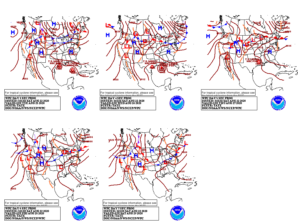
The first pictogram [top left] is for...
Tuesday Aug 25
Note the HIGH that is over Arkansas today, moves East at about 10 mph, to get over Tennessee.
That HIGH is causing both Storms to curve toward the Northwest.
Read the day forecast in the box as "Valid" date.
HIGH pressure front movements tell the tale...
Jim...
PS: Tennessee welcomes Laura next Saturday.
Wooopsssss!!!!
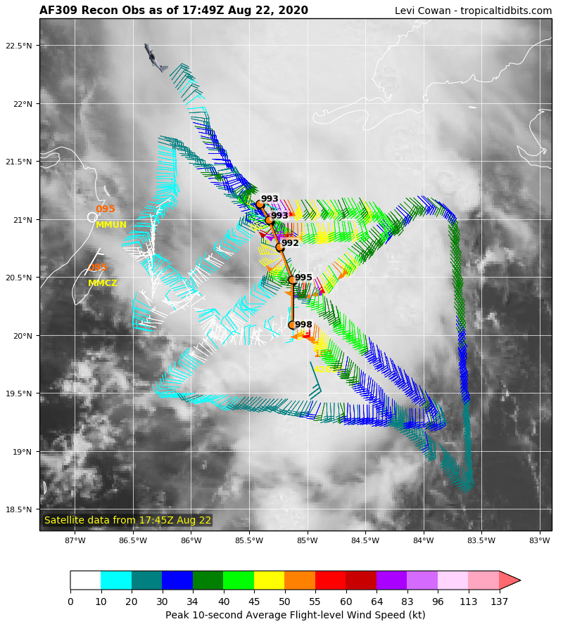
The Hurricane Hunters found TS Marco center and it did NOT go over the Yucatan.
The next official forecast will change both Storm's paths.
______
The smart one...

Both storms may hit US.
For my current feelings, see Chuck Berry's song in my post #1
Jim...
The Hurricane Hunters found TS Marco center and it did NOT go over the Yucatan.
The next official forecast will change both Storm's paths.
______
The smart one...
Heading over today to do the prep work of removing all canvass, doubling the lines, and adjusting for +5 feet of water.
Both storms may hit US.
For my current feelings, see Chuck Berry's song in my post #1
Jim...
jssailem
SBO Weather and Forecasting Forum Jim & John
- Oct 22, 2014
- 24,455
I think you meant to say..
Both Marcos and Laura are out their playing and it is starting to look like Jim has been singing out to them...Dammit, Jim! Dammit, Jim!
Dammit Jim, Dammit Jim, Dammit Jim, Dammit Jim . . .Dammit Jim, Dammit Jim, Dammit Jim...

Черт возьми, Джим! Черт возьми, Джим! Черт возьми, Джим! Черт возьми, Джим!