high water?

Jan 11, 2014
11,321
Sabre 362 113 Fair Haven, NY
April 8 this past spring the lake was 246’ at that point the spring melt was happening on the Ottawa River in 5-6 weeks with them slowing the out flow at the dam to protect Montreal the water went to over 249’
At that time they were able to open the dam and the out flow was maxed out for a couple of months at 10,400
They dropped the level back to 246’
Since then they have cut the out flows way back to 8,500+- to reduce the current for shipping
This period was the time when they could of lowered the water to 244.5 and it would of set us up for a good spring. Instead shipping got preference over the entire lake and we are now really in danger of even higher levels this coming spring
We humans have this great propensity to seek simple solutions to complex problems and complex solutions to simple problems. Makes me crazy sometimes.

What you do not account for in your explanation is the record high outflows from Lake Erie from May 1, 2019 to Oct 1, 2019. Additionally, with the exception of a brief period in early May, the inflow from all sources in 2019 exceeded the amount in 2017. In 2019 at its peak the inflow was over 12,000 cubic meter/second. Generally from mid March 2019 until mid July 2019 the total inflow to Lake Ontario exceeded 10,000 cm/sec that rate equals or exceeds the max outflow for the Moses-Saunders dam.

The IJC did begin lowering the outflow rate around the end of March. On March 30 it was 8630 cm/sec, on April 30 it was down to 6100 cm/sec and on July 6 it was back up to 9400 cm/sec. This roughly corresponds to the rise and fall of the Ottawa River.

Around the time they began to reduce the outflow from Ontario, the Erie inflow was at 7530 cm/s, about 380 cm/s lower than the maximum recorded for that date. Two weeks later the inflow from Erie had increased to 8260 cm/s which was 280 cm/s above the max recorded for that time. The above max flow continued through October 1, 2019, briefly returning above the max levels in November.

Since Jan 1, 2020, the Moses-Saunders Dam has been at roughly 10,300 cm/s. On December 31 the Lake was at 246.13 feet a week later it had dropped on Jan 6 it had dropped to 246.06 feet, less than 1 inch. Inflows had remained pretty constant at ~7,500 cm/s, or about 1,000 cm/s above historical average.

The main culprit in the 2019 flooding was too much water coming downstream from the Upper Great Lakes. The outflow from Lake Ontario was at or above maximum average from June 1 to October 1. Throughout the summer the total supply to the lake was about equal to the outflow, so the lake level remained relatively constant.

This data is easily accessible on the IJC website. Take some time and look at the inflows and outflows. Could the IJC have done something different? Of course, would it have had much positive effect, I doubt it. Hindsight is always 20/20.

 
  • Like
Likes: jon hansen

TomY

Alden Forum Moderator
Jun 22, 2004
2,758
Alden 38' Challenger yawl Rockport Harbor
I feel like I'm taking Great Lakes 101, and you guys are getting your PHD's. I need some basics,...

I may have missed it but can you explain the causes of the sudden high water levels? Is it the high rainfall the last several seasons or the politics of dams/shipping, or both? What is being done to improve water levels or is this just a temporary problem?

What does this mean for you - your sailing, in different areas/lakes? Are you worried about access to docks etc. due to high spring water levels?
 
Oct 29, 2016
1,915
Hunter 41 DS Port Huron
I would say both, more water in the Great Lakes Basin (Rain & Snow) and controlling the outbound flow from Lake Ontario into the St Lawrence Seaway protecting against flood the downstream areas (Montreal). Many hundreds if not thousands of marina gangways are underwater, or will be in the spring due to exceptionally high water in the GLB, especially in Lake Ontario, where the greatest effect of regulating of the outbound flow is felt.
 
Oct 19, 2017
7,732
O'Day 19 Littleton, NH

This chart shows some interesting historic relationships between lake levels and Montreal Harbor levels. It's increasing to more that the peak level in Montreal was in March while both lakes peaked a month later. Obviously there is outflow control downstream of Montreal that allowed for higher output than input at that time.

So, what does all this mean? :eek:I don't know.
But, very interesting, never the less.

-Will (Dragonfly)
 
  • Like
Likes: DayDreamer41
Jan 11, 2014
11,321
Sabre 362 113 Fair Haven, NY
I feel like I'm taking Great Lakes 101, and you guys are getting your PHD's. I need some basics,...

I may have missed it but can you explain the causes of the sudden high water levels? Is it the high rainfall the last several seasons or the politics of dams/shipping, or both? What is being done to improve water levels or is this just a temporary problem?

What does this mean for you - your sailing, in different areas/lakes? Are you worried about access to docks etc. due to high spring water levels?
@TomY to give you the short answer, yes to all of the above questions. ;)

Depending on your definition of sudden, water level changes are not sudden like tidal changes or flooding at this year's 
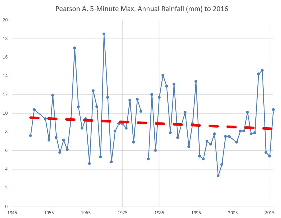
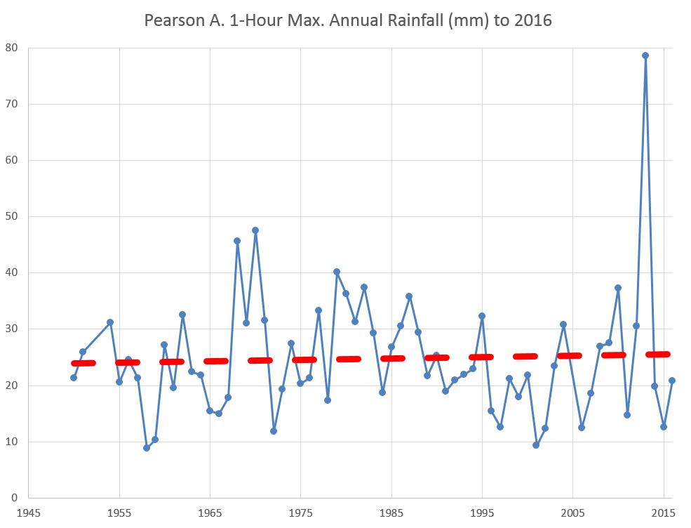
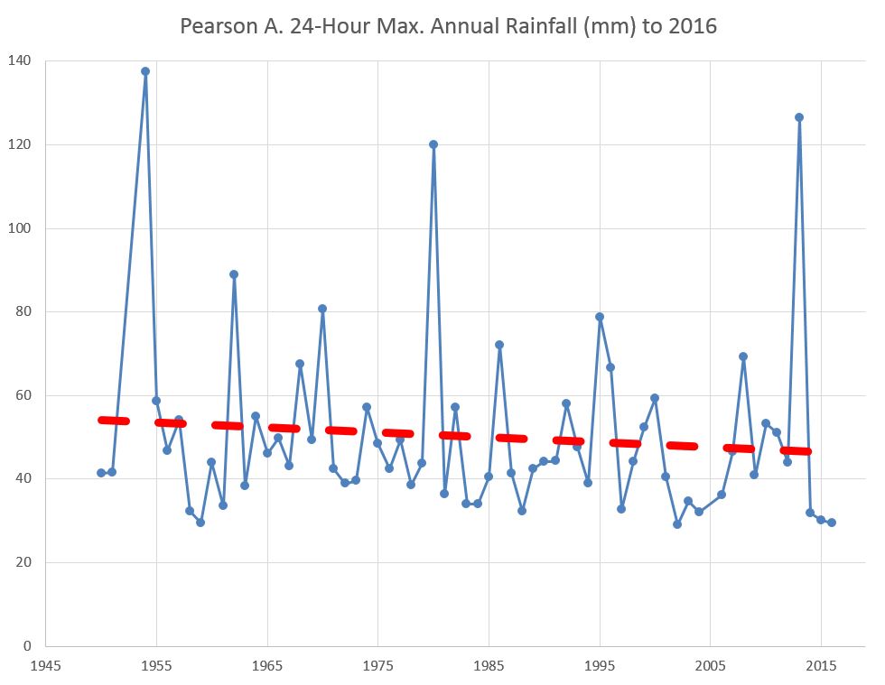
Annapolis Boat Show. There is a normal seasonal variations in water levels, the levels go up in the spring due to increased spring rainfall and melting snow and gradually decrease through the summer, fall and winter due to decreased rainfall and evaporation (especially in the winter). Even though we are still at extremely high water levels this year, that still holds, water levels are lower now than they were in July. For the most part short term increases in rainfall have little effect on water levels. If a major hurricane comes through and dumps a foot of rain (it's happened) we'll see a quick rise of an inch or two but that's not a big deal. We do get seiches that can cause a change reminiscent of tides, but we'll cover that in GLL 201.

The primary cause of the high water levels is increased precipitation in the Great Lakes basin. The catchment area is quite large and all that water has to go somewhere. The water levels between four of the Great Lakes is not controlled. There is a dam in Sault Ste Marie that controls water leaving Lake Superior, after that the next barrier is the Moses-Saunders Dam on the St Lawrence River. Once the water falls from the sky there is no stopping it until it reaches the Moses Saunders Dam.

There is lots of misinformation floating around about water levels on the Great Lakes. Take this quote from a Windsor, Ont newspaper referencing high water levels and currents on the Detroit River:

"The reason for the higher water speed has to do with the Moses-Saunders dam on the St. Lawrence River near Cornwall which has been opened more because of high water levels in the Great Lakes."

The Windsor Star needs to hire better fact-checkers. Between the Detroit River and the Moses Saunders dam there is this little Natural Wonder called Niagara Falls. The Moses-Saunders Dam is tall, but it is not taller than Niagara Falls at ~170 feet. But I digress.

The key takeaway is that if it rains in Duluth MN, eventually that water will reach Lake Ontario and the speed at which it reaches Ontario is, for the most part, not controlled by humans.

Lake Ontario is the smallest, by surface area, of the 5 Great Lakes. The next smallest lake is Erie and that is about 30% larger; a foot of water on Erie is equal to 16 inches on Ontario. Someone else can do the math on the relative size of the other lakes.

All of the water on Lake Ontario leaves the lake through the St. Lawrence River, there is a series of dams and locks between Cornwall Ontario and Montreal to allow for ocean going vessels to access the Great Lakes. The was the great St. Lawrence Seaway Project of the 1950s. (Sorry, @Will Gilmore Montreal is tidal.) Global access via the St Lawrence was seen as a having a tremendous economic impact on the midwest providing an economical way for midwest business to access global markets and providing an alternative to the Mississippi River route. The Seaway is particularly busy in the fall taking agricultural products to global markets. When I was in college the really big kids in the dorm got to work as stevedores unloading bags of cocoa beans from Africa for the nearby Nestle` plant in Fulton, NY. Anyway, the Seaway project was and is an economic benefit to both US and Canadian industries.

I am not a hydrology expert (nor do I play one on the internet), however, it is my understanding that any waterway has a maximum flow that it can sustain. It doesn't matter if there are dams or not, there is just a maximum amount of water the creek, stream, or river can accommodate. For the St. Lawrence, the maximum is somewhere about 10K to 11K cubic meters/second. If the dam is there and opened, 10K cm/s flows through, remove the dam and 10K flows through. If the inflow to Ontario is greater than 10K, then the lake level rises, if it is lower then the level lowers.

The IJC is tasked with managing the water levels on the St. Lawrence River. Their website will give a much more detailed description of their charge, however it boils down to several factors in no particular order:
  • Maintain safe shipping, i.e, deep enough water and manageable currents
  • Control downstream flooding.
  • Control upstream flooding (sorry Windsor CA, the IJC can't help you).
  • Maintain more normal (uncontrolled) water levels for environmental reasons
Shipping may seem to be a minor issue, however, there is billions of dollars of commerce that comes through the St Lawrence Seaway and that involves thousands of jobs, particularly in the Midwest of the US and Canada. Shipping is important.

For sailors on Lake Ontario it means docks under water, travel lifts stuck in the mud, marinas out of business. The plus side is we can get into anchorages and bays that are normally too shallow and we get to have fashion shows for the muck boots we all wear to access our boats. Seriously, it is costly for marinas, businesses and homeowners near the lake. By this summer, my marina owner will have spent several hundred thousand dollars to protect the marina and address flooding issues.

There is no long term solution save for addressing climate change which seems to be the cause of increased precipitation in the Midwest. In the mean time don't buy lake front property.
 
Aug 2, 2010
502
J-Boat J/88 Cobourg
So reading and re-reading the information presented here, I think I have affirmed the suspicion I had developed. If the IJC has a mandate to control the levels of the St. Lawrence and we get more water coming into Lake Ontario than the IJC is letting out, the lake level will rise. I believe this is accepted as fact by the folks I have read here.
Where I depart from the wisdom I have read here is the range of causal elements. I keep hearing that the precipitation in the Great Lakes Basin is the single causal element but that ignores the factor of the dam settings and resultant outflow down the river. It is not my belief that the IJC is the sole causal element but it certainly is one of them and ignoring it hampers the discussion.
Managing anything is tough and it requires picking "best for all" solutions which are inevitably worse for some. I could have more comfort if the discussion said the IJC is going to raise levels in Lake Ontario to protect the navigability and shorelines of the areas below the dam, but instead it seems lots of people want to blame Mother Nature and say we cannot do anything. We can and used to do more but have chosen to manage in a different way.
I sure am glad I don't have to make those decisions and I support those that do.
Dan
 
Jan 11, 2014
11,321
Sabre 362 113 Fair Haven, NY
Managing anything is tough and it requires picking "best for all" solutions which are inevitably worse for some. I could have more comfort if the discussion said the IJC is going to raise levels in Lake Ontario to protect the navigability and shorelines of the areas below the dam, but instead it seems lots of people want to blame Mother Nature and say we cannot do anything. We can and used to do more but have chosen to manage in a different way.
I think the point that gets missed is the IJC can control the lake level within a certain range, but it does not have absolute control, there are limits to how much they can affect lake levels and how fast those levels can change. The IJC has much less control than people assume. Additionally, folks tend to focus on their immediate surroundings. When Montreal had 3 or 4 feet of water running through the streets, they didn't particularly care about flooded docks in Little Sodus Bay or flooded waterfronts in Toronto. Likewise camp owners on Little Sodus Bay aren't focused on flooding in Montreal. We want to blame somebody, so the politicians jump in and muddy the waters.
 
  • Like
Likes: Hunter216

TomY

Alden Forum Moderator
Jun 22, 2004
2,758
Alden 38' Challenger yawl Rockport Harbor
Just what I needed, Dave, thank you.

As to the only control available; dams and out flow, who has priority over levels?

I suspect that is complicated too. But I would think the landowners, zillions on the GL coast, would have some clout to control outflow to prevent excessive erosion and flooding events. Wouldn't they have as much power as shipping, or at least be able to work together to achieve joint desired levels?

But the above may be mute if as you say the whole basin has maxed out from rainfall in-flow, and there is little control of ultimate water levels from the dams.

Unlike climate change science in general which is well documented to track and predict, extreme weather events (like increased rainfall) are a result and have less historic data.

If the current inflow from rainfall is to continue - or worse increase, then the GL could have to deal with the same long term problems sea level rise is causing for ocean coastlines today. Obviously as you say, marina's and shoreline property's are dealing with the current high water of the last few years.

Hopefully you'll get some dry years (a change in weather patterns), soon which is likely, isn't it?
 
Jan 11, 2014
11,321
Sabre 362 113 Fair Haven, NY
There is a plan, currently called Plan 2014, since it was developed in 2014. It's adoption just happened to coincide with the floods in 2017. That has led to some of the confusion, the plan changed, the floods occurred, it must be the plan that caused the flood.

The Plan lays out the priorities. Shipping is pretty high because of the economic benefits throughout the region, especially in the fall when large grain shipments are leaving the midwest. Other economic interests play a role too. Plan 2014 came about in part because of environmental concerns. There were some habitats that were too dry when they needed to be wet and too wet when they needed to be dry. The goal was to mimic historical unregulated levels.

When the plan is in effect (it has been suspended now) there are a host of formulas that govern the outflow. If you care to review them, they are available online (link below). I looked at the and my eyes glazed over and brought back unpleasant memories of college calculus. The levels and outflow are not simply gauged by some guy sitting at the dam deciding to let more water out or not.

 
Aug 27, 2012
92
Hunter 1990 Hunter 35.5 Toronto
We humans have this great propensity to seek simple solutions to complex problems and complex solutions to simple problems. Makes me crazy sometimes.

What you do not account for in your explanation is the record high outflows from Lake Erie from May 1, 2019 to Oct 1, 2019. Additionally, with the exception of a brief period in early May, the inflow from all sources in 2019 exceeded the amount in 2017. In 2019 at its peak the inflow was over 12,000 cubic meter/second. Generally from mid March 2019 until mid July 2019 the total inflow to Lake Ontario exceeded 10,000 cm/sec that rate equals or exceeds the max outflow for the Moses-Saunders dam.

The IJC did begin lowering the outflow rate around the end of March. On March 30 it was 8630 cm/sec, on April 30 it was down to 6100 cm/sec and on July 6 it was back up to 9400 cm/sec. This roughly corresponds to the rise and fall of the Ottawa River.

Around the time they began to reduce the outflow from Ontario, the Erie inflow was at 7530 cm/s, about 380 cm/s lower than the maximum recorded for that date. Two weeks later the inflow from Erie had increased to 8260 cm/s which was 280 cm/s above the max recorded for that time. The above max flow continued through October 1, 2019, briefly returning above the max levels in November.

Since Jan 1, 2020, the Moses-Saunders Dam has been at roughly 10,300 cm/s. On December 31 the Lake was at 246.13 feet a week later it had dropped on Jan 6 it had dropped to 246.06 feet, less than 1 inch. Inflows had remained pretty constant at ~7,500 cm/s, or about 1,000 cm/s above historical average.

The main culprit in the 2019 flooding was too much water coming downstream from the Upper Great Lakes. The outflow from Lake Ontario was at or above maximum average from June 1 to October 1. Throughout the summer the total supply to the lake was about equal to the outflow, so the lake level remained relatively constant.

This data is easily accessible on the IJC website. Take some time and look at the inflows and outflows. Could the IJC have done something different? Of course, would it have had much positive effect, I doubt it. Hindsight is always 20/20.

Look everyone knows the lake levels and out flows. We also know that because of the currents when they release high volumns of water the shipping cant operate. That is the problem., To appease the shipping they kept the flows low. Now that the shipping has stopped for the rest of the season they are trying to let more water out but unfortunately its too late They have decided that shipping supercedes everything else.
Lets hope that they are learning that they may have to shut down the shipping say in Nov in coming years to get the excess water out in time You are right there is too much water so instead of flooding an entire lake shipping needs to take some of the hurt|
 
Jan 11, 2014
11,321
Sabre 362 113 Fair Haven, NY
Lets hope that they are learning that they may have to shut down the shipping say in Nov in coming years to get the excess water out in time You are right there is too much water so instead of flooding an entire lake shipping needs to take some of the hurt|
The problem is not shipping, it is what is being shipped. If shipping is shut down in November, there will be a lot of grain, soybeans and other goods left on the dock in the midwest. We can't just decide to ship agricultural products in August instead of October. That affects farmers, dockhands, and a lot of businesses in the midwest in both the US and Canada. The other side of that equation are the recipients of that grain. A lot of people will go hungry around the world.

I'm always amazed in November and December when I look at MarineTraffic.Com and see the number of boats transiting the Seaway.
 
  • Like
Likes: Hunter216
Oct 22, 2014
20,989
CAL 35 Cruiser #21 moored EVERETT WA
Dave. Thanks for the PDF file. You are correct. It is as good as drugs at putting the average person to sleep.

Before my eyes glazed over, I came to the following observations.
  1. It took them 64 years to come up with a new plan
  2. They adjusted their water management level data from 1900 to 2008 a 108 year change in data references.
  3. This is a plan by consensus.
  4. Some folk want to put blame in order to support their position.
  5. The resultant plan became a treaty that took over 2 years to agree and ratify.
  6. all of this time,
    1. Weather conditions have Changed on cyclic patterns
    2. More industry and usage has evolved
    3. More surface water has been added to the basin as runoff that in the 1900’s was captured and absorbed
    4. Man believes he can control mother nature.
While none of these are earth shattering nor do they resolve the issues that still and will continue to fester.

As the Basin continues on it’s path of industrial and urban development the water issues will only get worse. In the process the water that was in the ground (the great basin aquifer) is being tapped to provide quality water, while the surface water is being silently polluted.

Again observations and no solution.

At least the release of all this fresh water will aide in the desalination of the waters near the mouth of the St Lawerence. Then the lobster may choose to move back south to Maine.
 
Aug 27, 2012
92
Hunter 1990 Hunter 35.5 Toronto
to make billions at their expense


The problem is not shipping, it is what is being shipped. If shipping is shut down in November, there will be a lot of grain, soybeans and other goods left on the dock in the midwest. We can't just decide to ship agricultural products in August instead of October. That affects farmers, dockhands, and a lot of businesses in the midwest in both the US and Canada. The other side of that equation are the recipients of that grain. A lot of people will go hungry around the world.

I'm always amazed in November and December when I look at MarineTraffic.Com and see the number of boats transiting the Seaway.
It doesn't matter whats being shipped That industry is destroying the entire lake shore of Lake Ontario. You cant say ok shipping you go ahead and make profits of millions a day at the expense of business, residents and recreation, It is costing those people millions of dollars of their life savings.
It really amazes me how this IJC and Board can sleep at night knowing what they are doing to a 100,000 people
As far as not getting their products to market etc. What business on this planet is allowed to destroy others while it makes huge profits? None
They should be forced to use their money that they make to adjust the conditions so that their business fits into the rest of the countries infrastructure. It shouldn't be up to the people and business that have been here for a hundred years that should now have to change everything to allow this industry to make billions at their expense
 
Sep 22, 2018
1,869
Hunter 216 Kingston
It doesn't matter whats being shipped That industry is destroying the entire lake shore of Lake Ontario. You cant say ok shipping you go ahead and make profits of millions a day at the expense of business, residents and recreation, It is costing those people millions of dollars of their life savings.
It really amazes me how this IJC and Board can sleep at night knowing what they are doing to a 100,000 people
As far as not getting their products to market etc. What business on this planet is allowed to destroy others while it makes huge profits? None
They should be forced to use their money that they make to adjust the conditions so that their business fits into the rest of the countries infrastructure. It shouldn't be up to the people and business that have been here for a hundred years that should now have to change everything to allow this industry to make billions at their expense
I was raised in a farming community and have a first hand perspective of how weather can impact a farms livelihood. A big part of the make or break is the ability to get your product to market when the price is high. Too many "lean" years and your out of business. A lot of that product gets moved via ships. Here is a little info on Canadian farming, next time you eat - thank a farmer (and maybe a ship owner). Oh and I live on property that was flooded in 2017 and 2019.

Farmers.jpg


Does Canada have enough young farmers? | Country Guide
 
  • Like
Likes: jon hansen
May 25, 2012
4,333
john alden caravelle 42 sturgeon bay, wis
here in toledo we are forecast to get 3" of rain this weekend. the whole state of michigan is going to get slammed.
 
Sep 22, 2018
1,869
Hunter 216 Kingston
here in toledo we are forecast to get 3" of rain this weekend. the whole state of michigan is going to get slammed.
Similar forecast for KIngston. Looks like a massive area all the way from Texas to northern Canada will be affected.:yikes:

The “tap” at the dam remains fully open and has made some progress at lowering Lake Ontario.
 

DougM

.
Jul 24, 2005
2,242
Beneteau 323 Manistee, MI
here in toledo we are forecast to get 3" of rain this weekend. the whole state of michigan is going to get slammed.
Just what I need in Michigan...
Already being told that the area where my place is located is going to be redesignated as a flood plain.

Adding to the high water story... when the water was low a few years ago, rumors were circulating that dredging in the St Clair river had caused additional bottom scouring that was increasing the volume of water being let out of the Lake Michigan/Huron Basin. The other story was that water was being let out through the Chicago River into the Mississippi River basin to aid barge traffic. Neither story really proven. When the water began to rise, the speculation was that because of flooding throughout the Mississippi basin, water was not being let out of Lake Michigan.

I guess you can pick any theory you wish. All I know,having lived around Lake Michigan for the majority of my life, is that the cycle from high water to low, or low to high seems to average about 10 years, so about five years from now we will probably be complaining about the perceptible drop in water level.
 
Feb 14, 2014
7,399
Hunter 430 Waveland, MS
In case you are wondering what is happening...
The El Niño that lasted for only 2-3 months in 2019 is happening to North America now.

They call it "El Niño" based on a single point threshold that lasts for several months.

So the Heat content was smaller, but it still produces moisture.:doh:

The Stratosphere is the coldest in the last 40 year.
Climate Prediction Center - Global Temperature Time Series

This causes the Jet Stream to meander, thus in and out of rain or snow.

Result is a mild wet winter from Pacific Heat.

El Niñito is with us.
Jim...
 

TomY

Alden Forum Moderator
Jun 22, 2004
2,758
Alden 38' Challenger yawl Rockport Harbor
Just what I need in Michigan...
Already being told that the area where my place is located is going to be redesignated as a flood plain.

Adding to the high water story... when the water was low a few years ago, rumors were circulating that dredging in the St Clair river had caused additional bottom scouring that was increasing the volume of water being let out of the Lake Michigan/Huron Basin. The other story was that water was being let out through the Chicago River into the Mississippi River basin to aid barge traffic. Neither story really proven. When the water began to rise, the speculation was that because of flooding throughout the Mississippi basin, water was not being let out of Lake Michigan.

I guess you can pick any theory you wish. All I know,having lived around Lake Michigan for the majority of my life, is that the cycle from high water to low, or low to high seems to average about 10 years, so about five years from now we will probably be complaining about the perceptible drop in water level.
There's some opinion you might be seeing higher highs and lower lows in the future due to extreme weather (warmer temps - snow melt, heavier rainfall, etc). If that turns out to be true at all I can imagine it will make working along the shoreline; marina's etc., tedious. Water infrastructure (fixed docks, landings, travel lift ways, etc), are tough to design for extreme highs and lows in water level.

Doug, you mention a change in flood plain designation for your home. What caused that?

I ask because we got placed in a flood plain in 2016. We live along side a small brook and I believe the change came about because of GPS and new mapping accuracy (height specifically). Sort of a pain in having to carry flood insurance when you live 100 feet above the high tide line.
 
Oct 19, 2017
7,732
O'Day 19 Littleton, NH
Im not sure how to interpret these charts. I don't know what the 1-hour max means compared to 5-min max or the 24-hour max.


Except for the 1-hour max chart, it looks like the average annual rainfall on Toronto is falling since 1955. Of course, the last 4 years are missing.
Here's the link to the site: Extreme Rainfall Trends Toronto and Mississauga - Extending Annual Maximum Series with Environment Canada Data
From the article: "We even have some records that go back 100 years like in Kingston, Ontario. Those trends charts show no change in annual extremes since the early 1900's"

-Will (Dragonfly)