- Oct 22, 2014
- 23,936
From the STCE Newsletter.
GOES turns 46...
Ode to GOES
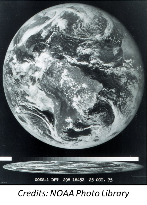
On 16 October 1975, the launch of GOES-1, NOAA's first Geostationary Operational Environmental Satellite (GOES - GOES Overview), took place. Just a few days later, on 25 October 1975, it produced its first near real-time full-disk image of the Earth from a fixed position thousands of kilometers away (figure underneath). The GOES are operated by NOAA, and provide critical meteorological data for weather forecasting, severe storm tracking, and research. They are also paramount in monitoring volcanic activity and associated ash plumes. See the NESDIS webpages at 40 Years of GOES: The Anniversary of GOES-1 for more info on GOES-1.
First image of the planet - FULL DISK.
GOES turns 46...
Ode to GOES
On 16 October 1975, the launch of GOES-1, NOAA's first Geostationary Operational Environmental Satellite (GOES - GOES Overview), took place. Just a few days later, on 25 October 1975, it produced its first near real-time full-disk image of the Earth from a fixed position thousands of kilometers away (figure underneath). The GOES are operated by NOAA, and provide critical meteorological data for weather forecasting, severe storm tracking, and research. They are also paramount in monitoring volcanic activity and associated ash plumes. See the NESDIS webpages at 40 Years of GOES: The Anniversary of GOES-1 for more info on GOES-1.
First image of the planet - FULL DISK.
