depth/chart plotters

Jul 12, 2022
32
precision precision 18 chowan
really need to hear what others are using on their trailer sailers. I am in the Chowan River, NC. With access to the Albemarle, pamilcio, Currituck sounds as well as the ICW. I will NOT be going past land into the "the grave yard of the atlantic". I have a few idea's on equipment (wants, not needs). can I get a response on what works well for you and what you recommend not to get? I may get an auto pilot in the future {"I'm eating this elephant one bite at a time"}. remember, this will be used in mostly shallow water 25' or less for the most part. thanks ahead of time, scott
 

Attachments

Aug 19, 2021
495
Hunter 280 White House Cove Marina
I am in the same boat and I am experimenting with the garmin echomap uhd 73sv. I think they are still on sale at basspro online.
Garmin ECHOMAP™ UHD 73sv | Marine Chartplotter

I am currently using the GT8HW-IH transducer. There is a thru hull option available. I just did not feel like pulling Prometheus out of the water. Since this could be a temporary install I used Bee's Wax (Toilet Seal) to stick it in place.

We gave it a workout over the weekend on the Poquoson Flats just off the Chesapeake Bay. In the channel leaving and entering the marina we were as shallow as 5'6" and on the flats we were as deep as 25'. We used the split screen feature Chart/depth. It worked like a champ all day long.

I will say setting it up pier side I was a little worried. I think pounding the sonar into the shallow, soft mud bottom causes it to appear to skip a beat. That issue completely disappeared once we were underway.
 
Jan 19, 2010
12,377
Hobie 16 & Rhodes 22 Skeeter Charleston
I have sailed a lot in your area... I have sereral write ups of our adventures but I've attached only one because I think it speaks to what you asked.

On the trip in the write-up I had a handheld gps (used on eBay), paper charts and I used sheet to tiller steering. I traveled 25 miles without touching the tiller and popped out right where I needed to be. The only time I turned on the gps was when I got caught in fog. Doing it again, I would want RADAR but all-in-all, a compass, (gps backup) and a way to take your hand off of the tiller is all you need in the Pamlico/Albemarle Neuss River area. With today's navigation apps, I don't even think a handheld gps is needed. Download Navionics and the NOAA weather radar app, preprogram the phone numbers of the local Coast Guard Stations into your phone, get a good VHF with weather and AIS and you are golden.

In the second paragraph of the 3/16 entry in the attached document, I talk a little about sheet-to-tiller steering.

I hope to retire to the NC coast and spend all of my summer days gunkholling around that area.
 

Attachments

Jul 12, 2011
1,165
Leopard 40 Jupiter, Florida
Following this -- I suppose it depends on how much you want to know about the bottom. I've sailed (and grounded) sailboats with 4 to 6 foot keels, and only had that single number from a wide-beam transducer and various charts. Being able to see all of the wrinkles and sunken cars on the bottom is sounding more interesting. I'd be curious if those with experience in having all that hydrographic data would weigh in -- do you get overwhelmed looking at the displays and forget to trim your sails or avoid crab traps?
 
  • Like
Likes: rgranger
Jul 12, 2022
32
precision precision 18 chowan
thanks for all the input and replies so far!!! I will say that in the chowan river, sheet steering is nearly out of the question as narrow waters, high banks on one side low banks on the other play foolish games with the wind. sand bars off shore, stump fields, and creek channels are prevalent. I think that once I pass under the 17 bridge at Edenton NC I would be ok for learning sheet steering. a lot of the concerns are that the river tides can drop and expose "items" that a normal boat will pass over top of but may cause damage to a sailboat. rgranger, I look forward to reading about your adventures! keep the info coming!
 
Jan 19, 2010
12,377
Hobie 16 & Rhodes 22 Skeeter Charleston
With a draft of 1.5', you can probably push off of most sandbars. Depth is nice to have and it is also a useful navigation tool for those times when what you see with your eyes and what you think you are seeing on the charts don't jive... but In your case I don't think a depth sounder is a safety need. In my younger days I owned a lot of different sailboats and eventually went back to a swing keel ....BECAUSE of the skinny water in the Albemarle and Pamlico sounds. I just love the wildness of the OBX sound side but you will kiss the bottom from time to time.:biggrin: But you can always hop out and push off when you make contact. Just make sure you drop the sails BEFORE you push off the sandbar....:yikes:
 
  • Like
Likes: Parsons
Jul 12, 2022
32
precision precision 18 chowan
lol , Yea I hope that I don't ground it! This is more for peace of mind for me, and a learning tool for my beautiful wife {who has already shown great interest in learning all the aspects of sailing}. I've gone over old tree stumps that were half as big as the boat I was in, two foot under water in 6' of water......and were 50 yards off of the shore line (now that's an old stump). The center board drops out of the keel on my SB. and is a swing style.....but the rudder is my concern. It's an older , made of wood, style. I do not wish to damage it in any way because of how nice it looks and works. Crusty ol salt, would you say the Garmin your using is a good all around unit that could go from a bass boat to a weekend sailer if i get 2 transducers? and how jumbled is the screen (is it something you have to stare at or can you just scan it and pick up the info that your needing i.e. depth, channel drops and rises, way points etc.?? not really looking for something to "Hunt for Red October" with! I'm just a simple guy that wants to stay in the channels.
 
Jul 12, 2011
1,165
Leopard 40 Jupiter, Florida
Yea I hope that I don't ground it!
Get over that fear of grounding your boat. There are three types of sailors - those that have gone aground, those that never leave the dock, and liars. I'd worry about hard groundings (rocky stuff), grounding on a falling tide, or puncturing the hull, but rubbing a little mud or sand is common.
 
Jan 19, 2010
12,377
Hobie 16 & Rhodes 22 Skeeter Charleston
... would you say the Garmin your using is a good all around unit that could go from a bass boat to a weekend sailer ...
Right now I have a Hummingbird. It came with the boat so I didn't do any market research etc.
1658337917906.png

Most modern depth sounders use color coding to help you understand the bottom. On mine, the more red the color, the harder the bottom..

Here is a youtube that explains how to read the sonar

 
Jan 19, 2010
12,377
Hobie 16 & Rhodes 22 Skeeter Charleston
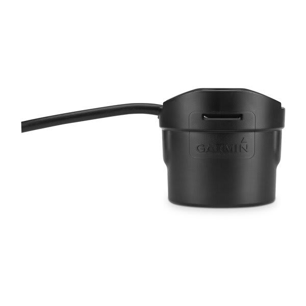
But if depth is all you need and space is limited, get something like this...

1658338246098.png
 
  • Like
Likes: Ward H
Jul 12, 2022
32
precision precision 18 chowan
really like the chart view of the topography for the area on the helix, and I like the simplicity of the depth recorder. thank you!
 
Aug 19, 2021
495
Hunter 280 White House Cove Marina
Crusty ol salt, would you say the Garmin your using is a good all around unit that could go from a bass boat to a weekend sailer if i get 2 transducers? and how jumbled is the screen (is it something you have to stare at or can you just scan it and pick up the info that your needing i.e. depth, channel drops and rises, way points etc.?? not really looking for something to "Hunt for Red October" with! I'm just a simple guy that wants to stay in the channels.
Funny you mention that. I have a 14' v-hull that does not have a fishfinder. I purchased the in hull transducer so that I can mount the clear view transducer on the trolling motor.

I mean I cannot use both boats at the same time
 
Jul 15, 2020
41
Hunter Hunter 260 Lake Tahoe
Garmin echoMAP 43dv with transducer can be moved between boats very easily. You have a base plate and transducer fixed to each boat and the unit itself just slots on/ off. I have been using it for years and its been great.
 
Jul 15, 2020
41
Hunter Hunter 260 Lake Tahoe
Garmin echoMAP 43dv with transducer can be moved between boats very easily. You have a base plate and transducer fixed to each boat and the unit itself just slots on/ off. I have been using it for years and its been great.
I guess this is an updated version: you would need to purchase 2 transducers and base plates and if you cant find them on amazon you can get direct from the Garmin site. https://www.amazon.com/Garmin-Sunli...garmin+echomap+with+transducer,aps,135&sr=8-9
 
Jul 12, 2022
32
precision precision 18 chowan
thank you everyone for your timely and useful input. Wifey' read the responses and said "if you know the direction (compass), you know the weather (phone app), you know how to read the channel markers (buoys)......you just need depth, honey'. Surely one of your friends has an older unit that they have upgraded from and are not using. Give a call and see if they would part with it?" !@#$%^6^& , well there goes that dream. I guess she has a point.
 
Jan 4, 2006
6,495
Hunter 310 West Vancouver, B.C.
Wifey' read the responses and said "if you know the direction (compass), you know the weather (phone app), you know how to read the channel markers (buoys)......you just need depth, honey'.
No good can ever come from "wifey" reading anything here on SBO. She may even ban YOU from reading anything here. Just thinkin' out loud.
 
Jul 12, 2022
32
precision precision 18 chowan
put a simple depth finder on today. No thrills , no frills, no colors or fish or tree tops etc. ....did a perfectly good job. thanks for all the input!