- Oct 22, 2014
- 21,206
You may need to go beyond your typical rain coat as we start December 2023. Current forecasts are looking like Flood Event rain storms heading to our corner of the world. This should not surprise those who have followed our discussion of the ENSO currents and the change event from La Niña to El Niño conditions. We will feel it this winter in the Pacific NW and then next summer as the Atlantic Hurricane season shapes up. Stay tuned to your local weather channel for the latest updates. Head the warnings not to drive over flooded road ways. Beware of Salmon crossing streets in the flood waters.
It is going to be a Wet 2 to 3 weeks here in the PacificNW.
From the write up of Cliff Mass Weather Blog:
It is going to be a Wet 2 to 3 weeks here in the PacificNW.
From the write up of Cliff Mass Weather Blog:
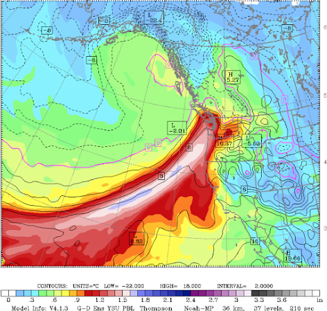
Below is a forecast map of total water vapor content through a vertical column of the atmosphere at 10 PM Monday. The blues and light pinks indicate the largest values.
Atmospheric rivers like this tap large amounts of water vapor in the tropics and subtropics. Moisture also converges into the "river" from the sides, not unlike the water of small streams flowing into a major river along its path.

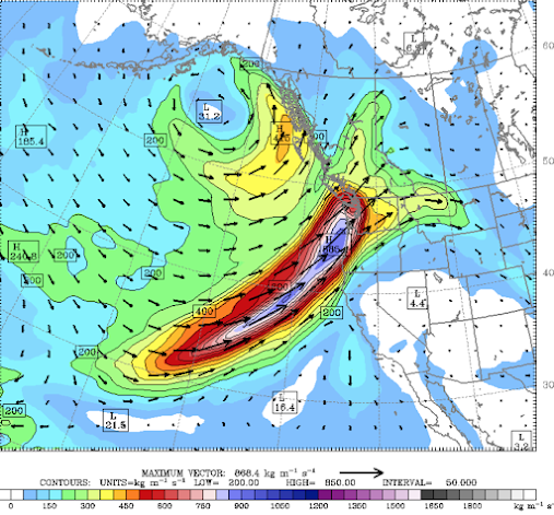
Professional meteorologists generally prefer to look at another measure of the potency of atmospheric rivers called integrated water vapor transport (IWVT), which is water vapor content times the wind speed.
It is a measure of how much water vapor is being transported by the wind and is better correlated with rainfall potential.
Here is the IWVT at the same time as the image above (10 PM Monday). Blues indicate large values.

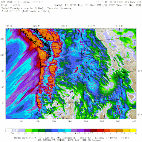
Then the atmospheric river comes in (JAWS music should be played now). The total precipitation through 4 AM Tuesday is impressive, with 7-10 inches over the mountains of Washington and SW British Columbia. Most of that atmospheric river moisture is being pulled out of the atmosphere by precipitation over regional terrain.

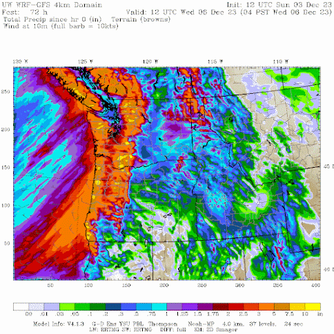
One day later even more, particularly over Oregon.


