• Sailing is all about the Weather.

    Big into the exploration of Atlantic Hurricanes since Katrina came uninvited into his world, James (Jim) Gurley (JamesG161) has followed every Tropical Storm birthed in Atlantic, Gulf and Caribbean waters since. Being a boater, he knows that we often need more time to prepare than we get from the TV weather folk. Jim relies on the science of storm development to share early warning info with friends and fellow boaters.

    Early in 2018, Jim and John Shepard, (JSSailem) started to chat about the weather data available. John asked Jim to help forecast Pacific NW storms, and this morphed into discussions on weather forecasting.

    For John, sailing in the PNW is sometimes hit and miss. One day is ugly, then a string of beautiful days but no wind, followed by a series of blue-sky days and 12 knot breezes. Being ready for those great sailing days means you need to look to the Pacific Ocean and what is brewing. John has been into Pacific NW Weather since the 1970’s when his first PNW November storm hit bringing more than 40 days and 40 nights of continual rain.

    Together we want to share information, new APPs, safety, and thoughts about letting the weather help you. Identify some of the resources for sailors and help prepare you for your next sailboat outing.

    It is far better to go out on the water knowing what to expect in weather terms, than to be out on the water and see dark ominous clouds suddenly appear, unprepared.

Affects of the 2026 El Niño event on PacificNW Weather.

jssailem

SBO Weather and Forecasting Forum Jim & John
Oct 22, 2014
24,906
CAL 35 Cruiser #21 moored EVERETT WA
It is now November. I would expect the morning temps to be chilling as the Sun makes its way south from the 45th Parallel (just 10 miles north of me). The days are getting shorter (a little over 9 hours), but the temperature this morning is 57º F.

When I look at the conditions in the North Pacific 3 large low-pressure cells are converging in the Gulf of Alaska. The usual pattern, the cells are urged forward like a freight train, arriving at the coast one at a time with a couple of high-pressure cell days of separation. No high-pressure cells at this time.
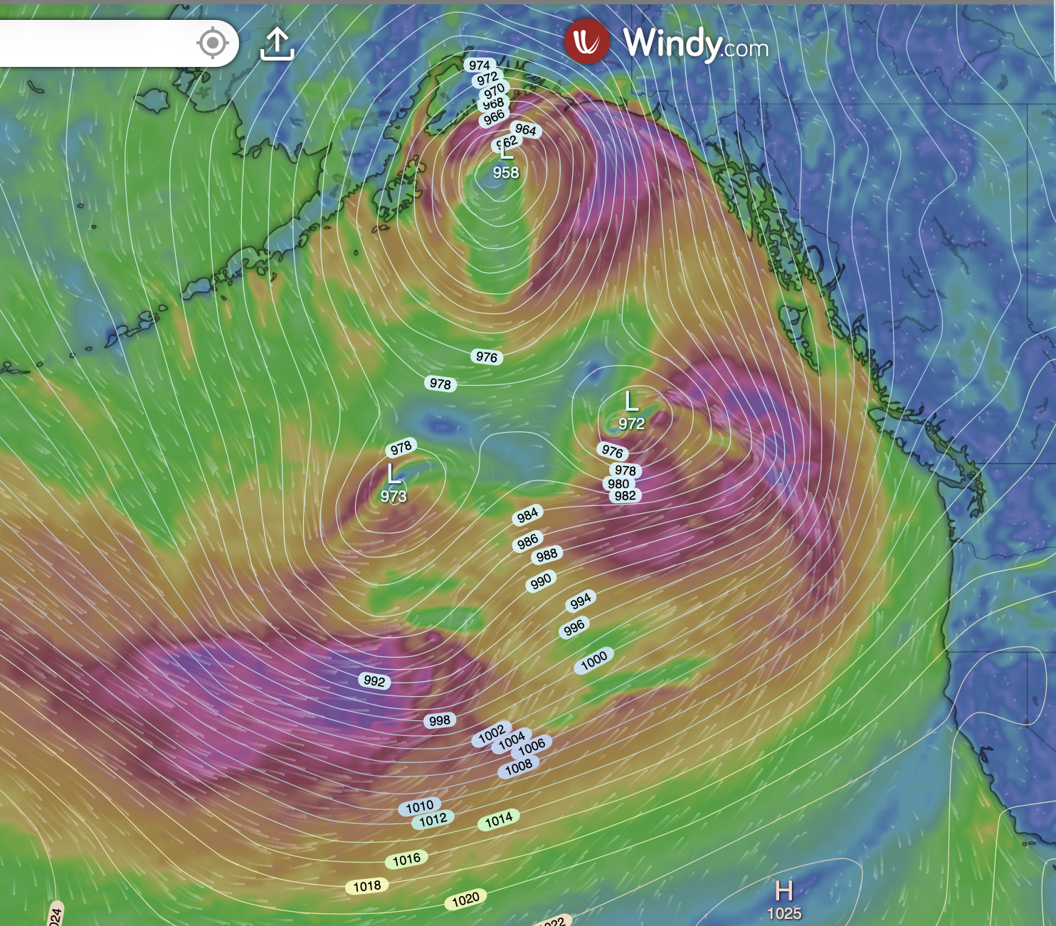
Screenshot 2026-11-10 at 6.09.38 AM.png


The rotation of a low-pressure cell is counterclockwise. These three are setting up the typical Pineapple Express formation, drawing in warm, moist air from the area of the Hawaiian Islands. Lots of inbound warm, moist air, rain potential.

Looking at the South Pacific you can see a series of low-pressure cells lined up marching across the equatorial waters.
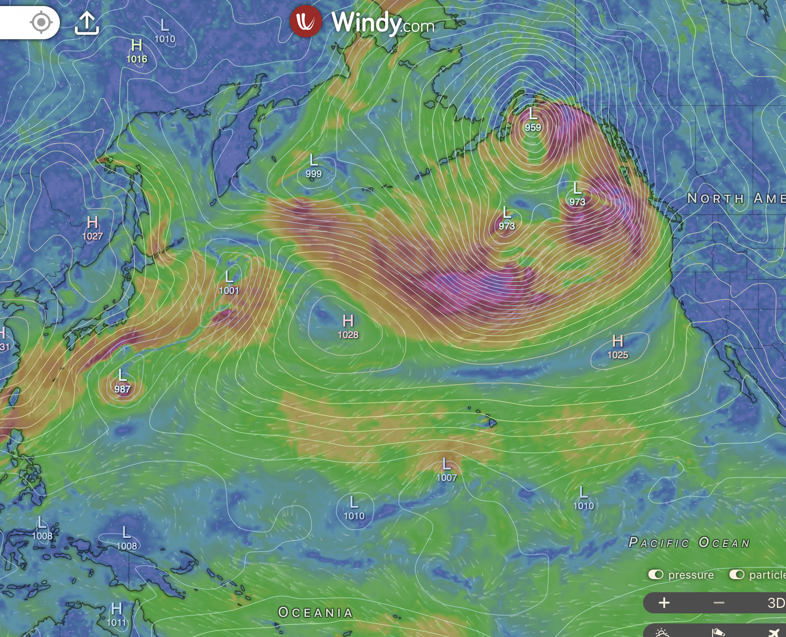
Screenshot 2026-11-10 at 6.14.43 AM.png


Buckle up. I think we may be in for a bumpy ride.
 
May 1, 2011
5,584
Pearson 37 Lusby MD
Good luck in the PACNW! Wx guessers are saying my neck of southern MD is going to have a relatively dry winter with only 5-15" of the white precipitation in the forecast. I'll believe it when I see it!
 
  • Like
Likes: jssailem

jssailem

SBO Weather and Forecasting Forum Jim & John
Oct 22, 2014
24,906
CAL 35 Cruiser #21 moored EVERETT WA
Then there is this WX watcher's comments.

@MatthewPfab
That’s not rain! Our coastal radar (KLGX) is picking up the massive waves along the WA coast! Due to its low beam tilt angle (0.0°), the radar is able to see the large waves (20-25 feet) and some of the spray they kick up! A unique quirk of PNW weather watching!

They would be consistent with the large low-pressure cells on the south side of the Alaska Gulf, driving waves at the coast.
 

Attachments

Jan 4, 2006
7,859
Hunter 310 West Vancouver, B.C.
The days are getting shorter (a little over 9 hours), but the temperature this morning is 57º F.
Oh ya ?

If you'd stayed on permanent Daylight Saving Time you wouldn't be seeing those winter problems. Up here, it's sunny and warm all day long :
1794343705238.png