• Sailing is all about the Weather.

    Big into the exploration of Atlantic Hurricanes since Katrina came uninvited into his world, James (Jim) Gurley (JamesG161) has followed every Tropical Storm birthed in Atlantic, Gulf and Caribbean waters since. Being a boater, he knows that we often need more time to prepare than we get from the TV weather folk. Jim relies on the science of storm development to share early warning info with friends and fellow boaters.

    Early in 2018, Jim and John Shepard, (JSSailem) started to chat about the weather data available. John asked Jim to help forecast Pacific NW storms, and this morphed into discussions on weather forecasting.

    For John, sailing in the PNW is sometimes hit and miss. One day is ugly, then a string of beautiful days but no wind, followed by a series of blue-sky days and 12 knot breezes. Being ready for those great sailing days means you need to look to the Pacific Ocean and what is brewing. John has been into Pacific NW Weather since the 1970’s when his first PNW November storm hit bringing more than 40 days and 40 nights of continual rain.

    Together we want to share information, new APPs, safety, and thoughts about letting the weather help you. Identify some of the resources for sailors and help prepare you for your next sailboat outing.

    It is far better to go out on the water knowing what to expect in weather terms, than to be out on the water and see dark ominous clouds suddenly appear, unprepared.

TD 2 ---> Tropical Storm Arlene and more

JamesG161

SBO Weather and Forecasting Forum Jim & John
Feb 14, 2014
7,728
Hunter 430 Waveland, MS
The Tropical Season 2023 starts. TD1 was subtropical.
_________
TD2.png


This is a good reminder that Tropical Storms follow the path of least resistance or LOW pressure movements.
______

This will produce a lot of Rain, which does cool down the Tropical Breeding Ground.
TD2 Rain.png

Jim...
 

JamesG161

SBO Weather and Forecasting Forum Jim & John
Feb 14, 2014
7,728
Hunter 430 Waveland, MS
The First Flight was low level to inspect TS Arlene.


recon_AF303-0302A-ARLENE.png


The Direction of movement is the same.

Jim...
 

JamesG161

SBO Weather and Forecasting Forum Jim & John
Feb 14, 2014
7,728
Hunter 430 Waveland, MS
Tropical Storm Arlene died in the Atlantic. After a brief whimper.:clap:

Jim...
 
  • Like
Likes: Ward H
Feb 15, 2008
210
Hunter 49 Sydney
Perhaps someone can point me in a better direction in regards to Planning, APPs and safety. I do between 6000 & 10,000nm per year mainly in the Pacific and Asia, and was in the last Category 5 Super Typhoon in December Philippines.
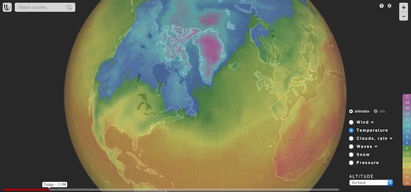
Firstly: Typically for anything big and ugly in my neck of the world the forecasting models ( for big and ugly stuff) are pretty good and the only complaint I have is that they constantly weight to long to raise the flag, or even say things like there is a 20% chance this will be come cat 4 or cat 5. Once its announced then tracking and forecasting from my view is pretty good. So to combat this I set a number of Alerts up in Windy usually 300nm east of me, because most of my big an ugly stuff comes from the east, be North East or SE. So I get the email from Windy that alerts me well ahead of time and I can pay more attention, and generally get more than a week's warning. I do the same thing for passages I want SW type winds around 14knots, so I set an alert for this along the proposed route. Once I have set this up I don't have to pay a lot of attention to the latest forecast, I can focus on other than being a meteorologist. I cant find any other proactive tools to do this, do any others exist ?

Second problem: I plan larger trips over around 2 gears, so currently looking at Ozy, to New Caledonia, to Fiji, to Marshals, Micronesia, Japan (or Palau), back to Philippines. 2 years and around 15,000nm. So when are the best winds, can I get a sailing line, least cyclones, most sunny days, best current etc All of these things make for great, ok, or horrible experience. There is nothing that Im aware of that pulls this together. Even the simpler aspects seem to fall short. ie I keep grib files going back in some cases two or 3 years, and for the world at least 1 year. I know history doesn't mean that it will be repeated, but it is an indicator, it gives you typical weather pattern tracks, shows the transitioning ITC zones and where it converges. I now get other sailors asking me for this historic information. So I keep all the old gribes and it forms part of my planning. I then take a simple excel spread sheet add the places in order Im thinking about down the left colum, then months across the top colour code for wind and rain and very quickly you can see where you need to find a place to hide over the cyclone season, where its likely to be wet, where the wind will be on the nose and you will struggle to get a sailing line, where your timing for great weather (green) runs into Cyclones ( red), or rain (blue). As far as I know there is no known tools to pull this together.

Safety: From a safety aspect we need proactive tools. Something that will poke us in the butt when we are enjoying ourselves. There is little sense in my view having an oil pressure light on a dash you cant see unless you go looking at it every hour the motor is on, so hopefully it has a buzzer. I want a buzzer for weather, that I can taylor to suit how and under what conditions it alerts me. In my case i use email, as its one of the few off boat communication tools I have 99% of the time.

So I have solved most of my own requirements, but it would be so good to have some generic tool/APP that pulls all this information together that has some customized alerting.
 

JamesG161

SBO Weather and Forecasting Forum Jim & John
Feb 14, 2014
7,728
Hunter 430 Waveland, MS
The keys are Tropical Waves and their movements. They move West normally.

The World is divided into Sectors of Monitoring Responsibilities. The USA has 3 zones.
_________

Windy as forecasted [Your mastery of that for alerts is very good]

Uses ECMWF , which the best World Wide models and predictions.

Note the LOW from ECMWF today, in your desired area. [I am a Premium member]
Screenshot 2023-06-06 at 3.01.57 AM.png
_______________
The next best tropical wave monitoring and Analysis is from here.

Tropical Tidbits

Note: The best historical data only goes back to the start of the Satellite Era or the 1970's.

You can track that above LOW here
Current Storm Information | Tropical Tidbits

wp0323.gif

_____

ITC zones and where it converges
You know your weather!

Safety: From a safety aspect we need proactive tools. Something that will poke us in the butt
If set up correctly, I would use Windy.com for that.

Jim...
 

jssailem

SBO Weather and Forecasting Forum Jim & John
Oct 22, 2014
22,368
CAL 35 Cruiser #21 moored EVERETT WA
Windy is trying to implement a course and weather planning tool for aviation and boat. Such a tool is very complex. It is ok for 36-48 hours but tends to be less reliable the further you go into the future.
It works on the computer browser not the phone or ipad app. Provides distance as well as a weather forecast along the route of travel. You can specify wind speed colors to indicate desired and the forecast will showtimes along the route that relate to your desired parameters.
 
Feb 15, 2008
210
Hunter 49 Sydney
Yep Windy is a great tool for sure. But it needs an offline PC version. Like what they did with Google Maps and Google earth.

ECMWF is not as good as GFS in the pacific, China sea or Indian ocean. I only use ECMWF if I want the absolute worst case, knowing 99% of the time it will be less. GFS while sadly not updated as often is more accurate over here.

Tropical Tidbits, yes . Agreed a nice representation. I have tended to settle on including waves and current in grib files so I can also see them on Raytech (PC based chart plotter), relative to where I am and going. Not as flash looking for sure but a bit more practical for me in my situation, where I may not have cell coverage for example, and need to pull it down via HF or Sat

Historical data; do you know where I can get historical gribs including historical current info ??
I have historical storm/cyclone/typhoon tracks, but that's about it, other than what i collect.

Planning tools: Yea a good course and weather planning/routeing tool would be great, but sadly Im not sure anyone is going to do it properly and we will probably still be left with a mish mash of tools to do it. But I look forward to seeing Windy’s version. Or an expansion of predict wind. It took me some years to get Raymarine to implement Polar’s on there plotters, and I still cant get them to implement satellite images properly, which are essential in the Pacific and West through Indian Ocean.

If any chart plotter manufacture actually does this properly they would corner the market for sure. Imagine a chartploter with animated grib files (or nice animated imagery when you have good internet) and based on your preferred model and selection critera., include current wave height and direction , add parameter driven proactive alerts, and customizable polar course plotting, automated offset and anchoring warnings they would be number 1 in the market.
 

jssailem

SBO Weather and Forecasting Forum Jim & John
Oct 22, 2014
22,368
CAL 35 Cruiser #21 moored EVERETT WA
I like your wish list.
Here is a simple route from Sydney to Wellington NZ. The planning feature is only available on Windy.com with a (paid) Premium Account.
 
Feb 15, 2008
210
Hunter 49 Sydney
Yea, been working with Raymarine on and off for a while, testing their products before released, but with the Flir move they reduced there international testing. When I bought Screensaver I also bought Raytech, full version. Most don't like it, for various reasons, but being IT background I didn't find it too hard, and it is enormously powerful, more so than anything else. I will probably end up ditching the physical plotter.
However, point being its routing is absolutely outstanding. So the route shown in your example, if I download the grib for that, Raytech would plot an optimum course based on the boats polar, wind and current, rather than just giving you just the weather down the rumb line, cause it knows I cant sail direct in some spots Sydney to Wellington. Viewfax actually also does what you have there, it will move the boat down any course at any speed (or actual) and move through the weather grib at the same time. And you can do this via gribs even downloaded over HF as per the attached.
 

Attachments

JamesG161

SBO Weather and Forecasting Forum Jim & John
Feb 14, 2014
7,728
Hunter 430 Waveland, MS
where I may not have cell coverage for example, and need to pull it down via HF or Sat
That is only other method I know to get nearby weather info on a ocean vessel.
_____
And you can do this via gribs even downloaded over HF as per the attached.
Try this App.
PredictWind Apps - PredictWind
_____

Yep Windy is a great tool for sure. But it needs an offline PC version
I know of no weather tool that works offline. They all need some current data input.
Otherwise get a good HF radio, Sextant, Chronometer, and Barometer.

Windy is the best tool. It has waves and forecasts too.

A Mastery of Windy is means being Captain of your boat's Safety.

It took many conversations between @jssailem and me to become Masters of Windy. Plus Windy improves their APP often.
_____
Like what they did with Google Maps and Google earth.
Where do you think they get their information?

_______
I lack more information for you, but Windy is the best.

Screenshot 2023-06-07 at 6.20.28 AM.png


More items on the right side are selectable, that was the maximum that could be shown.
[I am Premium Member $20USD/ year]

Jim...
 
  • Helpful
Likes: jssailem

Ward H

.
Nov 7, 2011
3,764
Catalina 30 Mk II Cedar Creek, Bayville NJ
I'm also a premium member of Windy but being a seasonal sailor I struggle with what I remember on how to use for longer term forecasting than the next couple of days.

For @JamesG161 and @jssailem , how about hosting a tutorial for using Windy posted on this forum? Maybe even a Zoom event? One that can be recorded for future reference?
 

jssailem

SBO Weather and Forecasting Forum Jim & John
Oct 22, 2014
22,368
CAL 35 Cruiser #21 moored EVERETT WA
Interesting idea.