Hi everyone. We are going to be launching our new to us catalina 30 that we are currently doing upgraded maintenance on. I have renovated two other sailboats but only have sailed in inland lakes. We need to move our boat from ashtabula to sandusky in the spring. I am looking for a good battery powered chartplotter that does not require me to input all the waypoints myself. I have a garmin 86sc but that requires me to add all the way points. Any advice?
advice on auto chart plotter
- Thread starter Erbardy
- Start date
Putting in all the waypoints (read off a chart) is how you keep track of where you're going. You'd hate to go over a shallow reef at low tide and not know it.
We always made sure we had the waypoints we needed before leaving and added any that we thought we might need.
We always made sure we had the waypoints we needed before leaving and added any that we thought we might need.
Some plotters have autorouting capabilities, often based off Navionics charts. It’s also possible to use Navionics on a phone to autoroute and export as a GPX file. That GPX file can be imported into many plotters to keep the route with the waypoints.
Having said that, autorouting is a good starting point but should not be relied upon for an authoritative route. Any autoroute deserves close inspection to make sure it’s clear of hazards like shoals or bridges. It’s also important to review the whole route to make sure any confusing channel intersections or other tricky spots are understood before you’re on the water.
Having said that, autorouting is a good starting point but should not be relied upon for an authoritative route. Any autoroute deserves close inspection to make sure it’s clear of hazards like shoals or bridges. It’s also important to review the whole route to make sure any confusing channel intersections or other tricky spots are understood before you’re on the water.

All of the dedicated chart plotters. I am aware of need to be hard wired to the boat's DC system.
A charting program on a tablet is an alternative to a dedicated chart plotter. Aquamaps is an affordable and easy to use chart program.
One of the joys of sailing on the Great Lakes is the ease of navigation. We can cross Lake Ontario with just 4 or 5 way points and once we leave the harbor there are no shoals, rocks, or reefs to hit until we get to the other side. We sailed on Ontario for 30 years without a chart plotter and seldom used the GPS or Loran.
Do pick up a copy of the Richardson Chart Book for Lake Erie.
I don't understand your reluctance to enter waypoints. What's up with that? You have a handheld, which is a good back-up. You can also use your phone or tablet. But, now that you will be sailing your Catalina 30 on Lake Erie, you will find it useful to have a dedicated chartplotter. You can choose an economical Garmin GPSMAP, Raymarine Axiom or B&G Vulcan and you will be happy. Are you trying to avoid navigation? I don't get the question ... 
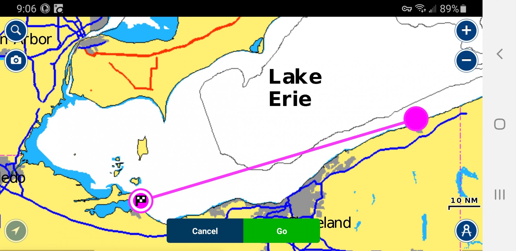
From Ashtabula to Sandusky there aren't really any waypoints that would be automatically generated. It's a long trip though, so you might want to stop one or two places on the way. If you stay off the coast about a mile or so you won't have any issues there. Using Navionics and a paper chart book is excellent advice.
Navionics Boating USA Inland Lakes app on your smart phone.
I have used Navonics on my iPhone for three years now. Very easy to chart a course. If you put in your cruising speed, it also calculates your time ... and if you estimate you fuel burn rate it will also estimate your fuel consumption. Navoinics also can show you places to dock, refuel and find provisions.
Hi,
I can see how you would think i am trying to acoid navigation. The case is more that I want to fina an automatic way to plot a course just in case I miss a shoal or obstacle in the waypoints that i plot. It's more just a wayt o overcome my inexperience until I gain some more open lake sail time under my belt.I don't understand your reluctance to enter waypoints. What's up with that? You have a handheld, which is a good back-up. You can also use your phone or tablet. But, now that you will be sailing your Catalina 30 on Lake Erie, you will find it useful to have a dedicated chartplotter. You can choose an economical Garmin GPSMAP, Raymarine Axiom or B&G Vulcan and you will be happy. Are you trying to avoid navigation? I don't get the question ...
It is entirely possible to plot too many waypoints. Depending on waypoints can lead to poor navigation practices as it keeps your eyes in the boat and not out on the water where they belong. Typically I only plot one waypoint at the destination or just outside the harbor. This gives me a rough idea of the remaining time and distance. Along the way I rely on finding the channel marks and following them. The chart plotter is handy for helping to identify their location.Hi,
I can see how you would think i am trying to acoid navigation. The case is more that I want to fina an automatic way to plot a course just in case I miss a shoal or obstacle in the waypoints that i plot. It's more just a wayt o overcome my inexperience until I gain some more open lake sail time under my belt.
If the course I'm sailing goes around a headland then I will plot 2 waypoints, one far enough off shore from the headland to avoid and obstacles and a second one at the destination.
The absolute wrong way to use waypoints is to set the waypoint at a buoy or mark and engage the autopilot steer the course to the waypoint and then the next waypoint.
So I think you have it backwards, actually. The proper way to use autorouting on a chartplotter/tablet/phone (according to the manufacturers warnings) is exactly as @Davidasailor26 wrote above: Let the chartplotter/tablet/phone autoroute first, then YOU go in and scrutinize the route at sufficient magnification to see all chart annotations and ensure that the autorouting didn't do something stupid, or more usually something nearly stupid, like route you close to a depth too shallow for your keel where shoaling often occurs but isn't represented on the chart. So YOU are responsible for checking the autorouting, not the other way around - it doesn't check YOUR routing to see if you made an error. Its also useful to check the latest Waterway Guide updates to make sure you know if there is anything VERY recent you should know about (missing markers, new shoaling, naval gunfire closing off areas for certain periods, etc.).Hi,
I can see how you would think i am trying to acoid navigation. The case is more that I want to fina an automatic way to plot a course just in case I miss a shoal or obstacle in the waypoints that i plot. It's more just a wayt o overcome my inexperience until I gain some more open lake sail time under my belt.
I think your thinking is misguided. With inexperience, the last thing you should be relying upon is an "automatic" course plotting. Relying upon an automated system is far more dangerous than honing your own senses. Just get a good chartplotter and focus on the charts it provides and focus on your surroundings (including the movement of nearby boats and ships). I don't really see any need for waypoints anyway.Hi,
I can see how you would think i am trying to acoid navigation. The case is more that I want to fina an automatic way to plot a course just in case I miss a shoal or obstacle in the waypoints that i plot. It's more just a wayt o overcome my inexperience until I gain some more open lake sail time under my belt.
The fact is, I rarely ever even make waypoints other than temporary marks on the chartplotter when I'm setting my autopilot course. I don't even have the autopilot steer to a waypoint. Instead, I set a temporary mark (so I know how far and about how much time) and set the autopilot independently, and then I make small adjustments to autopilot as I'm going along. I'm keeping an eye on the chartplotter as we progress. I make waypoints for anchoring locations, I guess.
jssailem
SBO Weather and Forecasting Forum Jim & John
- Oct 22, 2014
- 24,454
I can understand that line of thinking. Our reliance on the auto routing of cars with apple and google maps has given us a reliance on the machine. It must be better than what we could do ourselves.The case is more that I want to fina an automatic way to plot a course just in case I miss a shoal or obstacle in the waypoints that i plot. It's more just a wayt o overcome my inexperience until I gain some more open lake sail time under my belt.
It is not that easy. Roads are fixed in locations and hundreds of thousands of drivers from 18 wheeler semi's to smart cars and sports cars travel the same ones every day. This gives the machines a lot of data that they can use to route you.
Boating is not that. The water, shoals, sand bars, reefs are in constant movement. The route required by a container ship is greatly different than by a Catalina 30.
You need to be aware of the route that you can take. Once you take a route and complete it safely, you can mark the waypoints you took so you can repeat the route. The charts both electronic and paper have area's that show danger. You need to know them by looking at the charts and planning your route. When you get on the water it will take a little time to match the chart information with what you see from the cockpit.
You will run aground as some point. It will shock you. You'll learn and survive. You will know to take a different route next time.
As you start your plotter... As I am sure you will buy one and feel better about it, you will notice a warning flash by on the screen as you try to plot a route. The Caution Note is to tell you that it is your responsibility to navigate not the machines nor the company that built the machine. Many a navigator has made the mistake of following a machine route. Sometimes they run into wrecks plotted on the chart but never recognized by the machine.
What ever you do about the electronics, be sure to zoom in on all of the parts of the route you plan to take. Sometimes the machines hide the danger when you are zoomed out and looking at the big picture.
Chartplotters record the routes you take. There is no need to set waypoints. I can find my way out and back through the Oyster Creek channel and back through the Double Creek channel to my slip in pitch darkness just by following the tens of lines that I have already made in daytime. Get a helm-mounted chartplotter connected to your DC battery system and enjoy the fruits of technology! Once you have sailed around your favorite area you will have complete confidence in seeing exactly where you have already been.You need to be aware of the route that you can take. Once you take a route and complete it safely, you can mark the waypoints you took so you can repeat the route. The charts both electronic and paper have area's that show danger. You need to know them by looking at the charts and planning your route. When you get on the water it will take a little time to match the chart information with what you see from the cockpit.
You will also identify each of those little wiggles in the lines where you have run aground in the past! Those wiggles will never be repeated if you are paying attention!
Last edited:
You are on a fool's errand which will eventually cost you dearly :It's more just a wayt o overcome my inexperience until I gain some more open lake sail time under my belt.
I would also strongly suggest you get CHS charts of the areas you sail in. They give you an additional source of information when planning a longer passage.
A healthy respect for navigation is imperative before you untie the dock lines. You have not learned this yet, so best learn it here. It's much cheaper that way.
You have weeks to learn how to enter waypoints. That might be your best bet.We need to move our boat... in the spring.
I have a garmin 86sc but that requires me to add all the way points. Any advice?
Entering waypoints on a chartplotter is much easier than entering waypoints on a handheld GPS. Chart plotters typically have at least 4 ways enter waypoints:You have weeks to learn how to enter waypoints. That might be your best bet.
- Manually by entering the Lat/Long Data
- Sailing to the waypoint and automatically entering them when you are there
- Scrolling the cursor to the waypoint and hitting an "enter" button which saves the waypoint.
- Importing the way point from a data file.
While chartplotters are great at close range navigation. They really suck when trying to get the "big picture". Just ask Team Vestas.

New video of Team Vestas Wind's grounding and recovery
A look at the dramatic footage of Team Vestas Wind's grounding on Leg 2 of the Volvo Ocean Race and the team's attempt to recover equipment from the critically damaged vessel.
 www.sailingworld.com
Thanks everyone! I have charts ordered and can work through it. I am en engineer and can work through charting a plot and will take all your advice in consideration. Not looking to be hasty or make stupid mistakes. Just trying to learn. That is why I posted in this forum. So thank you for your input.
Hi,
A few points I would like to make:
First - thanks for posting this, looking for advice, and admitting you are inexperienced. That's the best way to gain knowledge and eventually experience.
I believe that your your current 86SC can do auto guidance, but you may need to update the charts in it. According to Garmin, the US LakeVu G3 charts contains auto guidance:
From the garmin site:
Experience unparalleled coverage and brilliant detail when you’re on the water. LakeVü g3 inland charts provide exceptional coverage, clarity and detail with integrated Garmin and Navionics content on more than 18,000 lakes — including more than 160 Garmin Elite surveyed lakes.
Auto Guidance Technology
The Auto Guidance feature1 uses your desired depth and overhead clearance to calculate a route and suggest a path to follow.

----
The GPSMAP86SC is listed as a supported device, but the user manual is not clear on if auto guidance is supported.
Now for some more 'stuff' from me. This will probably get long, so read on or stop, up to you.
IMO the best way to plan a route is to look at a number of charts, starting with a small scale / big picture so you can see the entire route in one chart, and then moving to bigger scale / smaller picture so you can see any hazards you need to be aware of or avoid.
Back in the day, I used to pencil in a line on the chart, write down the course heading, record my position on the chart hourly, etc. I haven't done that in years.
There are many many ways of actually using the route information you have generated. As written by posters above, some people make a note of hazards and then just sail along, keeping a general idea of where they want to go and things to avoid. Others add a waypoint or two and use that.
For me, personally:. If I am going to a specific destination, even if it's a short trip, say 10nm, or a destination I have been to many times, I ALWAYS create a route (or use an existing one), load it onto my plotter and run the route while underway. It is super easy to do (more on that later), provides a number of benefits (to me), and allows me to focus MORE on what is going outside of the boat and LESS on mundane tasks like where am I, what is coming up next, what do I need to avoid, etc.
I am admitted gadget fan and I love the technology, so maybe it's just me, but I can't of a reason to NOT use all the tools I have. A good friend of mine, a very experienced sailor, boat owner, and talented racer, doesn't care for electronics and almost never uses his. To each his own.
I remember my first 'long distance' sail. After 1 year of sailing experience I had bought a new to me boat and I needed to deliver the boat from the brokerage to my home port. The distance was 35nm and started in a new port. I was super nervous about the trip. I studied the charts, charted the trip in the chartbook, and created a simple route in my old Garmin handheld. The trip turned to be just about perfect - great sailing weather, I timed the currents correctly, the boat worked perfectly, etc.
MY TECHNIQUES:
I run the Navionics boating all on my computer, phone, ipad, and tablet. I use Navionics charts on my B&G Zeus 3S plotter.
I will start with the boating app, usually on my ipad, and pick my starting location and destination, and let Navionics pick a route. Navionics route creation is pretty good. It will go NEAR Aids TO Navigation (ATON) but not select them as waypoints.
Depending on how long the trip will be, if I have been there before, if I need to go under any bridges, or anything new or different, I will consult my paper charts.
Then I will look at the Navionics and I may manually edit the route. I have noticed that Navionics is way more conservative than I am. On a 50nm trip I can usually shave off 5 or so miles and save valuable time.
Now I have a route I am happy with.
Before I start my trip I transfer the route from my phone to my Zeus plotter. This happens automatically once I connect the phone to the plotter via wifi.
Before I depart I usually 'RUN' the route and off I go.
When sailing (or motoring) to my destination, I like that the plotter automatically calculates and displays my speed, VMG to waypoint, time to next waypoint, distance to next waypoint, bearing to waypoint, heading, cross track error, time to destination, distance to destination, and a bunch of other useful information.
I don't NEED that information, but I like having it, and it's free. As the trip progresses I can easily determine that yes, I am where I think I am by visually seeing ATONs, etc. I quickly know that in about 15 minutes I will be passing this or that hazard and I should pay more attention to boat traffic etc.
MOST of the time my autopilot will be on and IT will run the route. When I arrive at a waypoint the autopilot will automatically change to the next waypoint. I DON'T LIKE THIS and wish it would beep and require me to press a button or something, but that's the way it works. So I am sure to be alert and prepared BEFORE a course change.
Last year I did a few long distance trips.
One was a return from Bermuda to NY on a friend's boat. I was not the navigator, only a crew, but I still created two routes in my handheld garmin and in navionics on my phone. The routes were simple - depart Bermuda and to go New York City, OR depart Bermuda and head to Greenport. Simple as could be.
The other trip was a two week trip to Portland Maine. The trip there was done non stop, through the Cape Cod Canal. So the entire 250 nm route was entered. The return trip was done one day at a time. So each night I would plan the next day's destination, including my routing. This was all uncharted waters for me, so I spent a good amount of time on the route. It all worked out well.
Anyway, good luck to you.
Barry
A few points I would like to make:
First - thanks for posting this, looking for advice, and admitting you are inexperienced. That's the best way to gain knowledge and eventually experience.
I believe that your your current 86SC can do auto guidance, but you may need to update the charts in it. According to Garmin, the US LakeVu G3 charts contains auto guidance:
From the garmin site:
Experience unparalleled coverage and brilliant detail when you’re on the water. LakeVü g3 inland charts provide exceptional coverage, clarity and detail with integrated Garmin and Navionics content on more than 18,000 lakes — including more than 160 Garmin Elite surveyed lakes.
Auto Guidance Technology
The Auto Guidance feature1 uses your desired depth and overhead clearance to calculate a route and suggest a path to follow.
----
The GPSMAP86SC is listed as a supported device, but the user manual is not clear on if auto guidance is supported.
Now for some more 'stuff' from me. This will probably get long, so read on or stop, up to you.
IMO the best way to plan a route is to look at a number of charts, starting with a small scale / big picture so you can see the entire route in one chart, and then moving to bigger scale / smaller picture so you can see any hazards you need to be aware of or avoid.
Back in the day, I used to pencil in a line on the chart, write down the course heading, record my position on the chart hourly, etc. I haven't done that in years.
There are many many ways of actually using the route information you have generated. As written by posters above, some people make a note of hazards and then just sail along, keeping a general idea of where they want to go and things to avoid. Others add a waypoint or two and use that.
For me, personally:. If I am going to a specific destination, even if it's a short trip, say 10nm, or a destination I have been to many times, I ALWAYS create a route (or use an existing one), load it onto my plotter and run the route while underway. It is super easy to do (more on that later), provides a number of benefits (to me), and allows me to focus MORE on what is going outside of the boat and LESS on mundane tasks like where am I, what is coming up next, what do I need to avoid, etc.
I am admitted gadget fan and I love the technology, so maybe it's just me, but I can't of a reason to NOT use all the tools I have. A good friend of mine, a very experienced sailor, boat owner, and talented racer, doesn't care for electronics and almost never uses his. To each his own.
I remember my first 'long distance' sail. After 1 year of sailing experience I had bought a new to me boat and I needed to deliver the boat from the brokerage to my home port. The distance was 35nm and started in a new port. I was super nervous about the trip. I studied the charts, charted the trip in the chartbook, and created a simple route in my old Garmin handheld. The trip turned to be just about perfect - great sailing weather, I timed the currents correctly, the boat worked perfectly, etc.
MY TECHNIQUES:
I run the Navionics boating all on my computer, phone, ipad, and tablet. I use Navionics charts on my B&G Zeus 3S plotter.
I will start with the boating app, usually on my ipad, and pick my starting location and destination, and let Navionics pick a route. Navionics route creation is pretty good. It will go NEAR Aids TO Navigation (ATON) but not select them as waypoints.
Depending on how long the trip will be, if I have been there before, if I need to go under any bridges, or anything new or different, I will consult my paper charts.
Then I will look at the Navionics and I may manually edit the route. I have noticed that Navionics is way more conservative than I am. On a 50nm trip I can usually shave off 5 or so miles and save valuable time.
Now I have a route I am happy with.
Before I start my trip I transfer the route from my phone to my Zeus plotter. This happens automatically once I connect the phone to the plotter via wifi.
Before I depart I usually 'RUN' the route and off I go.
When sailing (or motoring) to my destination, I like that the plotter automatically calculates and displays my speed, VMG to waypoint, time to next waypoint, distance to next waypoint, bearing to waypoint, heading, cross track error, time to destination, distance to destination, and a bunch of other useful information.
I don't NEED that information, but I like having it, and it's free. As the trip progresses I can easily determine that yes, I am where I think I am by visually seeing ATONs, etc. I quickly know that in about 15 minutes I will be passing this or that hazard and I should pay more attention to boat traffic etc.
MOST of the time my autopilot will be on and IT will run the route. When I arrive at a waypoint the autopilot will automatically change to the next waypoint. I DON'T LIKE THIS and wish it would beep and require me to press a button or something, but that's the way it works. So I am sure to be alert and prepared BEFORE a course change.
Last year I did a few long distance trips.
One was a return from Bermuda to NY on a friend's boat. I was not the navigator, only a crew, but I still created two routes in my handheld garmin and in navionics on my phone. The routes were simple - depart Bermuda and to go New York City, OR depart Bermuda and head to Greenport. Simple as could be.
The other trip was a two week trip to Portland Maine. The trip there was done non stop, through the Cape Cod Canal. So the entire 250 nm route was entered. The return trip was done one day at a time. So each night I would plan the next day's destination, including my routing. This was all uncharted waters for me, so I spent a good amount of time on the route. It all worked out well.
Anyway, good luck to you.
Barry
jssailem
SBO Weather and Forecasting Forum Jim & John
- Oct 22, 2014
- 24,454
There are lots of resources available to utilize your engineering training and apply it to navigation.
A YouTube search blossomed hundreds of videos like this one.
One of the best 3 part classes I have seen on video are the work of OffCenterHarbor. They feature Jane Ahlfeld who's instruction style I find extremely easy to understand and comprehend.

 www.offcenterharbor.com
Be safe out there on the water. You have an exciting transition from small lake to open water coming.
A YouTube search blossomed hundreds of videos like this one.
One of the best 3 part classes I have seen on video are the work of OffCenterHarbor. They feature Jane Ahlfeld who's instruction style I find extremely easy to understand and comprehend.
Coastal Navigation, Part 1 - Charts & Buoys - OffCenterHarbor.com
Nautical charts contain a wide range of numbers and symbols, each transmitting critical information to the mariner.
www.offcenterharbor.com
Be safe out there on the water. You have an exciting transition from small lake to open water coming.