BWCA/Quetico wilderness adventures

Aug 19, 2013
129
Sirius 22 Minneapolis
Some of my other boating activity. Since my first trip into the BWCA in 1978 I have returned 16 times since then. Here are some photos from the most recent 7 day trip in September 2014.

My canoe partner Lisa and me at the Moose River entry point with our venerable 1978 16 ft Sawyer canoe.


Wild rice on the Moose River


Beaver dam on the Nina Moose River


Seven hours later after traveling two stream systems, seven portages, and crossing three lakes we arrive at out first days destination...Lac La Croix and a campsite with a rare sand beach.


View looking north....Minnesota on the left Canada on the right.


looking east


Looking west


looking south...a storm approaches


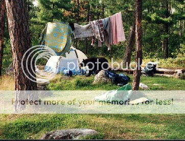
camp still standing after a night of thunderstorms.


Hot water shower facilities


Balancing slab of rock


calm day for a paddle


300-400 year old pictographs...a moose above and to the left and another above and to the right.


Figure with a spear


Once widespread there are only a few places where this ancient art survives.


View from Warrior Hill. Racing to the top of this hill carrying a heavy load was a test of manhood for young Native Americans back in the day.


Found another sand beach while out exploring


had fresh bear tracks


and otter


the little things


Two from the deadly Amanita family probably Yellow Patches


Sunset
 
Last edited:
Aug 19, 2013
129
Sirius 22 Minneapolis
From 2009. Curtain Falls between Iron Lake and Crooked Lake force you to make a 1/2 mile portage around falls and rapids. These two lakes are just a few of a long chain of lakes that run along the border of Minnesota and Canada. From Lake Superior to the interior of Canada this was one of the highways for the Voyageurs, the fur trappers who traveled this area in Birch bark canoes for the Hudson's Bay Company from the mid 1600's thru about 1880 and by the native inhabitants even further back in time. It's a great experience to walk the same portages and camp in the same spots from this long ago era.

Standing in Minnesota with Canada on the far shore.


Campsite tucked into the trees behind the bolder. Our canoe sits by the bolder on the left.


Views from a cliff overlooking the campsite


At another campsite on a prominent peninsula we found this natural stone hearth. This spot has probably been in use for hundreds of years. You can just make out our red omelet pan nestled above the flames. How many meals have been cooked here?
 
Oct 26, 2008
6,201
Catalina 320 Barnegat, NJ
Lucky you!

My first trip into BWCA and Quetico was in 1975 with my dad and my brother. We outfitted in Ely and entered Canada via Basswood Lake. I still have the maps around somewhere, and I remember a few of the lake names we paddled, such as Burke Lake and Sunday Lake (with help from Google Maps). We were out for 8 days in late August and went several days without seeing another canoe. We also carried too much food as we caught plenty of walleye and small mouth bass to eat. I 'd like to look for photos, but I might have to get help from my son (he'll have access to my ex-wife's house). Speaking of her, I proposed to her on a trip into BWCA off the Gunflint Trail in 1977. I lived in Grand Marais that summer, working on a survey crew and I spent many weekends paddling lakes in that area. As I recall, the locals seemed to be very hostile to the federal government for creating a wilderness area in those parts in those days.

Sadly, that is the last time I have been in that neck of the woods. My brother now lives in northern Wisconsin (Hayward), and we've been meaning to take an extended trip to that area. My goal would be to spend a summer or two sailing Lake Huron, Lake Superior, and northern Lake Michigan.

The maps we got from the outfitters had great detail, as I recall. They marked the campgrounds with a dot from a red felt-tip pen and they also marked the areas where we would be most likely to catch fish, but we found that it was pretty much anywhere along the shallow shore lines for bass, and the drop-offs yielded the walleye. Portages where marked on the maps, but we were unsure about recognizing them. The outfitters said just look out for the silver markings where the aluminum canoes scape on the rocks. I had to prove my strength by portaging the canoe with a Duluth pack on my back as well. Good thing that the longest was less than a mile, but a few were all uphill!
 
Aug 19, 2013
129
Sirius 22 Minneapolis
My first trip into BWCA and Quetico was in 1975 with my dad and my brother. We outfitted in Ely and entered Canada via Basswood Lake. I still have the maps around somewhere, and I remember a few of the lake names we paddled, such as Burke Lake and Sunday Lake (with help from Google Maps). We were out for 8 days in late August and went several days without seeing another canoe. We also carried too much food as we caught plenty of walleye and small mouth bass to eat. I 'd like to look for photos, but I might have to get help from my son (he'll have access to my ex-wife's house). Speaking of her, I proposed to her on a trip into BWCA off the Gunflint Trail in 1977. I lived in Grand Marais that summer, working on a survey crew and I spent many weekends paddling lakes in that area. As I recall, the locals seemed to be very hostile to the federal government for creating a wilderness area in those parts in those days.

Sadly, that is the last time I have been in that neck of the woods. My brother now lives in northern Wisconsin (Hayward), and we've been meaning to take an extended trip to that area. My goal would be to spend a summer or two sailing Lake Huron, Lake Superior, and northern Lake Michigan.

The maps we got from the outfitters had great detail, as I recall. They marked the campgrounds with a dot from a red felt-tip pen and they also marked the areas where we would be most likely to catch fish, but we found that it was pretty much anywhere along the shallow shore lines for bass, and the drop-offs yielded the walleye. Portages where marked on the maps, but we were unsure about recognizing them. The outfitters said just look out for the silver markings where the aluminum canoes scape on the rocks. I had to prove my strength by portaging the canoe with a Duluth pack on my back as well. Good thing that the longest was less than a mile, but a few were all uphill!
We did a trip in that same area from Basswood into Sunday Lake to Agnes which is that long lake that runs almost north and south...a truly spectacular lake. We went all the way to the top than came back down and returned through Silence, Summer, Noon and Shade Lakes. From there we passed through some small lakes and then hopped across a northern bay of Basswood to Burke and back into Basswood again and then the long haul back to the entry point on Moose Lake.

It has changed a slight bit since you were last here. Campsites and portages are still marked on BWCA maps but the wooden posts marking the portages are gone as well as all the canoe rests on the longer ones. Quetico maps do not show campsites. The aluminum scrapes are rare too as few use the old Grummans now. Some of the larger border lakes are still motorized with some phased out since you were here. The big fight in the 70's over the wilderness is pretty much a thing of the past as it brings in $$$ now from park users and keeps those towns alive since the mines went belly up. The BWCA did suffer some significant damage in a massive wind storm in 1999 and the resulting fires later and I have avoided that section of the park since then. Lucky for me we covered all of that area in earlier trips....not sure I have the heart to go back.

The maps have gotten better too since the old Fischer Maps...though I still use my oldies at times. I find that campsites and even portages have changed from the old maps so sometimes it's an adventure. The newer topo maps are great but you often have to carry several to cover the same area as the old Fischers....but the detail is so much better. I laminated my old Fischers so they have held up and I update them when I find changes.

We have been concentrating on the Lac La Croix area lately as there are so many route variations possible that we would have a hard time exhausting them.

nice smallmouth


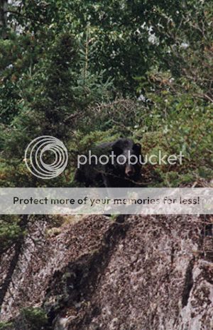
sometimes we have visitors


We used this 17 foot Coleman canoe for a few trips....it could carry a big load and was very stable in rough water but a slow paddler. We called it the station wagon.

Morning fog clearing on Knife Lake


Lake Insula


Portage on the border lakes route probably been in use for 500+ years.
 
Last edited:
Oct 26, 2008
6,201
Catalina 320 Barnegat, NJ
That did it ....

Now you've got me aching to go back. I wonder if my sons are up for it. Once you experience that time in the wilderness, it has a haunting effect, as I'm sure you know far better than me. Why else would you continue to return? The days are filled with labor; it can be cold, wet and uncomfortable. The bugs can eat you alive. Yet, your soul finds so much peace. I'm sure I don't need to tell you, and I might be romanticizing the experience since it was so long ago.

It's a special place for sure. When I was in Grand Marais in 1977, we used to hang out at the local tavern in the center of town (I'm sure it's still there - I think I recognized it in a show I recently saw about cuisine in Minnesota). Night after night was the same old theme about the federal government sticking their nose in where it don't belong ... mining ... logging ... fishing ... snowmobiling ... on and on. Finally, one night I happened to say that I thought the wilderness area was not just theirs, but a national treasure. That did it, my friends held a guy back who wanted to break his beer bottle over my head and the bartender told me it was time to leave. I came back the next night, but I kept my mouth shut and soon enough all was forgotten (or at least forgiven). :D
 
Aug 19, 2013
129
Sirius 22 Minneapolis
Now you've got me aching to go back. I wonder if my sons are up for it. Once you experience that time in the wilderness, it has a haunting effect, as I'm sure you know far better than me. Why else would you continue to return? The days are filled with labor; it can be cold, wet and uncomfortable. The bugs can eat you alive. Yet, your soul finds so much peace. I'm sure I don't need to tell you, and I might be romanticizing the experience since it was so long ago.

Even with one trip you tuned into the experience. I don't think you are romanticizing it. A travel day can be filled with labor and wear you out but sipping a hot drink sitting on a rock down by the water watching the sunset...it all goes away. I look at it as a spiritual refuge to recharge the soul. We had one experience that I call the "primordial night" when we were in Canada camping at about the halfway point on this narrow mile long peninsula. We could tell the site had not been used at all that summer as plants were growing in the stone hearth. There was a bleached out set or moose antlers next to we we parked the canoe. Full moon that night and the loons were calling out on the lake. Sitting around the campfire we hear a few wolves howl out towards the end of the peninsula and an answering howl from the rest of the pack down near the base of the peninsula. We must have trapped part of the pack when we set up camp and they were unwilling to expose themselves to us during the daylight especially as I am out tramping around gathering fire wood and making a racket. Now with night they were making their move to slip by us and rejoin the group. We were surrounded by howling wolves but they kept their distance and it was a memorable night. There are lots of wolves up there and we will hear them at night often but that was my closest encounter. In all my trips I have only seen one once crossing a portage trail.

I would encourage you to come back. The equipment has improved since you were here especially the canoes. 44 pound Kevlar canoes are the norm now vs 70+ for the old stuff...like my Sawyer.:D I think we will be upgrading to a Kevlar canoe soon. The outfitters all have these now and many people just rent the canoes...I would say that a vast majority of the canoes you see now are outfitter rentals.

From experience we have found the first week of September to be the prime week. The bugs are gone or almost gone, the water has reached it's peak temp and is just starting to cool, it is usually dry with warm days and cool nights. I would say three quarters of our trips have been this week and I can recall just a few days of rain...never had a trip washed out. This last trip we had rain on three nights but it always cleared by morning. The second choice is the week either side of that week. I would never go up there from June-mid August (the busy season) due to the bugs and the potential July thunderstorms. We sit out around the campfire late every night and go for midnite paddles when the moon is out and the bugs make that difficult so we avoid them.


We almost had a head-on collision with a moose. We were paddling along the shore and went under the downed tree and turning the corner there was a moose standing in the water on the other side that we just missed by a few feet. You can see the moose on the left about a quarter of the way in on the photo....it blends in pretty good.
 
Last edited: