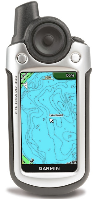
GPS delima

Pat

.
Jun 7, 2004
1,250
Oday 272LE Ninnescah Yacht Club, Wichita, Ks.
Looking to replace my old Garmin 3 plus gps and wondering what model of
handheld is good for an inland lake. I would prefer something slightly larger
than my old 3 plus...I'm on a relatively small 10,000 acre lake in Kansas...
thanks for your thougths..
 
Feb 17, 2006
5,274
Lancer 27PS MCB Camp Pendleton KF6BL
Although not a GPS, but it has a very good GPS, it would be a Galaxy Tab 3. The Tab has both US GPS and GLONASS which is the Soviet GPS system.

If you are interested in just a handheld, I would recommend one with both systems. Accuracy will be much better than just a single system.

I have two on the boat; GPS 12 at the helm and GPS 72 tied in at the VHF for DSC. Both are really good and very simple to use. I much prefer the GPS 12 as the data on display is really what I am looking for.

Good luck in your search.
 
Jan 19, 2010
12,938
Hobie 16 & Rhodes 22 Skeeter Charleston
With today's technology, I'd think an iPhone or iPad or other smart phone/tablet with some nav. apps. might be a good choice for an inland lake. About the same price but with much more flexibility in what you can do with it.

I also do most of my sailing on an inland lake and always have cell reception. And when I trailer to the coast....even two miles off shore, I can usually pick up a cell signal.
 
Nov 8, 2010
11,386
Beneteau First 36.7 & 260 Minneapolis MN & Bayfield WI
What are your needs?

If you plan on needing to rely on this GPS some day, get a dedicated unit. Dedicated units, unlike smartphones, can take a knock, get wet, and with a set of Lithium batteries can be relied upon to power on.

Do you want marine maps? If yes the first point will be sure that the unit you select supports your inland lake. Garmin has a good selection of inland lakes in their map database. Often maps can be added to a device, but that cost about $100. It is normally a better deal to by the model that has the maps included.

If the unit is for more casual use, you can go the smartphone route. Navionics has the best inland lake support. Look into getting a good waterproof case, like the Lifeproof. If your phone has GPS, there is no need for cell service for the location service to work.

Are you looking for a basic unit that just shows Lat/Long? PM me and I'll send you one for the cost of shipping. I've been in this business for a while and have a box of the things.
 
Feb 26, 2004
23,352
Catalina 34 224 Maple Bay, BC, Canada
Are you looking for a basic unit that just shows Lat/Long? PM me and I'll send you one for the cost of shipping. I've been in this business for a while and have a box of the things.
Great advice.

Hey, Jack, would one of these in your box be a Magellan Blazer???? :eek::eek::eek:
 
Nov 8, 2010
11,386
Beneteau First 36.7 & 260 Minneapolis MN & Bayfield WI
Great advice.

Hey, Jack, would one of these in your box be a Magellan Blazer???? :eek::eek::eek:
No Mr. Peabody, you've turned the dial on the Wayback machine too far! ;^)

Some Meridian, Sportracks, and box of every eXplorist we ever made.
 

Paul F

.
Jun 3, 2004
827
Hunter 1980 - 33 Bradenton
Get a Nexus 7 ($200) then buy Navionics US maps ($10) and a waterproof case ($7) and you have it. Navionics has almost all U.S. lakes. It's amazing, here are their on web maps, check it out.
http://www.navionics.com/en/webapp

no, I don't work for them, lol. but have used their maps for years.

I use to sail on Cheney Reservoir west of Wichtia a great place to sail.
 
Last edited:
Aug 10, 2011
37
none none Northern California
GPS

If you don't already have one, get a smartphone and/or tablet (like an iPad). Make sure it has GPS, which most of them do. Then buy the Navionics app that includes "Inland Lakes." It's excellent. At home, or at the nearest Starbucks if you don't have your own internet, you can select the geographic area you want to navigate within, and download it to your own device.
When out sailing, you don't need internet or cell coverage, only a good GPS signal. The Navionics software is very good and the charts of the lakes (I'm in northern california on a fairly small lake (not Tahoe) are excellent.
Fair Winds
Oldersalt
 
Feb 17, 2006
5,274
Lancer 27PS MCB Camp Pendleton KF6BL
Allow me to say stay away from Navionics. Their maps are inferior and lack detain compared to NOAA BSB Raster charts. Now, with that said, if you cannot find a NOAA chart for your state on their download site, then your only recourse is Navionics. I spent $50 for inferior charts when I could have used NOAA charts on my Galaxy Tab 3.

Just saying. It is your choice but I just wanted to flip the coin.
 
Nov 8, 2010
11,386
Beneteau First 36.7 & 260 Minneapolis MN & Bayfield WI
Allow me to say stay away from Navionics. Their maps are inferior and lack detain compared to NOAA BSB Raster charts. Now, with that said, if you cannot find a NOAA chart for your state on their download site, then your only recourse is Navionics. I spent $50 for inferior charts when I could have used NOAA charts on my Galaxy Tab 3.

Just saying. It is your choice but I just wanted to flip the coin.
Its interesting that we cannot take digs at long-dead boat companies, but its OK to make generalized condemnations of leading cartography companies? Hmm.

NO map is perfect. I run into issues with NOAA maps all the time. The choice between raster and vector maps is personal. And vector maps are better on small screens anyway, because the software can de-clutter them, unlike raster maps which cannot be de-cluttered. The Navionics and Garmin vectors charts are comparable to NOAA ENCs in terms of detail and quality. The guy is in Wichita, Ks. The nearest NOAA maps are for water 600 miles away.
 

Pat

.
Jun 7, 2004
1,250
Oday 272LE Ninnescah Yacht Club, Wichita, Ks.
Yes, it true...out here on the prairie we have a bit of an issue finding anything that is boating related....Our little Garmin 3 plus saved our lives one clear beautiful evening when we decided to go up into a cove one evening to cook dinner on the bbq and spend what was suppose to be a clear night....enjoyed the evening greatly....go to bed. I wake up around 3:39 a.m. with the wind howling and frequent lighting in the NW
sky...My wife was not happy and really wanted to go back to our slip approx. 4 miles away....On the way to our anchorage I had marked several important points so I could find my way out of this cove should it be necessary for whatever reason...
I start the little diesel, using the GPS followed my marks and whalla...ventured back thru the shallow water making it across the lake to our slip (also marked)....the wind was maybe 45-50 mph out of the NW...we're headed South and using that crazy little map felt secure all the way home in the lightening and wind.....after this experience I no longer considered our gps a toy, but rather a life-saving tool when needed.....probably more than anyone wants to know. I'm currently looking at the Garmin 78. My only issue is the extremely small screen...sorry to bore everyone. Thanks for your thoughts, Patrick
 
Nov 8, 2010
11,386
Beneteau First 36.7 & 260 Minneapolis MN & Bayfield WI
Patrick,

As you may have seen, maps from Garmin cost about $100 for that device.... quite a bit of you only need one small lake map. But if you are clever, you can make your own map and download it to the device for free. I've done this many times, and garmin supports and documents how at the link below.

What you need is an image of a map of your lake, best gotten from the state's DNR or similar agency. You then use Google Earth to align the map to imagery, to 'geo-reference' it. Then you download it to the device. The process is documented. Below is a picture of a map I made in Minnesota, and what it looked like on the device.


https://dl.dropboxusercontent.com/u/955501/custommaps_instruct.pdf

 
Aug 22, 2011
1,113
MacGregor Venture V224 Cheeseland
What are your needs?

If you plan on needing to rely on this GPS some day, get a dedicated unit. Dedicated units, unlike smartphones, can take a knock, get wet, and with a set of Lithium batteries can be relied upon to power on.

Do you want marine maps? If yes the first point will be sure that the unit you select supports your inland lake. Garmin has a good selection of inland lakes in their map database. Often maps can be added to a device, but that cost about $100. It is normally a better deal to by the model that has the maps included.

If the unit is for more casual use, you can go the smartphone route. Navionics has the best inland lake support. Look into getting a good waterproof case, like the Lifeproof. If your phone has GPS, there is no need for cell service for the location service to work.

Are you looking for a basic unit that just shows Lat/Long? PM me and I'll send you one for the cost of shipping. I've been in this business for a while and have a box of the things.

Seems like entry level to the electronic map/gps game is around $200.
25 gallons of LP :cry:.

Jackdaw;

If you are looking to empty your box a little I for one would gratefully help you with that it for the cost of shipping. We have Paypal or whatever.

:redface:
 
Nov 8, 2010
11,386
Beneteau First 36.7 & 260 Minneapolis MN & Bayfield WI
If you are looking to empty your box a little I for one would gratefully help you with that it for the cost of shipping. We have Paypal or whatever.

:redface:
Cool, give me a day or so to sort out what I have.... The collection looked like this a few years ago; the box must be here somewhere...


Pat

.
Jun 7, 2004
1,250
Oday 272LE Ninnescah Yacht Club, Wichita, Ks.
I do own a Garmin Mapsource CD (Topo) which is downloadable to the Garmin 78 series.
But, I don't think it is in color (have not checked that yet)...I called Garmin in Olathe, Ks.
last week to verify this.....pat
 
Aug 22, 2011
1,113
MacGregor Venture V224 Cheeseland
Wow! The mother lode!

At your convenience kind sir.
Sadly the ice isn't going anywhere soon.


Cool, give me a day or so to sort out what I have.... The collection looked like this a few years ago; the box must be here somewhere...


Pat

.
Jun 7, 2004
1,250
Oday 272LE Ninnescah Yacht Club, Wichita, Ks.
Paul F. Exactly what I need for our lake...even shows our slips...my Garmen Topo Map,
i.e. Map Source CD had land contours but not lake depths so this would be great...I've also used our 3 plus in the BVI nine times, but am doubting we'll be there again...Thanks for the advice.