Wondering what people's thoughts are on the PNW Current Atlas app. It looks like I downloaded it and then never used it, so my free trial period has expired. The only way I can try it now is to buy it. Is it worth the 28 bucks, or whatever? I live near Vancouver and sail in the Georgia Strait, and thereabouts.
PNW Current Atlas App
- Thread starter Tedd
- Start date
Have you checked out Deep Zoom? It's a web site, but works on my iphone and has some cool features with the green arrows showing currents over time at key points.
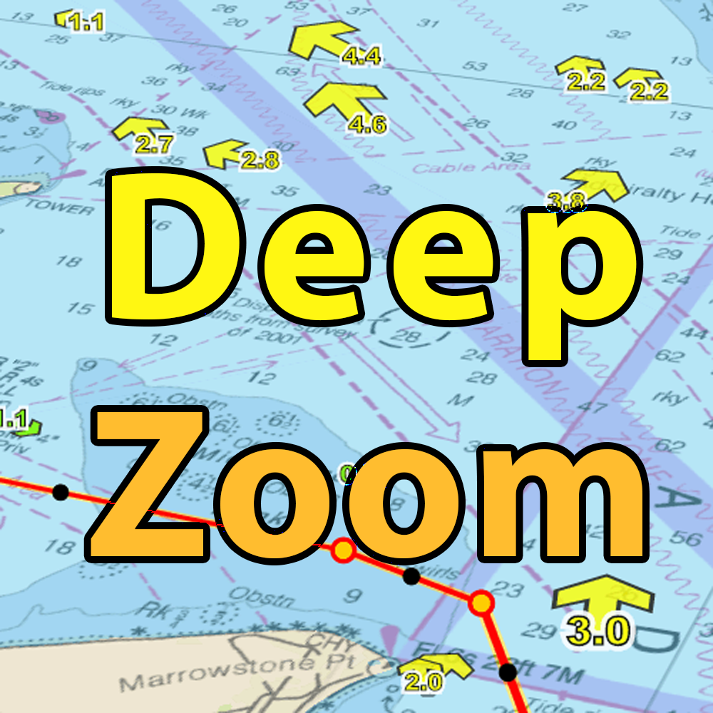
Not sure about Canada though, might not support it or is a setting I don't have correct...

Not sure about Canada though, might not support it or is a setting I don't have correct...
Attachments
-
 1,017.3 KB Views: 139
Hi Tedd, never had a much of a need for any kind of current app during our many cruises north into BC over the years. Some people like them, though. Basically, it floods north to the top end of Georgia Strait and south above that. I've always kept an eye on a good tide schedule, also slack water through the narrows (Dodd, et al), and cruised accordingly. Little current effect on east/west passages, but north south passages a different story. Johnstone floods to the south as do the Green River rapids and Yacultas rapids. Georgia Strait has little current affect due to its size, but a knot or two heading north on a flood would help.
I've always used Ports and Passes with good results. There are others but you can get a copy here: 2022 Ports and Passes
Most chandleries carry this publication.
I've always used Ports and Passes with good results. There are others but you can get a copy here: 2022 Ports and Passes
Most chandleries carry this publication.
What this app appears to have done is convert the Canadian Hydrographic Services (CHS) Current Atlas Juan de Fuca Strait to Georgia Strait to a device friendly product.Wondering what people's thoughts are on the PNW Current Atlas app. It looks like I downloaded it and then never used it, so my free trial period has expired. The only way I can try it now is to buy it. Is it worth the 28 bucks, or whatever? I live near Vancouver and sail in the Georgia Strait, and thereabouts.
Here is the original and free CHS publication in digital format:
CHS Current Atlas
To make use of this atlas a somewhat convoluted procedure must be undertaken OR take advantage of borsboom precomputed atlas lookup tables:
Current Altas Lookup Tables - 2019 to 2030
The CHS Current Atlas gives a decent overall large scale view of currents at a given time. But nothing more. For more exacting current information when transiting passes and narrows, I tend to rely heavily on Ports and Passes as @Terry Cox indicates. For tide levels needed for say anchoring, I find Navionics charts close enough. However I do not find that Navionics provides accurate enough times for transiting tide gates. Experience has proven that late by 15 minutes or more can mean a 6 hour wait for the next slack.
Unfortunately, I have found no publication or application that gives accurate data North of the Discovery Islands, this includes of course, the Broughton Archipelago and Great Bear Rainforest.
PNW Current Atlas app developer (and PNW sailor) here. Happy to answer any questions. The summary above is correct - it is a more friendly digital version of the Canadian publications. I find it really used for Juan de Fuca crossings out of Port Townsend and I want an easier way to us it (than the books). I license this data from CHS. Right now it covers the San Juan and Gulf Islands but it will cover Strait of Georgia when I can incorporate that additional data set. Beyond that, as surmised above, there is no other data available like this for other areas sadly.
Tedd: I wish I could renew your trial but both Apple and Google effectively prevent me from getting around their app store limits.
Cheers,
David
Tedd: I wish I could renew your trial but both Apple and Google effectively prevent me from getting around their app store limits.
Cheers,
David


Thanks, @david.jade . I probably will buy the app as it does seem to do what I want. Since I'm between boats at the moment, I'm killing some time doing little route planning exercises such as, "How long would it take to reach Montague Harbour today?" The app seems perfect for that kind of thing.
@Hello Below ,
Those are some great links, thanks very much! I had downloaded the CHS publication before but I hadn't heard of the borsboom tables before--very handy!
Those are some great links, thanks very much! I had downloaded the CHS publication before but I hadn't heard of the borsboom tables before--very handy!
Just note that the borsboom tables do not use official CHS tidal data as the basis of all the calculations. This is because the reference station tides is not freely available to republish like this anymore. So it uses older tidal harmonic data that was once public many years ago. The issue is, it's been updated by CHS over the years to be much more accurate. My app uses the licensed data.
Will this matter much? Not a whole lot since these atlas charts are averaged predictions anyway (so the chart book isn't thousands of pages long). But it's just something to know. Its more a choice of do you want to take the time to look up things in chart books or see the same charts faster in a more accesible and user friendly way.
Also, never use any of these sources to predict tidal gates (i.e. rapids or passes) are they are not granular enough for that even if the current markers look to be overlaid on a tidal gate. Always use official (i.e. published by CHS) tidal tables for those.
Hope this info helps.