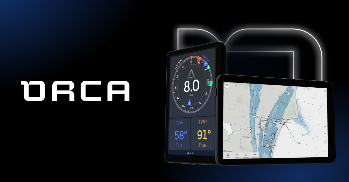
Interesting idea. Looks like basically a hardened tablet with a sun-readable screen, with some software tailored for navigation. To actually integrate with NMEA2000 networks it looks like you need their Orca Core for $500. So a complete package for an NMEA connected setup would be $2100. For comparison the latest generation B&G Zeus3s chartplotter has a sticker price of $2800 for 9” or $4400 for 12”.
A few things I’d want to learn more about are:
- The quality of their proprietary charts
- Whether they’re compatible with any other charting ecosystems like Navionics, C-Map, or NOAA ENC’s
- How their screen handles direct sunlight, both for readability and heat management
- How their touch interface works when wet or wearing gloves
- It doesn’t look like there’s any integration with ActiveCaptain, Waterway Guide, or Army Corps of Engineers surveys
In general I’m happy to see more offerings trying to advance what’s possible with onboard navigation systems. While not as technically stagnant as in-car navigation, the industry leaders could still use some pressure to keep them innovating.
Has anyone installed and use this? It's new and seems like it would be like WAZE and easier to plot a trip.
Orca is navigation for the modern boater. Meticulously designed to help you plan and find your way at sea, without getting in your way.

getorca.com
For pure trip planning and routing there are already some other options. The Navionics iPhone/Android app has an auto-route feature that helps plot a course based on minimum depths. The route still needs a sanity check to make sure it’s not doing anything weird, but to get an idea for distances and general planning it’s pretty good. For routing over longer passages PredictWind, OpenCPN, and QTVLM each offer weather routing based on weather forecasts and a boat’s polar diagram to find the optimal route.