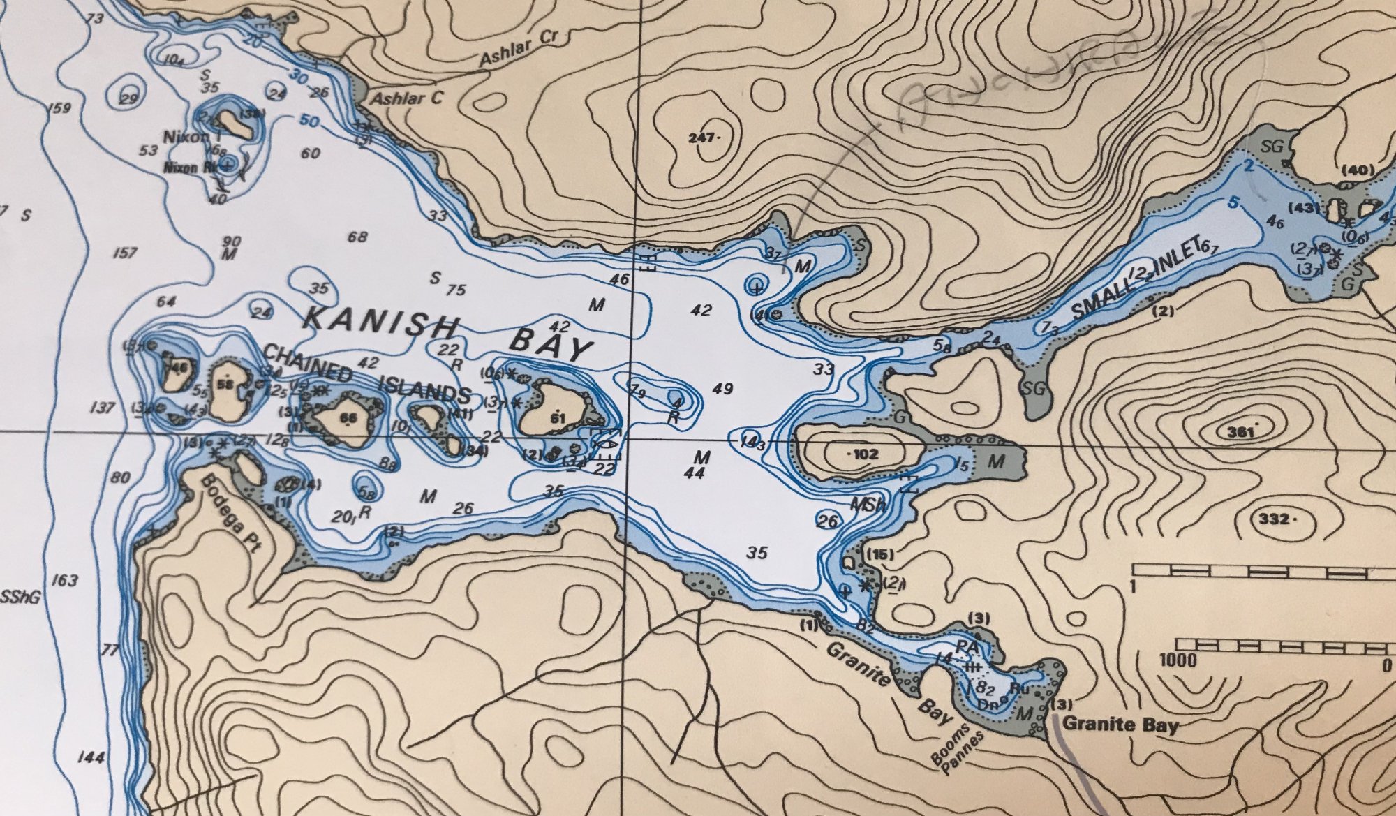
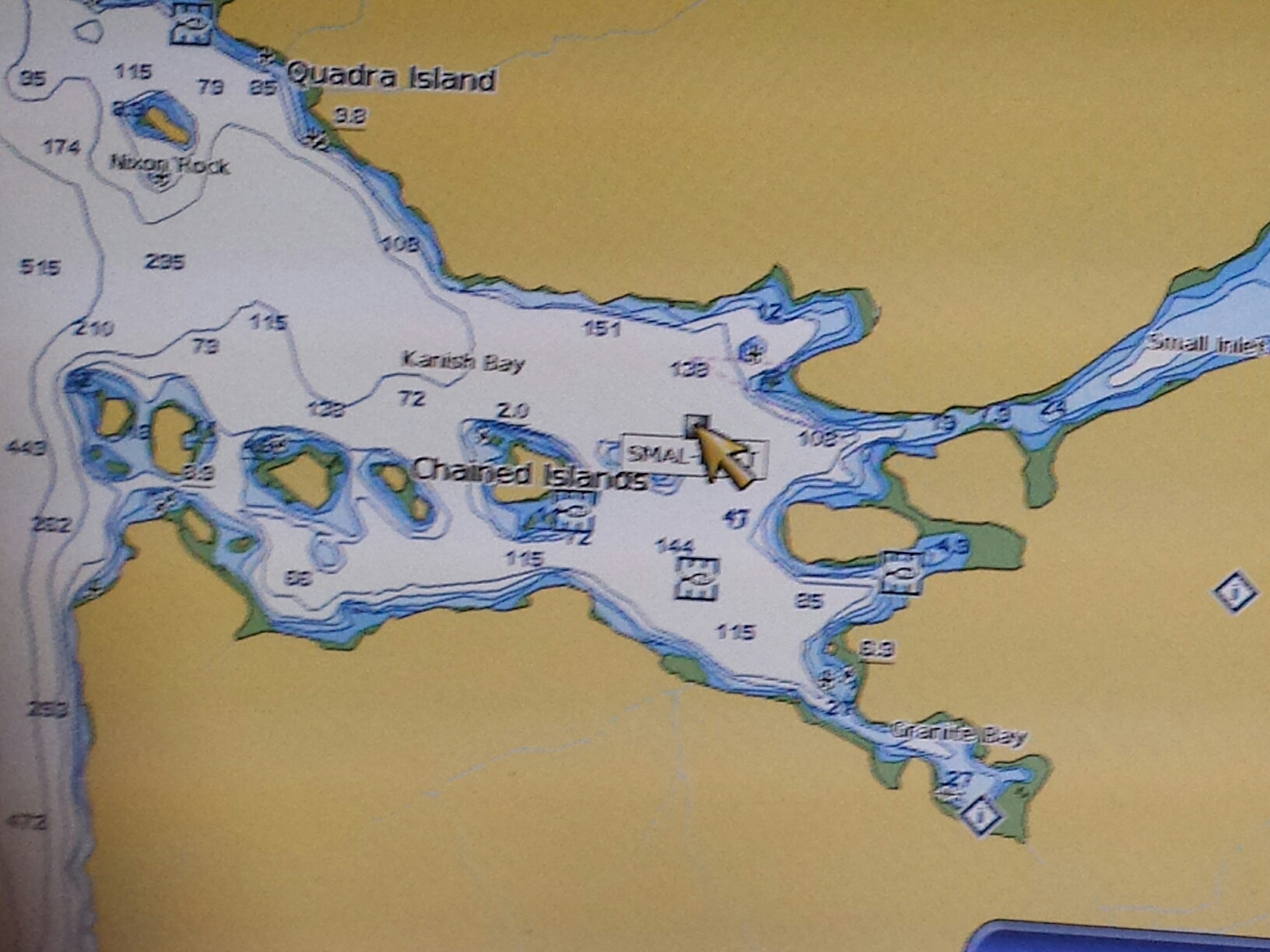
I have US and Canadian maps in raster format. They look almost like real paper charts on my notebook and by connecting to my GPS I see the position of my little boat. So now I was gifted a Garmin gpsmap 4012. It works as it should but the chart display is not as detailed as my raster charts. Garmin charts are a proprietary file, I have observed. My raster charts are .BSB and .KAP files. How can I convert to view on my Garmin? The top chart below is a raster chart (BSB) from the Canadian Hydrographic Office. The other one is from my Garmin GpsMap.
Last edited:
