Any tips for Sailing Lake Powell?
- Thread starter sfr
- Start date
- Status
- Not open for further replies.
August NO
I was just in Lake powell in August on a power boat ride and my van was 100 degrees and not much wind,we don't do as much sailing in July August Sept in Florida because too hot and not much wind,I would think the same for lake Powell.
I only took a short ride but not for me at all.
Nick
I was just in Lake powell in August on a power boat ride and my van was 100 degrees and not much wind,we don't do as much sailing in July August Sept in Florida because too hot and not much wind,I would think the same for lake Powell.
I only took a short ride but not for me at all.
Nick
I recently cleaned up this "East end of Lake Powell" picture site to make the pictures easier to view..
These were always family outings with lots of kayaking and swimming rather than pure sailing trips. We always went in June and they were great trips.
http://analogengineering.com/sail/powell/
These were always family outings with lots of kayaking and swimming rather than pure sailing trips. We always went in June and they were great trips.
http://analogengineering.com/sail/powell/
Summer is very hot and not much wind like Nick said. Fall and Spring can be very unpredictable with the fronts effecting the region a lot more. We live 90 miles due east of the lake in the first town in that direction and we can get 60+ mph winds for a few days running in the spring and the fall. In the spring I'd pick May, but the water is still going to be cold from the snow melt in the Rockies.
My favorite time would be Sept.. It still can be very warm then though. The water is still warm and the fronts aren't as strong, but you still have to be careful. If you read our trip reports you will see that we were trapped in one front that resulted in a fractured shoulder and other problems for me. I'm not trying to scare you as it is a....

...beautiful place to go. I'd take a lot of good shore line as you can't always anchor as it is so deep (can be a couple hundred feet deep 10 feet off a shore). If you have a boat that can be...

...beached do that.
Where would you be putting in and how long do you want to stay out? It is a hard lake to sail and took us 18 days to go 95 miles by sail only, but some of that was dealing with 3 different fronts. Most people that take a sailboat there motor most of the time.
Read our two trip reports...
http://purplesagetradingpost.com/sumner/macgregor-trips-1/macgregor-trips-1-index.html
...and you will have a lot better feel for the lake and let me know if I can help further.
One last thing is that they will do a Zebra Mussel check on the boat which you don't want to fail as they can impound the boat. There again the park service has info on that and call if you have any concerns.
Just get prepared and take the boat and see some of the most beautiful canyon country in the world,
Sum
[FONT=Arial, sans-serif]============================[/FONT]
Our Endeavour 37
Our MacGregor 26-S Pages
Our Trips to Utah, Idaho, Canada, Florida
Mac-Venture Links
My favorite time would be Sept.. It still can be very warm then though. The water is still warm and the fronts aren't as strong, but you still have to be careful. If you read our trip reports you will see that we were trapped in one front that resulted in a fractured shoulder and other problems for me. I'm not trying to scare you as it is a....
...beautiful place to go. I'd take a lot of good shore line as you can't always anchor as it is so deep (can be a couple hundred feet deep 10 feet off a shore). If you have a boat that can be...
...beached do that.
Where would you be putting in and how long do you want to stay out? It is a hard lake to sail and took us 18 days to go 95 miles by sail only, but some of that was dealing with 3 different fronts. Most people that take a sailboat there motor most of the time.
Read our two trip reports...
http://purplesagetradingpost.com/sumner/macgregor-trips-1/macgregor-trips-1-index.html
...and you will have a lot better feel for the lake and let me know if I can help further.
One last thing is that they will do a Zebra Mussel check on the boat which you don't want to fail as they can impound the boat. There again the park service has info on that and call if you have any concerns.
Just get prepared and take the boat and see some of the most beautiful canyon country in the world,
Sum
[FONT=Arial, sans-serif]============================[/FONT]
Our Endeavour 37
Our MacGregor 26-S Pages
Our Trips to Utah, Idaho, Canada, Florida
Mac-Venture Links
Walt
Very Very nice and I was told to rent one of the house boats at the marina or a power boat and go exploring the lake with some Kayaks as you did.
I did a lot of camping and beach camping on Long Island,NY with my boys and wife and friends out east and always thought we were blessed to have a great place to enjoy with family and friends for week ends and longer vacations.
I did our road trip this past summer out west and found out what a beautiful awsome US we have and so many great places to enjoy.
We can't wait to go on another road trip and see more of our great beautiful country,we met many people from Europe who were so very much impressed with our country also.
Nick
Re: Any tips for Sailing Lake Powell
This is OT but I have to commend Sum and Walt on their pictures. SBO could make a very nice calendar with member donated pictures if they wanted to.
Thanks for sharing.
This is OT but I have to commend Sum and Walt on their pictures. SBO could make a very nice calendar with member donated pictures if they wanted to.
Thanks for sharing.
Re: Any tips for Sailing Lake Powell

Just spent two days there and it while really nice seemed TOTALLY POWERBOAT in every aspect from wind direction to massive powerboat traffic
While we were out west the last week in general it seemed pretty common to go from NOTHING to 60 knots back to NOTHING in 7 minutes
Just spent two days there and it while really nice seemed TOTALLY POWERBOAT in every aspect from wind direction to massive powerboat traffic
While we were out west the last week in general it seemed pretty common to go from NOTHING to 60 knots back to NOTHING in 7 minutes

Walt great panoramas of the lake :dance:.
I'd plan the trip like what Walt has done or like what we did on our short trip and plan on sailing when you can where you can and don't make that a focus of the trip. Motoring more than you might do at home will allow you to see much more and to also get further away from the ramps and the people.
The lake is huge, 2nd largest man-made lake in the U.S. and 150 miles long with more shoreline than the Pacific West coast, but there are only 3 places to put in and only one place for ice or to fuel on the lake away from the put-in locations.
If you like to be more by yourself putting in at the head of the lake at Hite might be my first choice. Next would be Halls Crossing/Bullfrog which I counted as one, but they are right across the lake from each other and there is a car/truck ferry that crosses between them (check to see if it is running and the times if you plan on using it.). That area would be my second choice if you want to avoid others. The last place I'd put in would be were most people go since it is closest to Calif./AZ and that is at Page.
Look at the width...

...of the ramp there. Yep that is all ramp. Make darn sure you aren't there Memorial Day, 4th of July or Labor Day. The destination from there for tours and visitors is usually up the lake to Rainbow Bridge (large Arch) 40+ miles. Also I don't feel that the lake is as pretty there until you get 12-15 miles up the lake or so. Once you get past Rainbow Bridge the traffic goes way down and up the San Juan Arm where Walt went on the one trip you will have a lot of lake to yourself.
If you have a good VHF you can get NOAA weather over parts of the lake, but the canyons can really block it out so you are flying blind as far as the weather is concerned unless it is a very short trip. Don't count on getting AM or FM stations either. This is one of the most remote places in America.
I'd get the Lake Powell North and Lake Powell South from...
http://www.fishnmap.com/catalogframe.php
There are mile markers on the lake itself and with the maps you have a better idea where you are and maybe where you want to go. Looks like right now that...
http://lakepowell.water-data.com/
...the lake is about 78 feet down (was about 80 down when we used it). Don't forget the lake is very deep, 560 feet at the dam when full. It also looks like the ramp at Hite right now might be closed. It was also closed because of low water below the ramp when we put in there...

...but we were able to launch just from the shore, picture above.
When would you like to go there? We have visitors to the region that come in the winter thinking because the area is mostly desert that it is warm. Not so in the winter. Record low in our town is -20.
It will be a trip you won't soon forget if ever. If I googled your location right you aren't that far from Kootenay Lake where Ruth and I went. That was a great trip,
Sum
[FONT=Arial, sans-serif]============================[/FONT]
Our Endeavour 37
Our MacGregor 26-S Pages
Our Trips to Utah, Idaho, Canada, Florida
Mac-Venture Links
Its a big lake, you can get away from the power boaters.
Of course, there are other risk.. I think Suimner ran into a naked guy in a remote area.
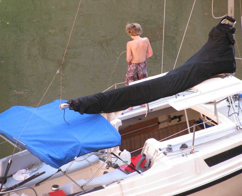
Young guy below illustrates how remote the lake can be (from one morning up Willow Creek on the Escalante river - young guy thought no one was watching)
Of course, there are other risk.. I think Suimner ran into a naked guy in a remote area.
Young guy below illustrates how remote the lake can be (from one morning up Willow Creek on the Escalante river - young guy thought no one was watching)
- Status
- Not open for further replies.