- Oct 22, 2014
- 21,207
I have been experimenting with LuckGrib as a software (MAC based program) to improve my sailing experiences. I have used it with success on an Atlantic transit in Open Water passaging. It is a remarkable tool with detail that often exceeds the desire of the boat captain.
Which leads me to experiment with it in sheltered waters and racing.
If you have the polars for a boat you can apply them as a data set. If not you can utilize polars from the list in the database for a boat that is similar and then adapt or alter the data to fit your own boat. This is a complex process yet with a bit of experimentation and observation you can have reasonable success.
The choices for what weather grib model to use is equally challenging. My personal choice is the ECMWF model. The attraction of setting a model then repeating the use as the raw data is updated (with the software structure and a fast internet this takes less than 30 seconds) is the speed of review. I found myself wishing the weather source data was more frequently updated. Of course that is ridiculous. You can't update weather before it happens and is recorded... At least not yet.
Here are some images of routing I developed.if you were exiting Deception Passage now Thursday at about 1100 and heading west or north around the San Juan Islands.
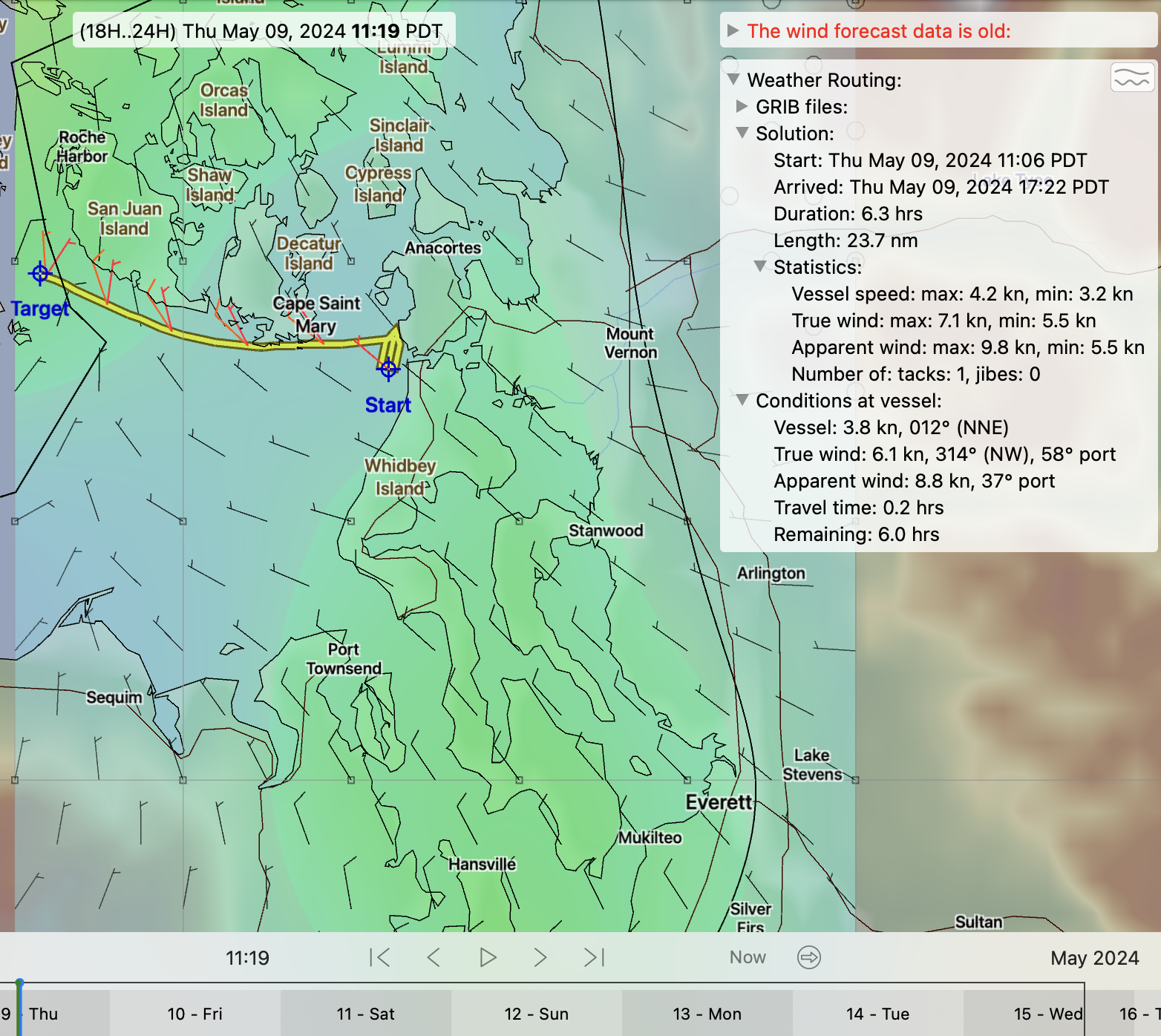
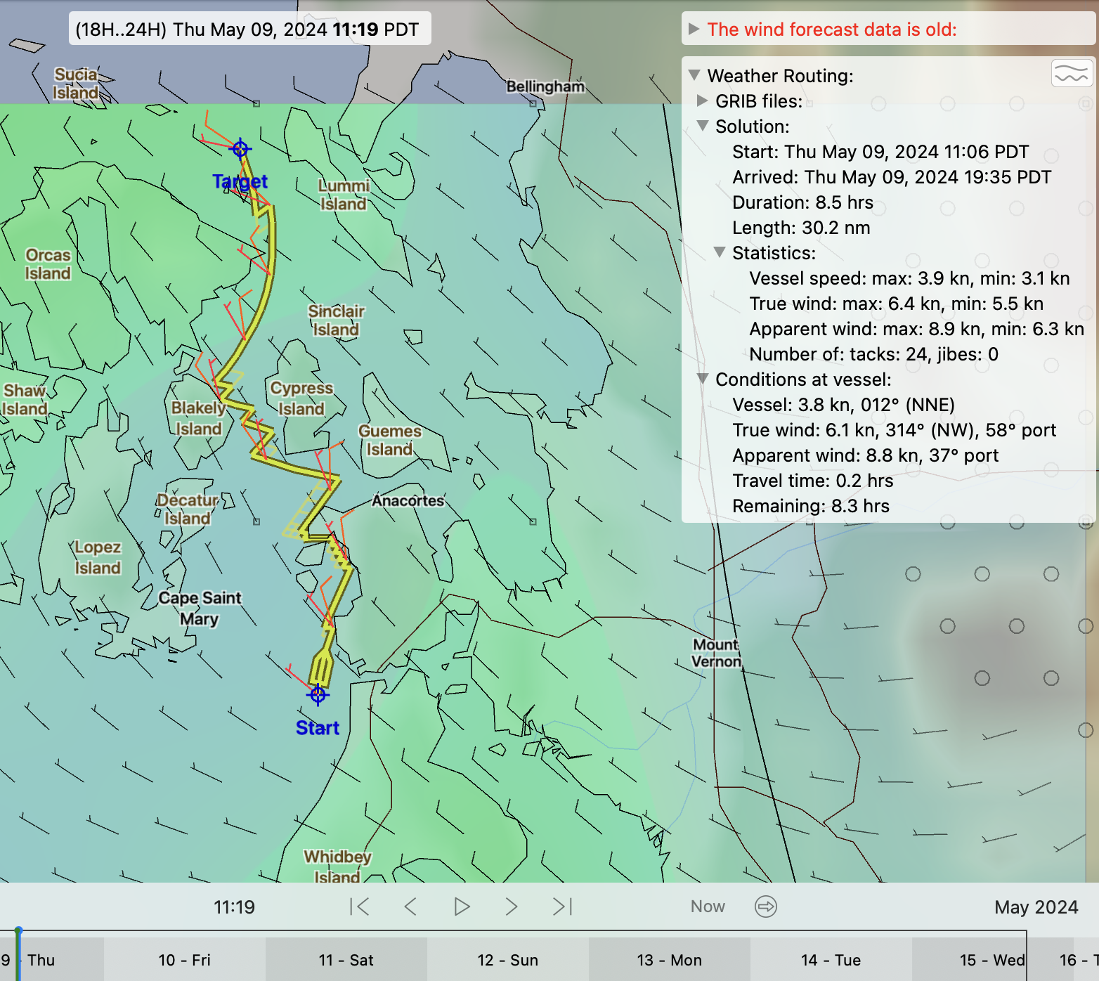
While the routing does not address tidal currents, it does avoid running into land. There is a detailed report created of position and point of sail in 5 minute increments available.
Which leads me to experiment with it in sheltered waters and racing.
If you have the polars for a boat you can apply them as a data set. If not you can utilize polars from the list in the database for a boat that is similar and then adapt or alter the data to fit your own boat. This is a complex process yet with a bit of experimentation and observation you can have reasonable success.
The choices for what weather grib model to use is equally challenging. My personal choice is the ECMWF model. The attraction of setting a model then repeating the use as the raw data is updated (with the software structure and a fast internet this takes less than 30 seconds) is the speed of review. I found myself wishing the weather source data was more frequently updated. Of course that is ridiculous. You can't update weather before it happens and is recorded... At least not yet.
Here are some images of routing I developed.if you were exiting Deception Passage now Thursday at about 1100 and heading west or north around the San Juan Islands.
While the routing does not address tidal currents, it does avoid running into land. There is a detailed report created of position and point of sail in 5 minute increments available.
