It is Friday and time for an update. Looks like today and through the weekend will be a reprieve from the rain.
What brings the dry weather? The large Pacific High pressure.
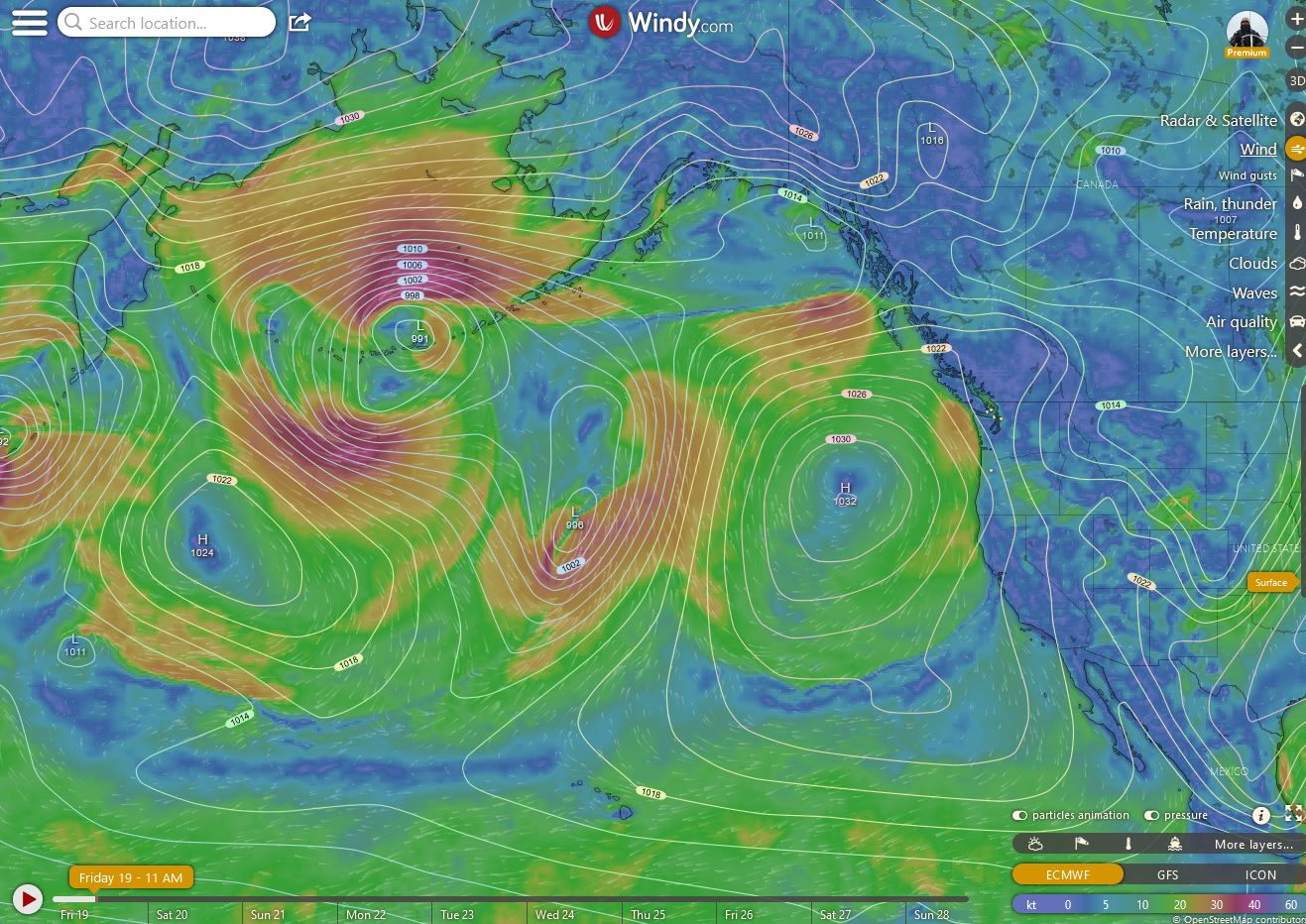
What brings the rain and snow in the forecast? The large Low Pressure cell dancing in the Aleutian Islands.
Here is the forecast from Rufus..
What brings the dry weather? The large Pacific High pressure.
What brings the rain and snow in the forecast? The large Low Pressure cell dancing in the Aleutian Islands.
Here is the forecast from Rufus..
Friday November 19
A pleasant weather weekend ahead, which is good news for cleanup & repairs from the flooding in the northern areas of the PNW. Grab your morning beverage.
The break in rainfall will last through this weekend; Sunday will be the warmest, with plenty of sunshine after a possible frosty morning in many locations. The next damp system is not due until later on Monday. Even then, it will not be a heavy rain producer. In fact, it could be more of a cloudy pattern, than one with lots of precip. The weak Low will move into CA, ushering in some clouds & showers for the Golden State on Tue. We can expect our weather to begin drying out dry on Tue, from north to south, as the Low drifts over CA. There will be a wetter front moving into the PNW late Wed on into Thanksgiving. Higher amounts of precip will fall over the NW corner of WA & Vancouver Is. Showers on Black Friday.
The post-Thanksgiving weekend is trending moderately wet & breezy yet again, as another front sweeps in on Sat. Similarly to the previous front, the heaviest precip will be north of OR. Timing may vary somewhat, as model projections have been indicating a VERY WET pattern returning to the PNW after Thanksgiving. Some solutions brought back heavy rain during that weekend, others hold it off until during the week after Thanksgiving. Either way, the relatively ‘calm’ weather in store for the PNW over the next 7 days will be appreciated & needed given the extended outlook.
As November ends and December begins (week of Nov 29 - Dec 3), we may be in for heavy rainfall, WIND and the coldest storm fronts of the season, to date. Each very wet front that arrives that week will progressively be colder & colder. In fact, by the end of that week, the PNW could be seeing 'The White' in many low elevation locations, even teasing valley floors. “There you go again”, some Patrons may be thinking. Well, there is that possibility. Sip on.
Ponder Point: By late November, we see indications that a COLD High pressure dome may begin moving from NE Siberian on over Alaska and the Yukon. Will the high pressure increase to our ‘trigger’ range of 1040+ mb? We’ll see. Anyway, this cold air mass is charting to drop temps over the Gulf of Alaska and the interior (winter pattern), with subsequent support for strong Pacific storms over the PNW. Each of those storms may bring colder air over our region. This is similar to Dec 2008, if it actually develops. For now, this is merely a projection, but one that could present low elevation snowfall that so many mention as an attribute of a strong La Nina winter in the PNW. We are, indeed, in a cold La Nina pattern (we’ll present details on Monday).
Beforehand, the wet week after Thanksgiving will be quite wet, but with one key benefit relative to last week’s horrible flooding - the lowering freezing level will “hold” much of the precipitation in the mountains as snow. (The freezing level was well over 8,000 ft in the last major rain event.)
The weekend of Dec 4,5 is trending either very WET with snow lowering to the footlhills, or generally wet with snow/rain mixed at the surface, turning to all snow late Sunday the 5th (esp over much of western WA). Review the Ponder Point above as to why. It will be interesting to see what Nature actually does.
