Dorian has moved on into the North Atlantic, Humberto is following a similar path.
And like train cars on a track next storm brewing in the Tropical Atlantic appears to be Invest 97L.
Invest 97L
As of 12:00 UTC Sep 16, 2019:
Location: 11.3°N 40.4°W
Maximum Winds: 25 kt Gusts: nan kt
Minimum Central Pressure: 1009 mb
Environmental Pressure: 1012 mb
Radius of Circulation: 120 NM
Radius of Maximum Wind: 40 NM
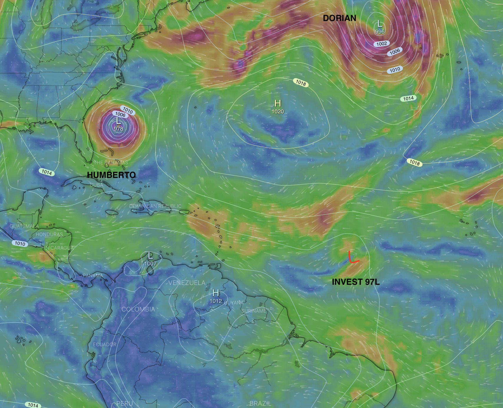
Not looking like much right now, but it is early.
Early path plots have the Low pressure area moving in a NW direction staying to the East of the Bahamas, due to the influence of the High Pressure over Venezuela. If this structure continues Invest 97L could follow a similar path of the previous two storms. The storm is moving along at about 200 nm a day. The series of High's being pumped across the US from the Pacific NW, if continued, could be the steering force needed to keep Invest 97L out to sea.
This is a storm to keep an eye on until we get a better picture of it's formation and direction.
Think good thoughts.
And like train cars on a track next storm brewing in the Tropical Atlantic appears to be Invest 97L.
Invest 97L
As of 12:00 UTC Sep 16, 2019:
Location: 11.3°N 40.4°W
Maximum Winds: 25 kt Gusts: nan kt
Minimum Central Pressure: 1009 mb
Environmental Pressure: 1012 mb
Radius of Circulation: 120 NM
Radius of Maximum Wind: 40 NM
Not looking like much right now, but it is early.
Early path plots have the Low pressure area moving in a NW direction staying to the East of the Bahamas, due to the influence of the High Pressure over Venezuela. If this structure continues Invest 97L could follow a similar path of the previous two storms. The storm is moving along at about 200 nm a day. The series of High's being pumped across the US from the Pacific NW, if continued, could be the steering force needed to keep Invest 97L out to sea.
This is a storm to keep an eye on until we get a better picture of it's formation and direction.
Think good thoughts.

