'Time and Tide wait for no man', even here on the high (mostly) coast of Maine.
- Thread starter TomY
- Start date
A well trained crew!But this group actually froze on command for me: Not a blur in sight(they broke out laughing a second later).
I bought the wireless remote for my Nikon. I can also control picture taking from a Nikon app on my phone. That lets me be in the picture and/or it prevents movement from manually pressing the button. The features on the new digital cameras are endless! All I have on my old Canon ftb are shutter speed and aperture adjustments. I still want to list all of my old equipment on eBay someday. Maybe there's a collector out there...
So sea level.... In the Hudson river, I have seen over the last 50 years a very small impact. The road to my marina flooded about the same at high tide as it did in 1969. The shore line has not changed in a discernible way. A wreck in Thompson Cove extends above the water the same as in 1969.
I've had a home on the west coast of Florida for the last 5 years and I have seen a noticeable rise in water levels on my pier and flooding has been much worst even when there was no significant storm activity. Hasn't reached the house yet but put the dock under water several times in spite of my raising it 2 feet when I re-build it 3 years ago. I can sail closer to dredge spoil areas than the charts say I should, another indication that water levels have risen.
I am an environmental engineer and have more that a passing interest in water bodies and their changes over time. I stay apolitical to cause effect because the time scale of there events are beyond even my years. I do not personally believe we can stop these effects but also believe that solutions to global warming have an more immediate positive effect in having better air to breath, water to drink and land to live on. If that slows warming, an added benefit. Political will..... I'm apolitical so leave that to others.
I really can't imagine how water height is measured. Here I can't discern any raise in Sea Level. I can go places I've visited for 50 years and cannot see any difference in height of tides. What ever difference there is, is magnitudes less than that of tide, wind effects, rain fall etc. But then other reports differ. Several have spoken of disappearing islands. I can't comment on that. Different observers see different things. That is the challenge in measuring oceanic rising and for that matter, temperature. And that water doesn't stay in the same place.
Unfortunately, the politicians have forced this broad subject to become politicized. For and against, believe or not, one group of elected people run in each direction. They run for, or they run against. And money pours in on both sides. No easy resolution in sight.So sea level.... In the Hudson river, I have seen over the last 50 years a very small impact. The road to my marina flooded about the same at high tide as it did in 1969. The shore line has not changed in a discernible way. A wreck in Thompson Cove extends above the water the same as in 1969.
I've had a home on the west coast of Florida for the last 5 years and I have seen a noticeable rise in water levels on my pier and flooding has been much worst even when there was no significant storm activity. Hasn't reached the house yet but put the dock under water several times in spite of my raising it 2 feet when I re-build it 3 years ago. I can sail closer to dredge spoil areas than the charts say I should, another indication that water levels have risen.
I am an environmental engineer and have more that a passing interest in water bodies and their changes over time. I stay apolitical to cause effect because the time scale of there events are beyond even my years. I do not personally believe we can stop these effects but also believe that solutions to global warming have an more immediate positive effect in having better air to breath, water to drink and land to live on. If that slows warming, an added benefit. Political will..... I'm apolitical so leave that to others.
Back in my whitewater kayaking days I wondered the same thing. Turns out it is pretty simple. Here's a basic diagram:I really can't imagine how water height is measured. Here I can't discern any raise in Sea Level. I can go places I've visited for 50 years and cannot see any difference in height of tides. What ever difference there is, is magnitudes less than that of tide, wind effects, rain fall etc. But then other reports differ. Several have spoken of disappearing islands. I can't comment on that. Different observers see different things. That is the challenge in measuring oceanic rising and for that matter, temperature. And that water doesn't stay in the same place.
Measuring sea level is basically the same idea. Find a solid place near the ocean, get a vertical pipe and connect it to a horizontal pipe and let the water in. In the old days there was a simple measuring stick, now NOAA uses more sophisticated methods. See: https://tidesandcurrents.noaa.gov/levelhow.html
Makes sense, the Earth's crust is not stable therefore sea level is not stable.Sea level is measured very precisely by satellites. One recent discovery is that sea level rise is not uniform around the globe.
Climate change is complicated but that isn't an excuse for inaction. For example, the Chesapeake region landscape is sinking as a result of the end of the last ice age, as you note. But that only accommodates a bit more than 50% of our sea level rise. The rest of it is from an expanding volume of warming water that now blankets the eastern seaboard. That, by the way is how H. Sandy found enough thermal energy to strengthen and make it all the way to New Jersey where it came ashore with a force multiplier - high tide. Complicated, but deadly.Sinking land, see studies. They say sinking land is the largest factor in sea level rise along the Chesapeake. It has to do with a "fore bulge" caused by glaciers during the ice age and it is receding. So many complicating issues. I also would never expect sand bars in the bay to have any semblance of permanence. We're less than an insignificant speck in time.
As you say, the satellite altimetry is very accurate. But we've only had it since 1993. NOAA in colaboration with NASA and a few other gov. agency's around the globe keep an up to date site on NOAA for Sea Level Rise in various parts of the world.Sea level is measured very precisely by satellites. One recent discovery is that sea level rise is not uniform around the globe.
We've been recording trends with Tidal gauges for at least 150 years. Subject to more variables (and land movements where the gauges are located) and so less accurate than the new gear.
But even your rusty old bathroom scale, if you use it the same year after year, will tell you when you're getting fat(or skinny).
After what you said about Annapolis, I checked it and sure enough, your local sea level rise, measured by tidal gauges, is nearly twice ours on the coast of Maine. Annapolis is beautiful and has many historic buildings in jeopardy. Other areas in the mid Atlantic like Atlantic City NJ and Cape May on the coast, are showing the same faster rate.
John mentioned Venice Italy. There's a place that has been dealing with SLR for more than a millennium. But mostly due to the fact, they are sinking.
As a builder, the city of Venice fascinates me. Many of the stone front steps you see today along the canals, have an entire flight of stairs, below water. There are entire floors now below the surface water keeping an ancient journal of sea levels.
They keep raising themselves, inch by inch, century by century. Today, Venetians keep track of Global Sea Level Rise for the city which is right on par with most of the Earth for the last 50 years. But they're still moving down, some due to pulling the ground water out from below.
For the most part (as Scott said), we'll be doing the same here (in my harbor), when we can, inch by inch. But Venice is a city in the water, they don't have static roads and typical infrastructure.
I've not been in Venice during the Aqua Alta (Italian for High Water), but I've seen the photos. Their 'Spring Tides, combined with wind directions, heavy rain, can raise the water level dramatically. Amazing that they keep adapting, sitting at Bistro tables in hip boots.
Lenses:
Lost in the beautiful Jewish Ghetto in Venice, we found this old used book store. You may notice that most of the books are on old pieces of furniture and mostly off the floor.
As I walked around, I realized that some of the center book displays, are filling Gondola's. Form? Oh no, it's function .
Venice and there attempt to hold back the sea.
The problem.
Water fills St Marks Plaza.

So they built a 2 mile long break water to channel the see

To a dam system

To block the sea from entering the lagoon. But there are Engineering issues.
Venice and MOSE: story of a failure
After scandals and cost overruns, will the floood barrier project be dismanteled? Inspections show that many of the gates have been eroded by sea-life. And the hinges are at risk of cracking
https://www.google.com/url?sa=i&sou...aw29d8RbCeuiMqm0cS8UiEIz&ust=1543723675288982
It’s tougher to control Mother Nature than your significant other.
The problem.
Water fills St Marks Plaza.
So they built a 2 mile long break water to channel the see
To a dam system
To block the sea from entering the lagoon. But there are Engineering issues.
Venice and MOSE: story of a failure
After scandals and cost overruns, will the floood barrier project be dismanteled? Inspections show that many of the gates have been eroded by sea-life. And the hinges are at risk of cracking
https://www.google.com/url?sa=i&sou...aw29d8RbCeuiMqm0cS8UiEIz&ust=1543723675288982
It’s tougher to control Mother Nature than your significant other.
We were there last in 2016. Venice is being loved to death by all us that visit. Taking care of millions of visitors when you have no roads or other land means of transportation, is no small feat. Everything is delivered by water. Once the means took on the combustion engine, the extra erosion of constant boat wakes have been the way of life on the main canals.Re: Venice. We heard from locals, off the record, that a big problem with settling/sinking was dredging out for the cruise liners. Basically, when the did that, the earth under the islands started to refill it. We were there in 2008 if I recall correctly.
A distracted driver heads to work, oblivious to the all the doorway thresholds at the water line.
We visited in 2017. It was a positive time. I got to see the MOSE project after it had just been finished. The break water was incredible. The MOSE project is massive.

The channel is visited by fishermen and sailors

At the end of the breakwater “The lighthouse is life Paradise can wait”.


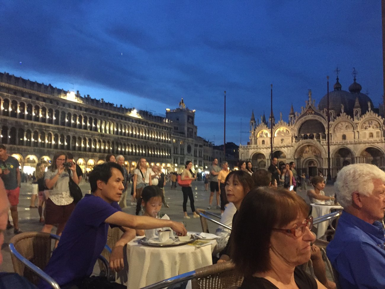
And Piazza San Marco is wonderful on a warm evening sipping a glass of Chianti, listening to a small orchestra, sharing the experience with new friends.
The channel is visited by fishermen and sailors
At the end of the breakwater “The lighthouse is life Paradise can wait”.
And Piazza San Marco is wonderful on a warm evening sipping a glass of Chianti, listening to a small orchestra, sharing the experience with new friends.
In my view “all men are created equal” is a statement that no individual, or collection of individuals, has, or have, any innate right or authority to rule or govern over others. There is no Devine right of kings or other monarchs to rule. The only legitimate “rule” or governance to be allowed is one that “we the people” consent to, etc.This is the narrow interpretation of the "all men created equal phrase." In this phrase and throughout the rest of the Declaration Jefferson and the other signers were saying that all men and all nations are equal. This is far more important than the common narrow interpretation. Here were 13 piss poor colonies, with no army, no currency, no navy with very different interests saying in effect "We are equal to England," at the time the strongest country in the world.
We are drifting far afield from sailing. Danielle Allen wrote an excellent book, Our Declaration: A Reading of the Declaration of Independence in Defense fo Equality. If you are interested in understanding the origins of our country and the values we declared 250 years ago, this is a must read. It is easily read and informative.
Last edited:
Please refresh the "track"...OK... we are getting way off track. I know I was partially to blame, but now we are talking the Declaration of Independence. So let's get back on track, please.
")